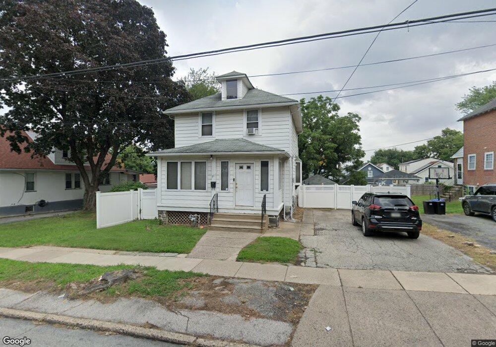
211 Lewis Ave Lansdowne, PA 19050
Estimated Value: $218,000 - $257,000
3
Beds
2
Baths
1,428
Sq Ft
$165/Sq Ft
Est. Value
About This Home
This home is located at 211 Lewis Ave, Lansdowne, PA 19050 and is currently estimated at $235,514, approximately $164 per square foot. 211 Lewis Ave is a home located in Delaware County with nearby schools including East Lansdowne Elementary School, Penn Wood Middle School, and Penn Wood High School - Cypress Street Campus.
Ownership History
Date
Name
Owned For
Owner Type
Purchase Details
Closed on
Aug 29, 2000
Sold by
Enderle Dennis R
Bought by
Holts Charles E and Holts Loretta L
Current Estimated Value
Home Financials for this Owner
Home Financials are based on the most recent Mortgage that was taken out on this home.
Original Mortgage
$98,824
Outstanding Balance
$36,018
Interest Rate
8.1%
Mortgage Type
FHA
Estimated Equity
$199,496
Create a Home Valuation Report for This Property
The Home Valuation Report is an in-depth analysis detailing your home's value as well as a comparison with similar homes in the area
Home Values in the Area
Average Home Value in this Area
Purchase History
| Date | Buyer | Sale Price | Title Company |
|---|---|---|---|
| Holts Charles E | $98,900 | Title Alliance Ltd |
Source: Public Records
Mortgage History
| Date | Status | Borrower | Loan Amount |
|---|---|---|---|
| Open | Holts Charles E | $98,824 |
Source: Public Records
Tax History
| Year | Tax Paid | Tax Assessment Tax Assessment Total Assessment is a certain percentage of the fair market value that is determined by local assessors to be the total taxable value of land and additions on the property. | Land | Improvement |
|---|---|---|---|---|
| 2025 | $5,286 | $123,720 | $48,610 | $75,110 |
| 2024 | $5,286 | $123,720 | $48,610 | $75,110 |
| 2023 | $3,953 | $123,720 | $48,610 | $75,110 |
| 2022 | $4,768 | $123,720 | $48,610 | $75,110 |
| 2021 | $7,109 | $123,720 | $48,610 | $75,110 |
| 2020 | $4,920 | $74,710 | $21,020 | $53,690 |
| 2019 | $4,838 | $74,710 | $21,020 | $53,690 |
| 2018 | $4,775 | $74,710 | $0 | $0 |
| 2017 | $4,530 | $74,710 | $0 | $0 |
| 2016 | $410 | $74,710 | $0 | $0 |
| 2015 | $410 | $74,710 | $0 | $0 |
| 2014 | $410 | $74,710 | $0 | $0 |
Source: Public Records
Map
Nearby Homes
- 7160 Clover Ln
- 7117 Atlantic Ave
- 120 Lewis Ave
- 7010 Atlantic Ave
- 109 Lexington Ave
- 104 Oak Ave
- 614 Littlecroft Rd
- 7056 Aberdeen Rd
- 7046 Clover Ln
- 0 Hirst Ave
- 7000 Greenwood Ave
- 135 Hirst Ave
- 7023 Guilford Rd
- 269 Hirst Ave
- 6993 Guilford Rd
- 6997 Guilford Rd
- 6866 Clover Ln
- 419 Gilpin Rd
- 402 Long Ln
- 58 Melrose Ave
- 217 Lewis Ave
- 207 Lewis Ave
- 225 Lewis Ave
- 214 Wildwood Ave
- 210 Wildwood Ave
- 218 Wildwood Ave
- 227 Lewis Ave
- 220 Wildwood Ave
- 201 Lewis Ave
- 206 Wildwood Ave
- 222 Wildwood Ave
- 216 Lewis Ave
- 229 Lewis Ave
- 210 Lewis Ave
- 200 Wildwood Ave
- 220 Lewis Ave
- 222 Lewis Ave Unit 2nd Floor
- 222 Lewis Ave
- 204 Lewis Ave
- 224 Lewis Ave
Your Personal Tour Guide
Ask me questions while you tour the home.