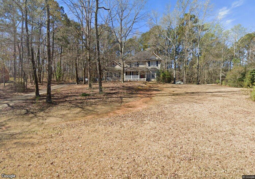
211 Linda Ln Lagrange, GA 30240
Estimated Value: $294,180 - $359,000
4
Beds
3
Baths
2,348
Sq Ft
$139/Sq Ft
Est. Value
About This Home
This home is located at 211 Linda Ln, Lagrange, GA 30240 and is currently estimated at $325,795, approximately $138 per square foot. 211 Linda Ln is a home located in Troup County with nearby schools including Ethel W. Kight Elementary School, Hollis Hand Elementary School, and Franklin Forest Elementary School.
Ownership History
Date
Name
Owned For
Owner Type
Purchase Details
Closed on
Nov 30, 1989
Sold by
First Federal Savings Bank Lag
Bought by
Wire Harry A and Wire Elena O
Current Estimated Value
Purchase Details
Closed on
Sep 14, 1989
Sold by
J E Hester & Sons Gen Cont
Bought by
First Federal Savings Bank Lag
Purchase Details
Closed on
Mar 1, 1987
Sold by
Mary D Hales
Bought by
J E Hester & Sons Gen Cont
Purchase Details
Closed on
Jan 1, 1987
Sold by
Larry M Hales
Bought by
Mary D Hales
Create a Home Valuation Report for This Property
The Home Valuation Report is an in-depth analysis detailing your home's value as well as a comparison with similar homes in the area
Home Values in the Area
Average Home Value in this Area
Purchase History
| Date | Buyer | Sale Price | Title Company |
|---|---|---|---|
| Wire Harry A | $81,000 | -- | |
| First Federal Savings Bank Lag | $94,000 | -- | |
| J E Hester & Sons Gen Cont | $11,500 | -- | |
| Mary D Hales | -- | -- |
Source: Public Records
Tax History Compared to Growth
Tax History
| Year | Tax Paid | Tax Assessment Tax Assessment Total Assessment is a certain percentage of the fair market value that is determined by local assessors to be the total taxable value of land and additions on the property. | Land | Improvement |
|---|---|---|---|---|
| 2024 | $2,835 | $105,932 | $18,000 | $87,932 |
| 2023 | $2,596 | $97,160 | $14,000 | $83,160 |
| 2022 | $2,380 | $87,280 | $10,000 | $77,280 |
| 2021 | $1,793 | $61,440 | $8,000 | $53,440 |
| 2020 | $1,793 | $61,440 | $8,000 | $53,440 |
| 2019 | $1,694 | $58,160 | $6,000 | $52,160 |
| 2018 | $1,694 | $58,160 | $6,000 | $52,160 |
| 2017 | $1,467 | $50,640 | $4,800 | $45,840 |
| 2016 | $1,472 | $50,790 | $4,800 | $45,990 |
| 2015 | $1,475 | $50,790 | $4,800 | $45,990 |
| 2014 | $1,307 | $45,162 | $4,800 | $40,362 |
| 2013 | -- | $47,627 | $4,800 | $42,827 |
Source: Public Records
Map
Nearby Homes
- 226 Linda Ln
- 103 Dogwood Ct
- 104 Dogwood Point
- 709 Vernon Ferry Rd
- 0 Deming St Unit 10550189
- 4004 White Oak Ln
- 135 Planters Ridge Dr
- LOT 4 Angela Dr
- E Angela Dr
- 40 River Point Dr
- 474 Newton Rd
- 124 Foxdale Dr
- 101 Ivy Springs Dr
- 102 Foxdale Dr
- 119 Plymouth Dr
- 190 Hill Rd
- 243 Oak Dr
- 102 Franklin Place
- 200 Cheyenne Dr
- 0 Antioch Rd Unit 10656005