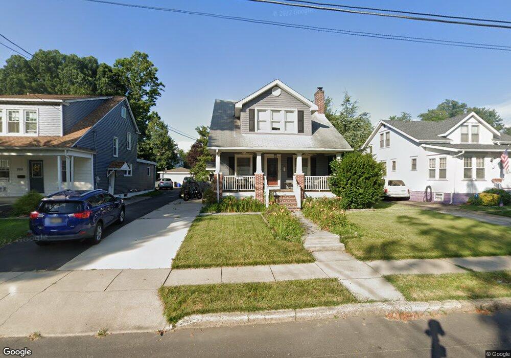
211 Manheim Ave Oaklyn, NJ 08107
Estimated Value: $293,000 - $402,000
--
Bed
--
Bath
1,502
Sq Ft
$242/Sq Ft
Est. Value
About This Home
This home is located at 211 Manheim Ave, Oaklyn, NJ 08107 and is currently estimated at $362,954, approximately $241 per square foot. 211 Manheim Ave is a home located in Camden County with nearby schools including Oaklyn Public School and Good Shepherd Regional School.
Ownership History
Date
Name
Owned For
Owner Type
Purchase Details
Closed on
Apr 22, 2010
Sold by
Waltrich Dorren
Bought by
Waltrich Doreen
Current Estimated Value
Purchase Details
Closed on
Sep 15, 2004
Sold by
Elsie M Clifford Est Of
Bought by
Buzby Jean M Mcdermott
Home Financials for this Owner
Home Financials are based on the most recent Mortgage that was taken out on this home.
Original Mortgage
$140,650
Interest Rate
5.84%
Create a Home Valuation Report for This Property
The Home Valuation Report is an in-depth analysis detailing your home's value as well as a comparison with similar homes in the area
Home Values in the Area
Average Home Value in this Area
Purchase History
| Date | Buyer | Sale Price | Title Company |
|---|---|---|---|
| Waltrich Doreen | -- | -- | |
| Buzby Jean M Mcdermott | $145,000 | -- |
Source: Public Records
Mortgage History
| Date | Status | Borrower | Loan Amount |
|---|---|---|---|
| Previous Owner | Buzby Jean M Mcdermott | $140,650 |
Source: Public Records
Tax History Compared to Growth
Tax History
| Year | Tax Paid | Tax Assessment Tax Assessment Total Assessment is a certain percentage of the fair market value that is determined by local assessors to be the total taxable value of land and additions on the property. | Land | Improvement |
|---|---|---|---|---|
| 2025 | $8,551 | $161,800 | $51,200 | $110,600 |
| 2024 | $8,247 | $161,800 | $51,200 | $110,600 |
| 2023 | $8,247 | $161,800 | $51,200 | $110,600 |
| 2022 | $7,833 | $161,800 | $51,200 | $110,600 |
| 2021 | $7,669 | $161,800 | $51,200 | $110,600 |
| 2020 | $7,558 | $161,800 | $51,200 | $110,600 |
| 2019 | $731 | $161,800 | $51,200 | $110,600 |
| 2018 | $7,198 | $161,800 | $51,200 | $110,600 |
| 2017 | $7,050 | $161,800 | $51,200 | $110,600 |
| 2016 | $6,969 | $161,800 | $51,200 | $110,600 |
| 2015 | $6,839 | $161,800 | $51,200 | $110,600 |
| 2014 | $6,584 | $136,700 | $51,200 | $85,500 |
Source: Public Records
Map
Nearby Homes
- 211 Newton Ave
- 505 Newton Ave
- 37 W Lakeview Ave
- 35 W Lakeview Ave
- 4 E Haddon Ave
- 211 Landis Ave
- 609 White Horse Pike
- 604 White Horse Pike
- 127 Manor Ave
- 28 W Greenwood Ave
- 16 W Greenwood Ave
- 111 E Beechwood Ave Unit 5
- 107 E Bettlewood Ave
- 730 White Horse Pike
- 325 Landis Ave
- 300 W Holly Ave
- 50 E Collingswood Ave
- 49 E Greenwood Ave
- 705 W Browning Rd
- 23 E Holly Ave
- 213 Manheim Ave
- 209 Manheim Ave
- 215 Manheim Ave
- 207 Manheim Ave
- 226 Newton Ave
- 217 Manheim Ave
- 205 Manheim Ave
- 300 Newton Ave
- 224 Newton Ave
- 220 Newton Ave
- 216 Newton Ave
- 219 Manheim Ave
- 203 Manheim Ave
- 304 Newton Ave Unit 120
- 304 Newton Ave Unit LOWER
- 304 Newton Ave Unit C
- 304 Newton Ave Unit A
- 304 Newton Ave
- 304 Newton Ave Unit 230A
- 304 Newton Ave Unit 100