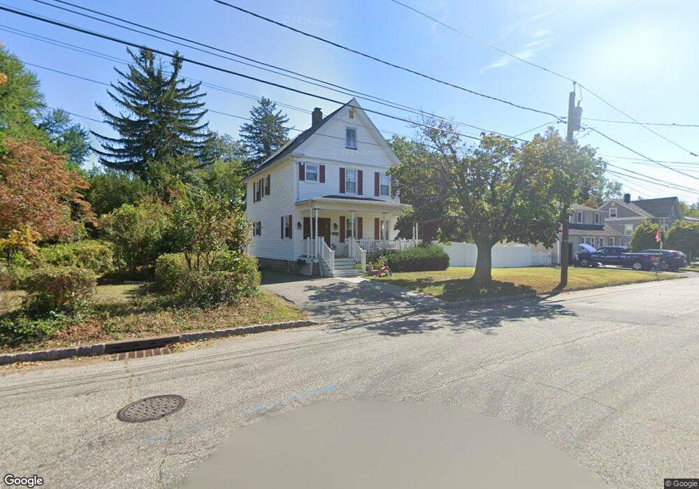
211 Maple Ave South Bound Brook, NJ 08880
Estimated Value: $480,000 - $570,000
--
Bed
--
Bath
1,576
Sq Ft
$336/Sq Ft
Est. Value
About This Home
This home is located at 211 Maple Ave, South Bound Brook, NJ 08880 and is currently estimated at $529,704, approximately $336 per square foot. 211 Maple Ave is a home located in Somerset County with nearby schools including Robert Morris School and Green Brook Academy.
Ownership History
Date
Name
Owned For
Owner Type
Purchase Details
Closed on
Jul 27, 2005
Sold by
Bravo Lazaro A
Bought by
Niebles Edgardo
Current Estimated Value
Home Financials for this Owner
Home Financials are based on the most recent Mortgage that was taken out on this home.
Original Mortgage
$259,200
Interest Rate
5.78%
Purchase Details
Closed on
Dec 13, 2002
Sold by
Combs John
Bought by
Niebles Edgardo and Bravo Lazaro
Home Financials for this Owner
Home Financials are based on the most recent Mortgage that was taken out on this home.
Original Mortgage
$199,500
Interest Rate
6.08%
Purchase Details
Closed on
Aug 27, 1991
Sold by
Combes Sr John E
Bought by
Combs John H
Create a Home Valuation Report for This Property
The Home Valuation Report is an in-depth analysis detailing your home's value as well as a comparison with similar homes in the area
Home Values in the Area
Average Home Value in this Area
Purchase History
| Date | Buyer | Sale Price | Title Company |
|---|---|---|---|
| Niebles Edgardo | -- | -- | |
| Niebles Edgardo | $210,000 | -- | |
| Combs John H | $105,000 | -- |
Source: Public Records
Mortgage History
| Date | Status | Borrower | Loan Amount |
|---|---|---|---|
| Previous Owner | Niebles Edgardo | $259,200 | |
| Previous Owner | Niebles Edgardo | $199,500 |
Source: Public Records
Tax History Compared to Growth
Tax History
| Year | Tax Paid | Tax Assessment Tax Assessment Total Assessment is a certain percentage of the fair market value that is determined by local assessors to be the total taxable value of land and additions on the property. | Land | Improvement |
|---|---|---|---|---|
| 2025 | $11,795 | $308,600 | $145,000 | $163,600 |
| 2024 | $11,795 | $308,600 | $145,000 | $163,600 |
| 2023 | $11,684 | $308,600 | $145,000 | $163,600 |
| 2022 | $10,918 | $308,600 | $145,000 | $163,600 |
| 2021 | $10,761 | $308,600 | $145,000 | $163,600 |
| 2020 | $10,236 | $308,600 | $145,000 | $163,600 |
| 2019 | $10,502 | $308,600 | $145,000 | $163,600 |
| 2018 | $10,443 | $308,600 | $145,000 | $163,600 |
| 2017 | $10,406 | $308,600 | $145,000 | $163,600 |
| 2016 | $10,171 | $308,600 | $145,000 | $163,600 |
| 2015 | $9,903 | $308,600 | $145,000 | $163,600 |
| 2014 | $9,665 | $308,600 | $145,000 | $163,600 |
Source: Public Records
Map
Nearby Homes
- 3 Edgewood Terrace
- 71 Remsen St
- 8 Von Steuben Ln
- 123 Elizabeth St
- 285 Maple Ave
- 20 Patriots Path
- 165 Prospect St
- 231 Beck Ave
- 535 Madison Ave
- 206 Bathgate Ave
- 10 Maplehurst Ln
- 15 Maplehurst Ln
- 112 East St
- 208 Sanders Ave
- 2 Drake St
- 63 Crestwood St
- 34 van Keuren Ave Unit 38
- 40 van Keuren Ave Unit 42
- 112-114 E Union Ave
- 320 Church St
- 209 Maple Ave
- 215 Maple Ave
- 210 Maple Ave
- 212 Maple Ave
- 207 Maple Ave
- 219 Maple Ave
- 214 Maple Ave
- 208 Maple Ave
- 205 Maple Ave
- 43 Edgewood Terrace
- 216 Maple Ave
- 202 Maple Ave
- 41 Edgewood Terrace
- 221 Maple Ave
- 15 Somers Place
- 218 Maple Ave
- 211 Lawrence St
- 213 Lawrence St
- 13 Somers Place
- 215 Lawrence St