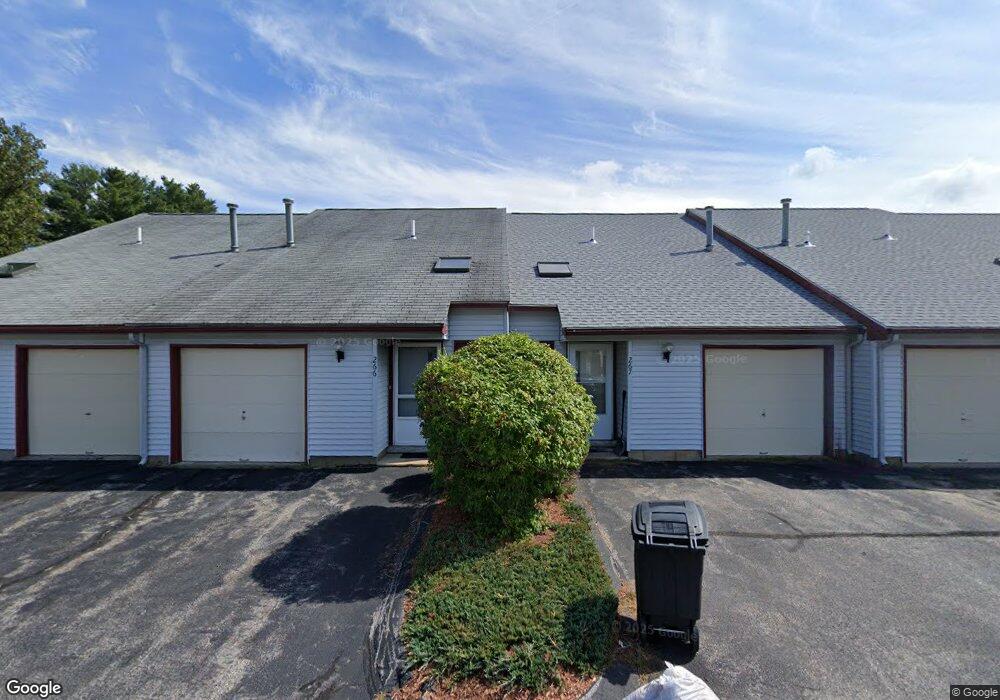
211 Millwright Dr Nashua, NH 03063
Northwest Nashua NeighborhoodEstimated Value: $263,000 - $301,000
2
Beds
1
Bath
1,072
Sq Ft
$268/Sq Ft
Est. Value
About This Home
This home is located at 211 Millwright Dr, Nashua, NH 03063 and is currently estimated at $286,856, approximately $267 per square foot. 211 Millwright Dr is a home located in Hillsborough County with nearby schools including Birch Hill Elementary School, Pennichuck Middle School, and Nashua High School North.
Ownership History
Date
Name
Owned For
Owner Type
Purchase Details
Closed on
Dec 1, 2014
Sold by
Acevedo Placido J
Bought by
Ferreira-Desouza Luciano and Oyola-Torres Barbaram
Current Estimated Value
Purchase Details
Closed on
May 24, 2010
Sold by
Fnma
Bought by
Acevedo Placido J
Home Financials for this Owner
Home Financials are based on the most recent Mortgage that was taken out on this home.
Original Mortgage
$75,650
Interest Rate
5.23%
Mortgage Type
Purchase Money Mortgage
Purchase Details
Closed on
Jun 26, 2009
Sold by
Young E Richard and Fnma
Bought by
Federal National Mortgage Association
Create a Home Valuation Report for This Property
The Home Valuation Report is an in-depth analysis detailing your home's value as well as a comparison with similar homes in the area
Home Values in the Area
Average Home Value in this Area
Purchase History
| Date | Buyer | Sale Price | Title Company |
|---|---|---|---|
| Ferreira-Desouza Luciano | $70,000 | -- | |
| Acevedo Placido J | $78,000 | -- | |
| Federal National Mortgage Association | $89,400 | -- |
Source: Public Records
Mortgage History
| Date | Status | Borrower | Loan Amount |
|---|---|---|---|
| Previous Owner | Federal National Mortgage Association | $75,650 |
Source: Public Records
Tax History
| Year | Tax Paid | Tax Assessment Tax Assessment Total Assessment is a certain percentage of the fair market value that is determined by local assessors to be the total taxable value of land and additions on the property. | Land | Improvement |
|---|---|---|---|---|
| 2025 | $3,957 | $235,100 | $0 | $235,100 |
| 2024 | $3,738 | $235,100 | $0 | $235,100 |
| 2023 | $3,013 | $165,300 | $0 | $165,300 |
| 2022 | $2,987 | $165,300 | $0 | $165,300 |
| 2021 | $2,654 | $114,300 | $0 | $114,300 |
| 2020 | $2,614 | $115,600 | $0 | $115,600 |
| 2019 | $2,515 | $115,600 | $0 | $115,600 |
| 2018 | $2,452 | $115,600 | $0 | $115,600 |
| 2017 | $1,798 | $69,700 | $0 | $69,700 |
| 2016 | $1,747 | $69,700 | $0 | $69,700 |
| 2015 | $1,710 | $69,700 | $0 | $69,700 |
| 2014 | $1,676 | $69,700 | $0 | $69,700 |
Source: Public Records
Map
Nearby Homes
- 5 Blackstone Dr Unit 7
- 3 Roedean Dr Unit UC101
- 9 Blackstone Dr Unit U88
- 5 Dumaine Ave Unit A
- 7 Dumaine Ave Unit H
- 7 Dumaine Ave Unit 7H
- 18 Dumaine Ave Unit C
- 18 Bangor St
- 6 Duckford Cir Unit U19
- 10 Westborn Dr
- 103 Jay Rd
- 14 Hall Ave
- 11 Erik St
- 17 Cambridge Dr
- 161 Cannongate III
- 26 Preserve Dr
- 9 Juniper Ln
- 189 Coburn Woods
- 2 Westchester Dr
- 5 Ivy Ln Unit U131
- 211 Millwright Dr
- 211 Millwright Dr Unit 211
- 212 Millwright Dr
- 212 Millwright Dr
- 210 Millwright Dr
- 210 Millwright Dr
- 209 Millwright Dr
- 209 Millwright Dr
- 213 Millwright Dr
- 213 Millwright Dr
- 214 Millwright Dr
- 214 Millwright Dr
- 214 Millwright Dr Unit 214
- 19 Stonebridge Dr Unit 292
- 208 Millwright Dr
- 208 Millwright Dr
- 208 Millwright Dr Unit 208
- 215 Millwright Dr
- 215 Millwright Dr
- 215 Millwright Dr Unit 215
Your Personal Tour Guide
Ask me questions while you tour the home.