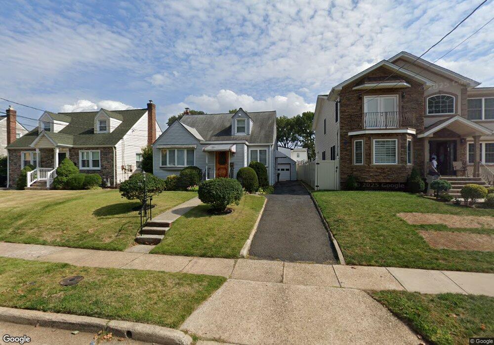
211 Morristown Rd Linden, NJ 07036
Estimated Value: $400,000 - $540,000
--
Bed
--
Bath
969
Sq Ft
$494/Sq Ft
Est. Value
About This Home
This home is located at 211 Morristown Rd, Linden, NJ 07036 and is currently estimated at $479,103, approximately $494 per square foot. 211 Morristown Rd is a home located in Union County with nearby schools including Number 10, Myles J. McManus Middle School, and Linden High School.
Ownership History
Date
Name
Owned For
Owner Type
Purchase Details
Closed on
May 22, 2024
Sold by
Lawson Sidney and Lawson Mark J
Bought by
Grunsweig Zev
Current Estimated Value
Home Financials for this Owner
Home Financials are based on the most recent Mortgage that was taken out on this home.
Original Mortgage
$322,500
Outstanding Balance
$318,156
Interest Rate
7.09%
Mortgage Type
New Conventional
Estimated Equity
$160,947
Purchase Details
Closed on
Aug 15, 1990
Bought by
Lawson Sidney
Create a Home Valuation Report for This Property
The Home Valuation Report is an in-depth analysis detailing your home's value as well as a comparison with similar homes in the area
Home Values in the Area
Average Home Value in this Area
Purchase History
| Date | Buyer | Sale Price | Title Company |
|---|---|---|---|
| Grunsweig Zev | $430,000 | Meister Abstract | |
| Grunsweig Zev | $430,000 | Meister Abstract | |
| Lawson Sidney | $150,000 | -- |
Source: Public Records
Mortgage History
| Date | Status | Borrower | Loan Amount |
|---|---|---|---|
| Open | Grunsweig Zev | $322,500 | |
| Closed | Grunsweig Zev | $322,500 |
Source: Public Records
Tax History Compared to Growth
Tax History
| Year | Tax Paid | Tax Assessment Tax Assessment Total Assessment is a certain percentage of the fair market value that is determined by local assessors to be the total taxable value of land and additions on the property. | Land | Improvement |
|---|---|---|---|---|
| 2025 | $9,430 | $134,100 | $58,000 | $76,100 |
| 2024 | $9,223 | $134,100 | $58,000 | $76,100 |
| 2023 | $9,223 | $134,100 | $58,000 | $76,100 |
| 2022 | $9,272 | $134,100 | $58,000 | $76,100 |
| 2021 | $9,319 | $134,100 | $58,000 | $76,100 |
| 2020 | $9,269 | $134,100 | $58,000 | $76,100 |
| 2019 | $9,238 | $134,100 | $58,000 | $76,100 |
| 2018 | $9,235 | $134,100 | $58,000 | $76,100 |
| 2017 | $9,036 | $134,100 | $58,000 | $76,100 |
| 2016 | $8,751 | $134,100 | $58,000 | $76,100 |
| 2015 | $8,417 | $134,100 | $58,000 | $76,100 |
| 2014 | $8,254 | $134,100 | $58,000 | $76,100 |
Source: Public Records
Map
Nearby Homes
- 333 Livingston Rd
- 113 Raritan Rd
- 74 Raritan Rd
- 123 Robbinwood Terrace
- 63 Elmwood Terrace
- 112 Melrose Terrace
- 2513 N Wood Ave
- 38 Pallant Ave
- 545 Livingston Rd
- 53 Pallant Ave
- 601 Birchwood Rd
- 357 Edgewood Rd
- 1718 Summit Terrace
- 1720 Dewitt Terrace
- 46 Palisade Rd
- 426 Edgewood Rd
- 1715 Orchard Terrace
- 617 Livingston Rd
- 204 Swarthmore Rd
- 57 Berlant Ave
- 207 Morristown Rd
- 217 Morristown Rd
- 203 Morristown Rd
- 212 Livingston Rd
- 2607 Summit Terrace
- 218 Livingston Rd
- 225 Morristown Rd
- 2603 Summit Terrace
- 2701 Summit Terrace
- 212 Morristown Rd
- 216 Morristown Rd
- 224 Livingston Rd
- 220 Morristown Rd
- 2707 Summit Terrace
- 231 Morristown Rd
- 228 Morristown Rd
- 230 Livingston Rd
- 2614 Summit Terrace
- 2515 Summit Terrace
- 2608 Summit Terrace