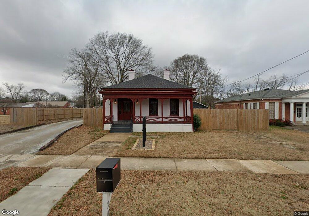
211 N 13th St Griffin, GA 30223
Spalding County NeighborhoodEstimated Value: $75,000 - $85,544
--
Bed
--
Bath
--
Sq Ft
9,148
Sq Ft Lot
About This Home
This home is located at 211 N 13th St, Griffin, GA 30223 and is currently estimated at $80,272. 211 N 13th St is a home located in Spalding County with nearby schools including Atkinson Elementary School, Cowan Road Middle School, and Griffin High School.
Ownership History
Date
Name
Owned For
Owner Type
Purchase Details
Closed on
Jan 16, 2024
Sold by
D King Holdings Llc
Bought by
Mpowerment Alliance Inc
Current Estimated Value
Purchase Details
Closed on
Nov 16, 1988
Sold by
Edwrds Timothy and Edwrds Christopher C
Bought by
Jones Joyce
Purchase Details
Closed on
Apr 25, 1988
Sold by
Wilson Robert Frances
Bought by
Edwards Timothy C and Edwards Christopher C
Purchase Details
Closed on
Apr 18, 1988
Sold by
Purdy Mrs Maude K
Bought by
Wilson Robert Frances
Purchase Details
Closed on
Oct 1, 1951
Sold by
Pudy T J
Bought by
Purdy Mrs Maude K
Purchase Details
Closed on
Nov 8, 1919
Bought by
Purdy T J
Create a Home Valuation Report for This Property
The Home Valuation Report is an in-depth analysis detailing your home's value as well as a comparison with similar homes in the area
Home Values in the Area
Average Home Value in this Area
Purchase History
| Date | Buyer | Sale Price | Title Company |
|---|---|---|---|
| Mpowerment Alliance Inc | $420,000 | -- | |
| D King Holdings Llc | -- | -- | |
| Jones Joyce | $48,500 | -- | |
| Edwards Timothy C | $23,000 | -- | |
| Wilson Robert Frances | $20,100 | -- | |
| Purdy Mrs Maude K | -- | -- | |
| Purdy T J | -- | -- |
Source: Public Records
Tax History Compared to Growth
Tax History
| Year | Tax Paid | Tax Assessment Tax Assessment Total Assessment is a certain percentage of the fair market value that is determined by local assessors to be the total taxable value of land and additions on the property. | Land | Improvement |
|---|---|---|---|---|
| 2024 | $459 | $12,028 | $7,600 | $4,428 |
| 2023 | $459 | $7,881 | $4,560 | $3,321 |
| 2022 | $315 | $7,881 | $4,560 | $3,321 |
| 2021 | $279 | $6,988 | $4,560 | $2,428 |
| 2020 | $279 | $6,988 | $4,560 | $2,428 |
| 2019 | $284 | $6,988 | $4,560 | $2,428 |
| 2018 | $295 | $6,988 | $4,560 | $2,428 |
| 2017 | $289 | $6,988 | $4,560 | $2,428 |
| 2016 | $294 | $6,988 | $4,560 | $2,428 |
| 2015 | $298 | $6,988 | $4,560 | $2,428 |
| 2014 | $307 | $6,988 | $4,560 | $2,428 |
Source: Public Records
Map
Nearby Homes
- 733 W Broad St
- 711 W Broad St
- 221 N 14th St
- 108 N 14th St
- 332 N 14th St
- 737 W Solomon St
- 822 W Solomon St
- 318 N 15th St
- 930 W Broad St
- 629 Williams St
- 200 AC W Ellis Rd
- 312.37 AC W Ellis Rd
- 321 N 10th St
- 333 N 10th St
- 1017 W Broad St
- 707 Williams St
- 411 Palace St
- 525 W Quilly St
- 713 Williams St
- 1025 W Broad St
- 209 N 13th St
- 222 N 13th St
- 228 N 13th St
- 214 N 13th St
- 206 N 13th St
- 0 W Broad St Unit 7130842
- W W Broad St Unit &136
- 0 W Broad St
- W W Broad St Unit 4
- W W Broad St
- 234 N 13th St
- 617 W Broad St
- 718 W Broad St
- 304 N 13th St
- 723 W Broad St
- 633 Wright St
- 640 W Broad St
- 615 W Broad St
- 212 N 14th St
- 629 Wright St