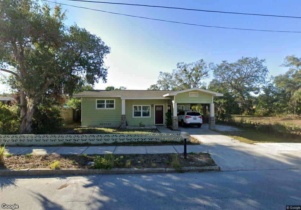
211 N Ring Ave Tarpon Springs, FL 34689
Estimated Value: $273,424 - $326,000
--
Bed
--
Bath
1,370
Sq Ft
$225/Sq Ft
Est. Value
About This Home
This home is located at 211 N Ring Ave, Tarpon Springs, FL 34689 and is currently estimated at $307,606, approximately $224 per square foot. 211 N Ring Ave is a home located in Pinellas County with nearby schools including Tarpon Springs Elementary School, Tarpon Springs High School, and Tarpon Springs Middle School.
Ownership History
Date
Name
Owned For
Owner Type
Purchase Details
Closed on
May 22, 2018
Sold by
Spanonidis Nick E and Hollars Elaine
Bought by
Patrick Ernest Costa
Current Estimated Value
Home Financials for this Owner
Home Financials are based on the most recent Mortgage that was taken out on this home.
Original Mortgage
$55,000
Interest Rate
4.4%
Mortgage Type
Seller Take Back
Purchase Details
Closed on
Aug 5, 2013
Sold by
Katra Mary
Bought by
Spanondis Nick E and Hollars Elaine
Create a Home Valuation Report for This Property
The Home Valuation Report is an in-depth analysis detailing your home's value as well as a comparison with similar homes in the area
Home Values in the Area
Average Home Value in this Area
Purchase History
| Date | Buyer | Sale Price | Title Company |
|---|---|---|---|
| Patrick Ernest Costa | $74,000 | None Available | |
| Spanondis Nick E | -- | Attorney |
Source: Public Records
Mortgage History
| Date | Status | Borrower | Loan Amount |
|---|---|---|---|
| Closed | Patrick Ernest Costa | $55,000 |
Source: Public Records
Tax History Compared to Growth
Tax History
| Year | Tax Paid | Tax Assessment Tax Assessment Total Assessment is a certain percentage of the fair market value that is determined by local assessors to be the total taxable value of land and additions on the property. | Land | Improvement |
|---|---|---|---|---|
| 2024 | $1,879 | $153,875 | -- | -- |
| 2023 | $1,879 | $149,393 | $0 | $0 |
| 2022 | $1,809 | $145,042 | $0 | $0 |
| 2021 | $1,816 | $140,817 | $0 | $0 |
| 2020 | $1,804 | $138,873 | $0 | $0 |
| 2019 | $1,797 | $137,563 | $55,873 | $81,690 |
| 2018 | $1,106 | $96,031 | $0 | $0 |
| 2017 | $1,086 | $94,056 | $0 | $0 |
| 2016 | $1,067 | $92,121 | $0 | $0 |
| 2015 | $489 | $61,409 | $0 | $0 |
| 2014 | $488 | $60,922 | $0 | $0 |
Source: Public Records
Map
Nearby Homes
- 440 Cypress St
- 0 N Grosse Ave
- 39 W Park St
- 0 N Pinellas Ave Unit MFRTB8366451
- 0 Athens St
- 200 Grand Blvd
- 107 E Spruce St
- 124 Athens St
- 207 Athens St
- 101 Read St
- 111 E Cedar St
- 439 E Boyer St
- 553 Division St
- 0 Boston St Unit MFRTB8362791
- 612 Boston St
- 139 Athenian Way
- 605 E Spruce St
- 184 N Spring Blvd
- 49 W Boyer St
- 0 Acacia St
- 209 N Ring Ave
- 232 Cypress St
- 232 Cypress St Unit 1
- 232 Cypress St Unit 2
- 216 Cypress St
- 212 Cypress St
- 212 N Ring Ave Unit 2
- 212 N Ring Ave Unit 3
- 212 N Ring Ave
- 212 N Ring Ave Unit 1
- 144 N Ring Ave
- 216 N Ring Ave
- 206 N Ring Ave
- 153 N Ring Ave
- 151 N Ring Ave
- 149 N Ring Ave
- 147 N Ring Ave
- 129 N Ring Ave
- 136 N Ring Ave
- 128 N Ring Ave