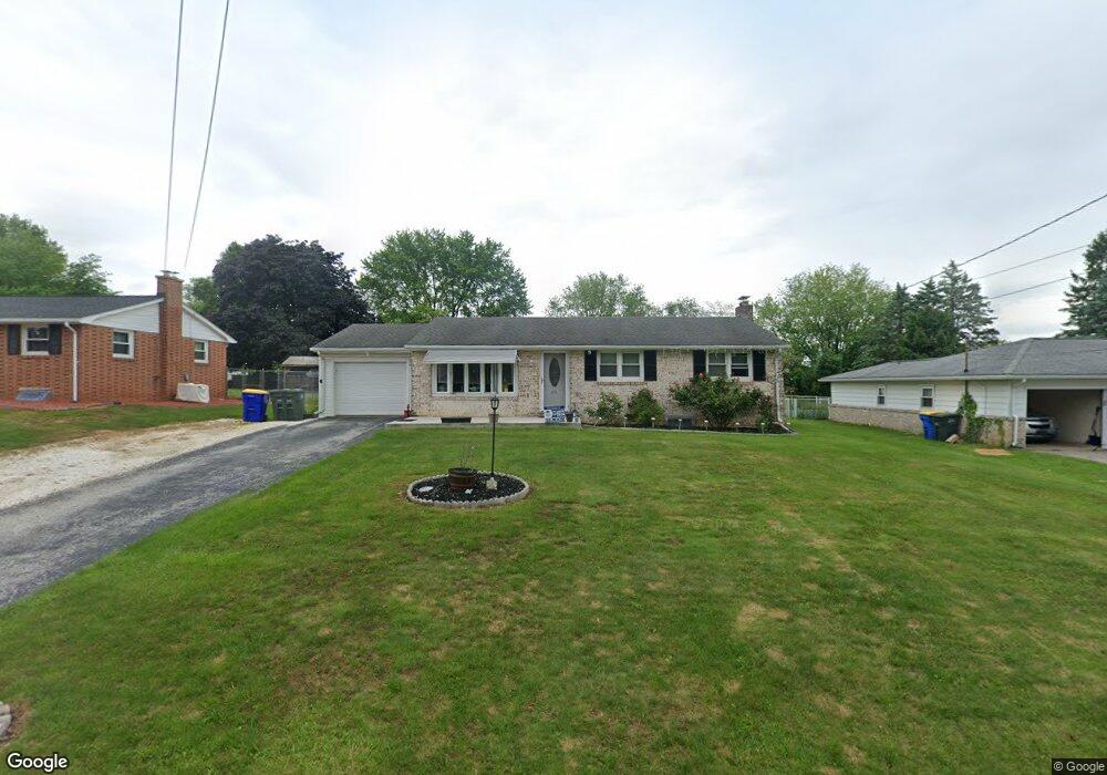
211 Nollyn Dr Dallastown, PA 17313
Estimated Value: $258,894 - $297,000
3
Beds
1
Bath
1,066
Sq Ft
$258/Sq Ft
Est. Value
About This Home
This home is located at 211 Nollyn Dr, Dallastown, PA 17313 and is currently estimated at $274,724, approximately $257 per square foot. 211 Nollyn Dr is a home located in York County with nearby schools including York Township Elementary School, Dallastown Area Middle School, and Dallastown Area Senior High School.
Ownership History
Date
Name
Owned For
Owner Type
Purchase Details
Closed on
Jun 28, 2019
Sold by
Auker Pearl E and Rhea Pearl E
Bought by
Campbell Thomas J and Campbell Christina L
Current Estimated Value
Home Financials for this Owner
Home Financials are based on the most recent Mortgage that was taken out on this home.
Original Mortgage
$124,800
Outstanding Balance
$109,737
Interest Rate
4%
Mortgage Type
New Conventional
Estimated Equity
$164,987
Purchase Details
Closed on
Jun 19, 2001
Sold by
Crist John W and Crist Charlotte L
Bought by
Auker Gary L and Auker Pearl E
Home Financials for this Owner
Home Financials are based on the most recent Mortgage that was taken out on this home.
Original Mortgage
$94,651
Interest Rate
7.09%
Mortgage Type
FHA
Create a Home Valuation Report for This Property
The Home Valuation Report is an in-depth analysis detailing your home's value as well as a comparison with similar homes in the area
Home Values in the Area
Average Home Value in this Area
Purchase History
| Date | Buyer | Sale Price | Title Company |
|---|---|---|---|
| Campbell Thomas J | $156,000 | None Available | |
| Auker Gary L | $95,400 | -- |
Source: Public Records
Mortgage History
| Date | Status | Borrower | Loan Amount |
|---|---|---|---|
| Open | Campbell Thomas J | $124,800 | |
| Previous Owner | Auker Gary L | $94,651 |
Source: Public Records
Tax History Compared to Growth
Tax History
| Year | Tax Paid | Tax Assessment Tax Assessment Total Assessment is a certain percentage of the fair market value that is determined by local assessors to be the total taxable value of land and additions on the property. | Land | Improvement |
|---|---|---|---|---|
| 2025 | $4,104 | $119,560 | $31,760 | $87,800 |
| 2024 | $4,044 | $119,560 | $31,760 | $87,800 |
| 2023 | $4,044 | $119,560 | $31,760 | $87,800 |
| 2022 | $3,912 | $119,560 | $31,760 | $87,800 |
| 2021 | $3,727 | $119,560 | $31,760 | $87,800 |
| 2020 | $3,727 | $119,560 | $31,760 | $87,800 |
| 2019 | $3,715 | $119,560 | $31,760 | $87,800 |
| 2018 | $3,690 | $119,560 | $31,760 | $87,800 |
| 2017 | $3,543 | $119,560 | $31,760 | $87,800 |
| 2016 | $0 | $119,560 | $31,760 | $87,800 |
| 2015 | -- | $119,560 | $31,760 | $87,800 |
| 2014 | -- | $119,560 | $31,760 | $87,800 |
Source: Public Records
Map
Nearby Homes
- 2933 Exeter Dr S
- 2981 Sunset Dr
- 2925 Starfire Dr
- 680 Hampstead Ct
- 2960 Starfire Dr
- 428 W Main St
- 0 Gary Dr
- 355 W Main St
- 106 Teila Dr
- 125 Verna Dr
- 424 Dartha Dr
- 0 S Franklin St
- 136 Teila Dr
- 435 Frederick Dr
- 732 Blossom Hill Ln
- 774 Blossom Hill Ln
- 2723 S Queen St Unit 96
- 519 Middleview Dr
- 122 S Pleasant Ave
- 64 S Pleasant Ave