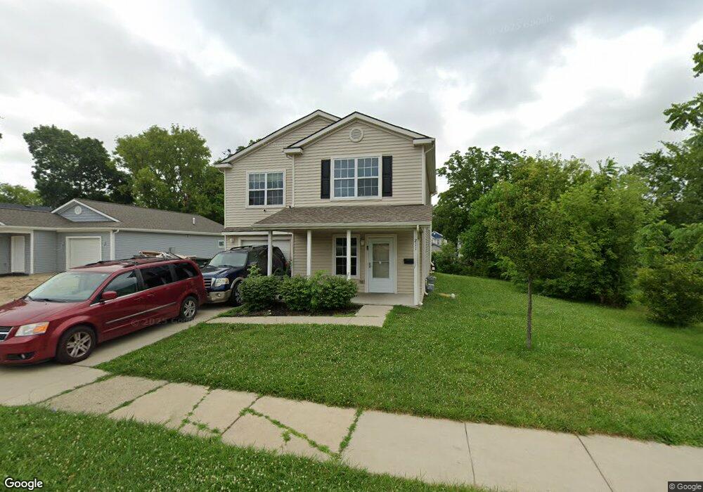
211 Osmun St Pontiac, MI 48342
Estimated Value: $136,000 - $456,000
3
Beds
3
Baths
1,920
Sq Ft
$132/Sq Ft
Est. Value
About This Home
This home is located at 211 Osmun St, Pontiac, MI 48342 and is currently estimated at $252,669, approximately $131 per square foot. 211 Osmun St is a home located in Oakland County with nearby schools including Walt Whitman Elementary School, Pontiac Middle School, and Pontiac High School.
Ownership History
Date
Name
Owned For
Owner Type
Purchase Details
Closed on
Sep 17, 2014
Sold by
Treasurer Of Oakland County
Bought by
Community Housing Network Inc
Current Estimated Value
Purchase Details
Closed on
Jan 25, 2009
Sold by
Grace Gospel Fellowship
Bought by
Rowell Rachelle
Purchase Details
Closed on
Feb 27, 2008
Sold by
Dohany Patrick M
Bought by
Grace Gospel Fellowship
Purchase Details
Closed on
Dec 6, 2000
Sold by
Walker Eula B
Bought by
Walker Jimmy L
Create a Home Valuation Report for This Property
The Home Valuation Report is an in-depth analysis detailing your home's value as well as a comparison with similar homes in the area
Home Values in the Area
Average Home Value in this Area
Purchase History
| Date | Buyer | Sale Price | Title Company |
|---|---|---|---|
| Community Housing Network Inc | -- | None Available | |
| Rowell Rachelle | $300 | None Available | |
| Grace Gospel Fellowship | -- | None Available | |
| Walker Jimmy L | -- | -- |
Source: Public Records
Tax History Compared to Growth
Tax History
| Year | Tax Paid | Tax Assessment Tax Assessment Total Assessment is a certain percentage of the fair market value that is determined by local assessors to be the total taxable value of land and additions on the property. | Land | Improvement |
|---|---|---|---|---|
| 2024 | $2,701 | $81,730 | $0 | $0 |
| 2023 | $2,574 | $72,330 | $0 | $0 |
| 2022 | $2,546 | $63,740 | $0 | $0 |
| 2021 | $2,468 | $57,600 | $0 | $0 |
| 2020 | $2,339 | $52,960 | $0 | $0 |
| 2019 | $2,412 | $45,650 | $0 | $0 |
| 2018 | $1,276 | $22,040 | $0 | $0 |
| 2017 | $88 | $1,580 | $0 | $0 |
| 2016 | $97 | $1,750 | $0 | $0 |
| 2015 | -- | $0 | $0 | $0 |
| 2014 | -- | $0 | $0 | $0 |
| 2011 | -- | $16,620 | $0 | $0 |
Source: Public Records
Map
Nearby Homes
- 000 Wall St
- 397 S Jessie St
- 187 Wall St
- 328 Whittemore St
- 472 S Jessie St
- 389 Osmun St
- 209 Ferry Ave
- 176 S Francis Ave
- 323 Ferry Ave
- 0 Woodward Ave
- 505 Auburn Ave
- 354 Ferry Ave
- 18 S Shirley St
- 33 S Tasmania St
- 447 S Marshall St
- 465 S Marshall St
- 000 Rapid St
- 583 Going St
- 53 N Roselawn St
- 55 N Roselawn St