Estimated Value: $309,000 - $364,000
5
Beds
3
Baths
2,703
Sq Ft
$123/Sq Ft
Est. Value
About This Home
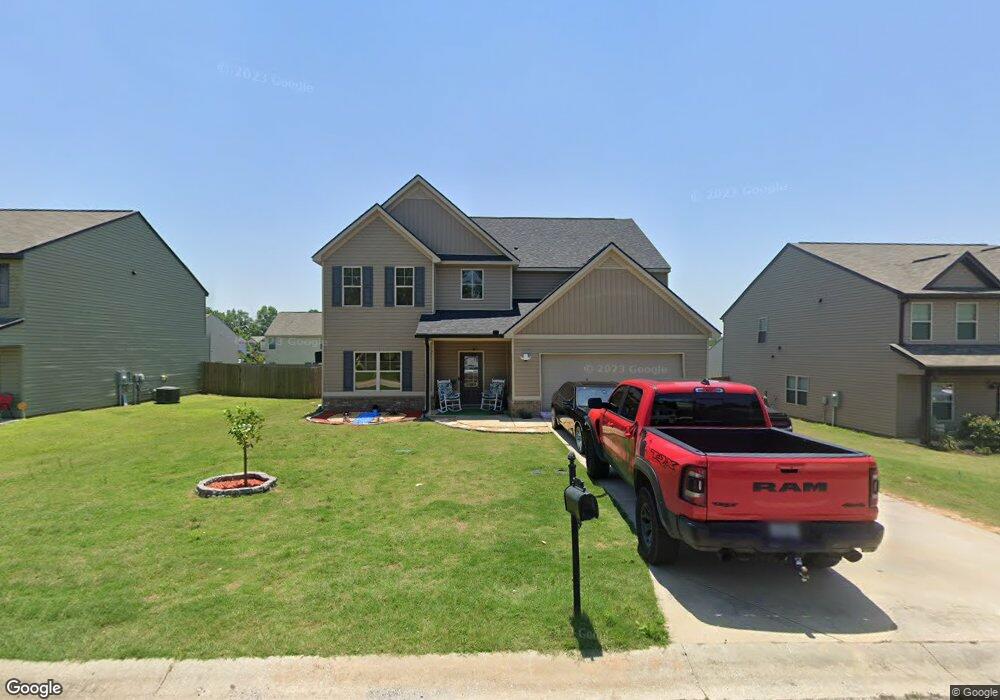
This home is located at 211 Ousley Way Unit 85- Westin, Perry, GA 31069 and is currently estimated at $332,890, approximately $123 per square foot. 211 Ousley Way Unit 85- Westin is a home located in Houston County with nearby schools including Morningside Elementary School, Perry Middle School, and Perry High School.
Ownership History
Date
Name
Owned For
Owner Type
Purchase Details
Closed on
Jun 28, 2019
Sold by
Builders Professional Group Llc
Bought by
Hill Melanda N
Current Estimated Value
Home Financials for this Owner
Home Financials are based on the most recent Mortgage that was taken out on this home.
Original Mortgage
$222,573
Outstanding Balance
$194,994
Interest Rate
3.82%
Mortgage Type
VA
Estimated Equity
$137,896
Purchase Details
Closed on
May 8, 2018
Sold by
Kd Properties Llc
Bought by
Builders Professional Group Llc
Home Financials for this Owner
Home Financials are based on the most recent Mortgage that was taken out on this home.
Original Mortgage
$142,701
Interest Rate
4.4%
Mortgage Type
Construction
Create a Home Valuation Report for This Property
The Home Valuation Report is an in-depth analysis detailing your home's value as well as a comparison with similar homes in the area
Home Values in the Area
Average Home Value in this Area
Purchase History
| Date | Buyer | Sale Price | Title Company |
|---|---|---|---|
| Hill Melanda N | $222,600 | None Available | |
| Builders Professional Group Llc | $15,000 | None Available |
Source: Public Records
Mortgage History
| Date | Status | Borrower | Loan Amount |
|---|---|---|---|
| Open | Hill Melanda N | $222,573 | |
| Previous Owner | Builders Professional Group Llc | $142,701 |
Source: Public Records
Tax History Compared to Growth
Tax History
| Year | Tax Paid | Tax Assessment Tax Assessment Total Assessment is a certain percentage of the fair market value that is determined by local assessors to be the total taxable value of land and additions on the property. | Land | Improvement |
|---|---|---|---|---|
| 2024 | -- | $114,320 | $8,000 | $106,320 |
| 2023 | $3,961 | $108,320 | $8,000 | $100,320 |
| 2022 | $2,173 | $96,520 | $8,000 | $88,520 |
| 2021 | $2,081 | $90,000 | $8,000 | $82,000 |
| 2020 | $2,018 | $86,880 | $8,000 | $78,880 |
| 2019 | $1,660 | $71,440 | $8,000 | $63,440 |
| 2018 | $93 | $5,440 | $5,440 | $0 |
| 2017 | $95 | $4,080 | $4,080 | $0 |
| 2016 | $95 | $4,080 | $4,080 | $0 |
| 2015 | $95 | $4,080 | $4,080 | $0 |
| 2014 | -- | $4,080 | $4,080 | $0 |
| 2013 | -- | $6,000 | $6,000 | $0 |
Source: Public Records
Map
Nearby Homes
- 118 Farmers Way
- 107 Lighterknot Trail
- 106 Raspberry Trail
- 311 Rusty Plow Ln Unit 16
- 307 Rusty Plow Ln
- 104 Red Barn Ct
- 102 Kanza Trail
- 307 Rusty Plow Ln Unit 14
- 108 Christine Cir
- 110 Gwendolyn Ave
- 500 Legacy Park Dr
- 204 Susanne's Retreat
- 2111 N Us Hwy 41
- 1008 Ridge Cir S
- 314 Waxmyrtle Way
- 0 Perimeter Roads Unit 20145464
- 1015 Cherokee Rd
- 149 MacK Thompson Road Common
- 309 Charles Gray Blvd
- 0 MacK Thompson Rd Unit 253661
- 209 Ousley Way Unit 89-Layla
- 209 Ousley Way Unit 81-Layla
- 209 Ousley Way Unit lt81-Layla
- 209 Ousley Way
- 209 Ousley Way Unit 87-Layla
- 213 Ousley Way Unit 83-EverestII
- 213 Ousley Way Unit 83-Everest
- 0 Ousley Way Unit 17-Patriot 8826392
- 0 Ousley Way Unit 20-Kendall I 8826393
- 210 Longbridge Way Unit 86-Patriot
- 210 Longbridge Way Unit l4-Patriot
- 207 Ousley Way Unit 89-Everest
- 207 Ousley Way Unit lt89-Everest
- 207 Ousley Way
- 215 Ousley Way Unit 81-Kendall I
- 215 Ousley Way Unit 81- Kendall
- 208 Longbridge Way Unit 88- Westin
- 208 Longbridge Way
- 212 Longbridge Way Unit 84-Kendall I
- 212 Longbridge Way