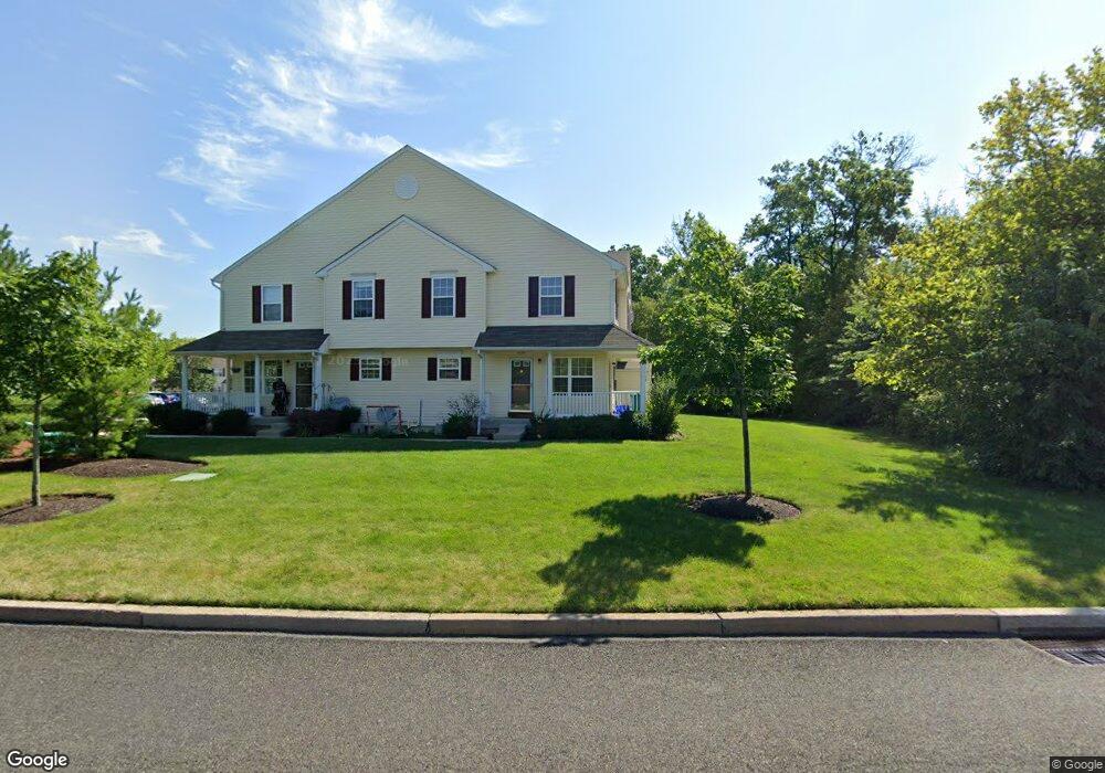
211 Prairie Ct Unit 211 Quakertown, PA 18951
Richland NeighborhoodEstimated Value: $273,000 - $306,149
3
Beds
3
Baths
1,250
Sq Ft
$236/Sq Ft
Est. Value
About This Home
This home is located at 211 Prairie Ct Unit 211, Quakertown, PA 18951 and is currently estimated at $294,537, approximately $235 per square foot. 211 Prairie Ct Unit 211 is a home located in Bucks County with nearby schools including Neidig Elementary School, Strayer Middle School, and Quakertown Community Senior High School.
Ownership History
Date
Name
Owned For
Owner Type
Purchase Details
Closed on
Mar 29, 2005
Sold by
Walnut Bank Farms Inc
Bought by
Hsu Michael and Revocable Trust Of Michael Hsu
Current Estimated Value
Home Financials for this Owner
Home Financials are based on the most recent Mortgage that was taken out on this home.
Original Mortgage
$146,400
Interest Rate
5.62%
Mortgage Type
Unknown
Purchase Details
Closed on
Jan 9, 1980
Bought by
Walnut Bank Farm Inc,
Create a Home Valuation Report for This Property
The Home Valuation Report is an in-depth analysis detailing your home's value as well as a comparison with similar homes in the area
Home Values in the Area
Average Home Value in this Area
Purchase History
| Date | Buyer | Sale Price | Title Company |
|---|---|---|---|
| Hsu Michael | $204,303 | None Available | |
| Walnut Bank Farm Inc, | $317,500 | -- |
Source: Public Records
Mortgage History
| Date | Status | Borrower | Loan Amount |
|---|---|---|---|
| Previous Owner | Hsu Michael | $146,400 |
Source: Public Records
Tax History Compared to Growth
Tax History
| Year | Tax Paid | Tax Assessment Tax Assessment Total Assessment is a certain percentage of the fair market value that is determined by local assessors to be the total taxable value of land and additions on the property. | Land | Improvement |
|---|---|---|---|---|
| 2025 | $4,691 | $22,000 | -- | $22,000 |
| 2024 | $4,691 | $22,000 | $0 | $22,000 |
| 2023 | $4,597 | $22,000 | $0 | $22,000 |
| 2022 | $4,523 | $22,000 | $0 | $22,000 |
| 2021 | $4,523 | $22,000 | $0 | $22,000 |
| 2020 | $4,523 | $22,000 | $0 | $22,000 |
| 2019 | $4,403 | $22,000 | $0 | $22,000 |
| 2018 | $4,257 | $22,000 | $0 | $22,000 |
| 2017 | $4,132 | $22,000 | $0 | $22,000 |
| 2016 | $4,132 | $22,000 | $0 | $22,000 |
| 2015 | -- | $22,000 | $0 | $22,000 |
| 2014 | -- | $22,000 | $0 | $22,000 |
Source: Public Records
Map
Nearby Homes
- 1221 Garden Ct
- 1206 Arbor Ct
- 12 Wagon Wheel Rd Unit 12
- 174 Wrangler Ct
- 811 W Mill St
- 105 Edgewater Ct
- 103 Edgewater Ct
- 803 W Broad St
- 48 Fonthill Ct
- 27 S 7th St
- 141 S 2nd St
- 1134 Virginia Way
- 1009 Heather Ln
- 94 Braithwaite Ln
- 262 Fairview Ave
- 766 Whistle Stop Ln
- 9 Maple St
- 4 Stonegate Village
- 56 Dewsbury Ln
- 5 Essex Ct
- 210 Prairie Ct
- 212 Prairie Ct Unit 212
- 209 Prairie Ct
- 208 Prairie Ct Unit 208
- 207 Prairie Ct
- 205 Prairie Ct Unit 205
- 206 Prairie Ct
- 1218 Garden Ct
- 204 Prairie Ct Unit 204
- 1220 Garden Ct
- 203 Prairie Ct Unit 203
- 214 Prairie Ct Unit BLDG V
- 214 Prairie Ct
- 213 Prairie Ct Unit 213
- 201 Prairie Ct Unit 201
- 1222 Garden Ct
- 202 Prairie Ct Unit 202
- 215 Prairie Ct Unit 215
- 216 Prairie Ct Unit 216
- 1224 Garden Ct