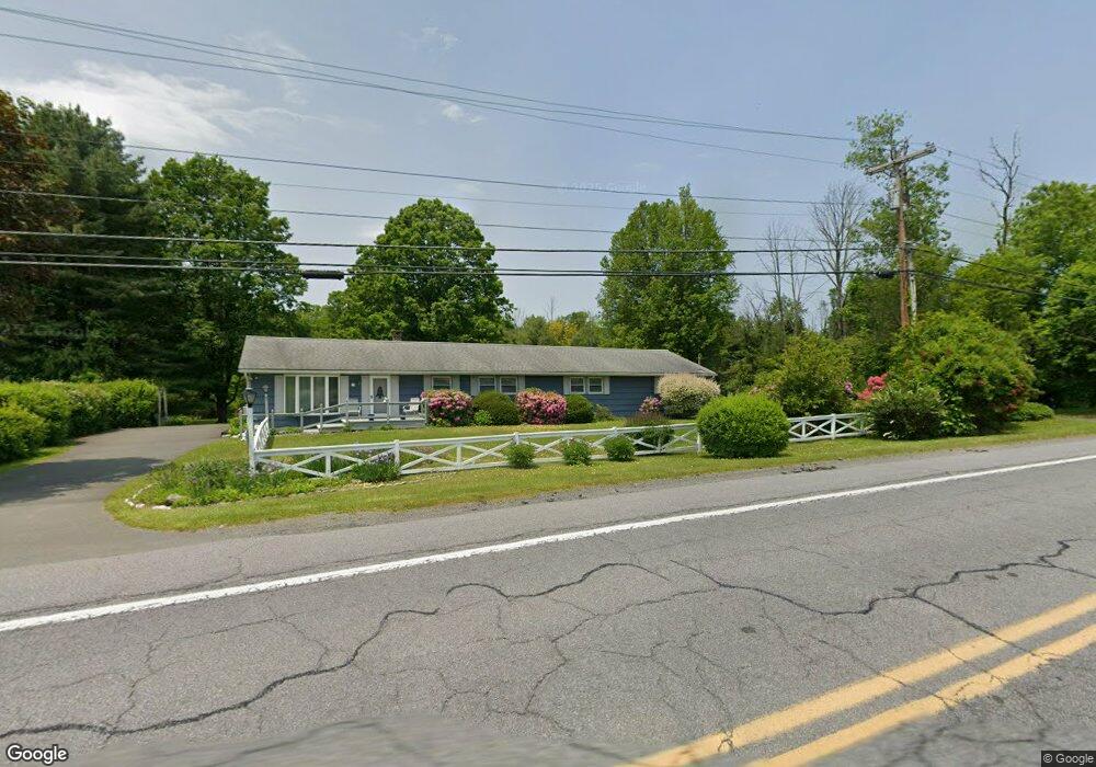
211 Route 390 Cresco, PA 18326
Estimated Value: $258,366 - $320,000
4
Beds
2
Baths
1,895
Sq Ft
$156/Sq Ft
Est. Value
About This Home
This home is located at 211 Route 390, Cresco, PA 18326 and is currently estimated at $295,592, approximately $155 per square foot. 211 Route 390 is a home located in Monroe County with nearby schools including Swiftwater Interm School, Swiftwater Elementary Center, and Pocono Mountain East Junior High School.
Ownership History
Date
Name
Owned For
Owner Type
Purchase Details
Closed on
Aug 1, 2022
Sold by
Murray Josephine A
Bought by
G & G Propertiespa Llc
Current Estimated Value
Purchase Details
Closed on
Nov 18, 1987
Bought by
Murray Robert A and Murray Josephine A
Create a Home Valuation Report for This Property
The Home Valuation Report is an in-depth analysis detailing your home's value as well as a comparison with similar homes in the area
Home Values in the Area
Average Home Value in this Area
Purchase History
| Date | Buyer | Sale Price | Title Company |
|---|---|---|---|
| G & G Propertiespa Llc | $250,000 | Pocono Property Abstract | |
| Murray Robert A | $118,000 | -- |
Source: Public Records
Tax History Compared to Growth
Tax History
| Year | Tax Paid | Tax Assessment Tax Assessment Total Assessment is a certain percentage of the fair market value that is determined by local assessors to be the total taxable value of land and additions on the property. | Land | Improvement |
|---|---|---|---|---|
| 2025 | $1,620 | $118,850 | $32,960 | $85,890 |
| 2024 | $1,229 | $118,850 | $32,960 | $85,890 |
| 2023 | $1,019 | $118,850 | $32,960 | $85,890 |
| 2022 | $4,652 | $118,850 | $32,960 | $85,890 |
| 2021 | $4,504 | $118,850 | $32,960 | $85,890 |
| 2020 | $4,570 | $118,850 | $32,960 | $85,890 |
| 2019 | $3,833 | $16,980 | $5,360 | $11,620 |
| 2018 | $3,833 | $16,980 | $5,360 | $11,620 |
| 2017 | $3,807 | $16,980 | $5,360 | $11,620 |
| 2016 | $770 | $16,980 | $5,360 | $11,620 |
| 2015 | $3,070 | $16,980 | $5,360 | $11,620 |
| 2014 | $3,070 | $16,980 | $5,360 | $11,620 |
Source: Public Records
Map
Nearby Homes
- 201 Blackberry Dr
- 210 Grouse Run
- 104 Sonnys Trail
- 349 Carlton Rd
- 436 Cranberry Creek Rd
- 384 Devils Hole Rd
- 0 Grange Rd Unit PM-122336
- 6509 Route 191
- 456 Devils Hole Rd
- 188 Olde Schoolhouse Rd
- 0 Route 191 Unit PWBPW243056
- 1163 Bush Rd
- 642 Tulip Tree Ln
- 115 Knob Rd
- 37 Seneca Rd
- 35 Brookeville Terrace Unit Lot 121
- 6656 Route 191
- 6663 Pennsylvania 191
- 11 Seneca Rd
- 3217 Hamlet Dr
- 211 Route 390
- 211 Route 390
- 205 Route 390
- 116 Ellison Ln
- 217 Route 390
- 223 Route 390
- 123 Ellison Ln
- 195 Route 390
- 115 Ellison Ln
- 388 Koerners Rd
- 227 Route 390
- Lot 5 Denbigh Ln
- 180 Blackberry Dr
- 180 Blackberry Dr
- 180 Blackberry Dr
- 180 Blackberry Dr
- 180 Blackberry Dr
- 3655 Koerner Rd
- 170 Blackberry Dr
- 185 Route 390