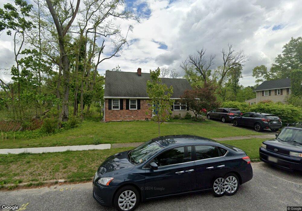
211 S Monroe Ave Wenonah, NJ 08090
Estimated Value: $428,146 - $453,000
--
Bed
--
Bath
1,965
Sq Ft
$223/Sq Ft
Est. Value
About This Home
This home is located at 211 S Monroe Ave, Wenonah, NJ 08090 and is currently estimated at $437,787, approximately $222 per square foot. 211 S Monroe Ave is a home located in Gloucester County with nearby schools including Wenonah Elementary School and Gateway Regional High School.
Ownership History
Date
Name
Owned For
Owner Type
Purchase Details
Closed on
Aug 23, 2012
Sold by
Romeo George C and Vitto Cindy L
Bought by
Freind William J and Freind Shelie G
Current Estimated Value
Home Financials for this Owner
Home Financials are based on the most recent Mortgage that was taken out on this home.
Original Mortgage
$176,000
Outstanding Balance
$121,061
Interest Rate
3.52%
Mortgage Type
New Conventional
Estimated Equity
$316,726
Purchase Details
Closed on
Jul 22, 2005
Sold by
Thomas Gerald D and Thomas Margaret
Bought by
Romeo George C and Vitto Cindy L
Home Financials for this Owner
Home Financials are based on the most recent Mortgage that was taken out on this home.
Original Mortgage
$196,800
Interest Rate
5.59%
Mortgage Type
Fannie Mae Freddie Mac
Purchase Details
Closed on
May 31, 2002
Sold by
The Evangelical Lutheran Church Of The H
Bought by
Thomas Gerald D and Thomas Margaret
Home Financials for this Owner
Home Financials are based on the most recent Mortgage that was taken out on this home.
Original Mortgage
$148,824
Interest Rate
7%
Mortgage Type
FHA
Create a Home Valuation Report for This Property
The Home Valuation Report is an in-depth analysis detailing your home's value as well as a comparison with similar homes in the area
Home Values in the Area
Average Home Value in this Area
Purchase History
| Date | Buyer | Sale Price | Title Company |
|---|---|---|---|
| Freind William J | $220,000 | Foundation Title Llc | |
| Romeo George C | $246,000 | Continental Title | |
| Thomas Gerald D | $150,000 | -- |
Source: Public Records
Mortgage History
| Date | Status | Borrower | Loan Amount |
|---|---|---|---|
| Open | Freind William J | $176,000 | |
| Previous Owner | Romeo George C | $196,800 | |
| Previous Owner | Thomas Gerald D | $148,824 |
Source: Public Records
Tax History Compared to Growth
Tax History
| Year | Tax Paid | Tax Assessment Tax Assessment Total Assessment is a certain percentage of the fair market value that is determined by local assessors to be the total taxable value of land and additions on the property. | Land | Improvement |
|---|---|---|---|---|
| 2025 | $9,602 | $216,500 | $90,600 | $125,900 |
| 2024 | $9,134 | $216,500 | $90,600 | $125,900 |
| 2023 | $9,134 | $216,500 | $90,600 | $125,900 |
| 2022 | $9,069 | $216,500 | $90,600 | $125,900 |
| 2021 | $9,156 | $216,500 | $90,600 | $125,900 |
| 2020 | $9,121 | $216,500 | $90,600 | $125,900 |
| 2019 | $8,974 | $216,500 | $90,600 | $125,900 |
| 2018 | $8,820 | $216,500 | $90,600 | $125,900 |
| 2017 | $8,820 | $216,500 | $90,600 | $125,900 |
| 2016 | $8,632 | $216,500 | $90,600 | $125,900 |
| 2015 | $8,448 | $216,500 | $90,600 | $125,900 |
| 2014 | $7,350 | $219,400 | $105,000 | $114,400 |
Source: Public Records
Map
Nearby Homes
- 108 S Clinton Ave
- 3 E Mantua Ave
- 47 New Jersey Ave
- 505 W Mantua Ave
- 509 Mantua Blvd
- 206 E Elm St
- 8 W Buttonwood St
- 1 W Buttonwood St
- 711 Howard Ave
- 413 Eryn Rd
- 315 Ogden Station Rd
- 313 Ogden Station Rd
- 748 Dartmouth Dr
- 100 Buddy Powell Ln
- 125 Ivy Ln
- 114 Buddy Powell Ln
- 916 Georgetown Rd
- 7 Manchester Ct
- 103 Carver Dr
- 106 Bock Ave
- 215 S Monroe Ave
- 209 S Monroe Ave
- 208 S West Ave
- 206 S West Ave
- 210 S West Ave
- 207 S Monroe Ave
- 205 S Monroe Ave
- 204 S West Ave
- 210 S Monroe Ave
- 208 S Monroe Ave
- 101 W Cedar St
- 206 S Monroe Ave
- 204 S Monroe Ave
- 6 W Willow St
- 12 W Willow St
- 10 W Willow St
- 201 S Monroe Ave
- 8 W Willow St
- 4 W Willow St
- 2 W Cedar St