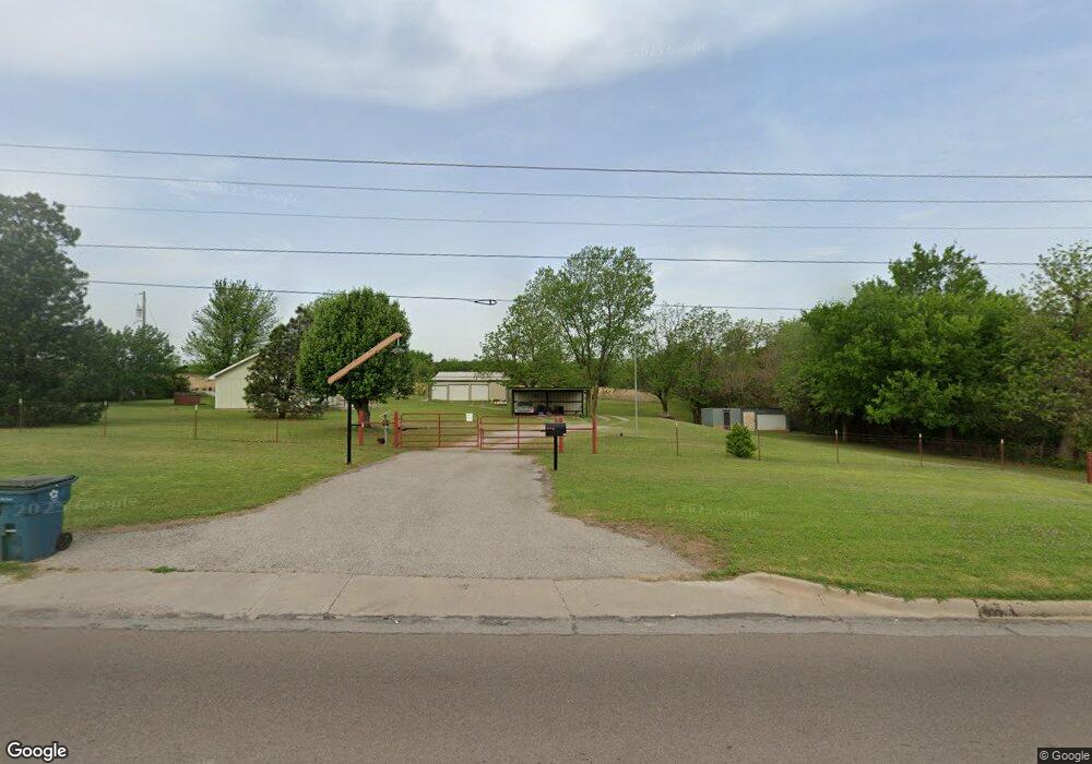
211 S Mustang Rd Tuttle, OK 73089
Estimated Value: $122,740 - $294,000
2
Beds
1
Bath
744
Sq Ft
$268/Sq Ft
Est. Value
About This Home
This home is located at 211 S Mustang Rd, Tuttle, OK 73089 and is currently estimated at $199,685, approximately $268 per square foot. 211 S Mustang Rd is a home located in Grady County with nearby schools including Tuttle Elementary School, Tuttle Intermediate School, and Tuttle Middle School.
Ownership History
Date
Name
Owned For
Owner Type
Purchase Details
Closed on
Mar 25, 2025
Sold by
Andrews Jacob R and Andrews Heather N
Bought by
Andrews Jacob R
Current Estimated Value
Purchase Details
Closed on
Mar 13, 2025
Sold by
Lynn Andrews and Marie Ellen
Bought by
Chris And Ellen Andrews Living Trust and Andrews
Purchase Details
Closed on
Sep 16, 2014
Sold by
Andrews Christopher Lynn
Bought by
Andrews Jacob R and Andrews Heath
Create a Home Valuation Report for This Property
The Home Valuation Report is an in-depth analysis detailing your home's value as well as a comparison with similar homes in the area
Home Values in the Area
Average Home Value in this Area
Purchase History
| Date | Buyer | Sale Price | Title Company |
|---|---|---|---|
| Andrews Jacob R | -- | None Listed On Document | |
| Andrews Jacob R | -- | None Listed On Document | |
| Chris And Ellen Andrews Living Trust | -- | None Listed On Document | |
| Chris And Ellen Andrews Living Trust | -- | None Listed On Document | |
| Andrews Jacob R | $70,000 | -- |
Source: Public Records
Tax History
| Year | Tax Paid | Tax Assessment Tax Assessment Total Assessment is a certain percentage of the fair market value that is determined by local assessors to be the total taxable value of land and additions on the property. | Land | Improvement |
|---|---|---|---|---|
| 2025 | $1,158 | $10,313 | $1,527 | $8,786 |
| 2024 | $1,185 | $9,822 | $1,455 | $8,367 |
| 2023 | $1,185 | $9,354 | $1,711 | $7,643 |
| 2022 | $1,041 | $8,909 | $1,667 | $7,242 |
| 2021 | $1,051 | $8,957 | $1,660 | $7,297 |
| 2020 | $1,075 | $9,071 | $1,598 | $7,473 |
| 2019 | $1,028 | $8,819 | $1,224 | $7,595 |
| 2018 | $715 | $6,473 | $1,232 | $5,241 |
| 2017 | $728 | $6,435 | $1,215 | $5,220 |
| 2016 | $886 | $7,700 | $1,154 | $6,546 |
| 2015 | $675 | $7,700 | $1,154 | $6,546 |
| 2014 | $675 | $6,155 | $528 | $5,627 |
Source: Public Records
Map
Nearby Homes
- 208 S Mustang Rd
- 218 S Mustang Rd
- 113 S Mustang Rd
- 204 S Mustang Rd
- 102 S Mustang Rd
- 17 S Mustang Rd
- 0 1 62 Acre Lot On S Mustang Rd Unit 872510
- 327 S Mustang Rd
- 318 S Mustang Rd
- 300 S Mustang Rd
- 8 S Mustang Rd
- 406 S Mustang Rd
- 5101 Leonard Dr
- 4906 E Highway 37
- 4817 Daugherty Dr
- 5014 E Highway 37
- 4908 Daugherty Dr
- 5102 Leonard Dr
- 410 S Mustang Rd
- 5116 E Highway 37
Your Personal Tour Guide
Ask me questions while you tour the home.