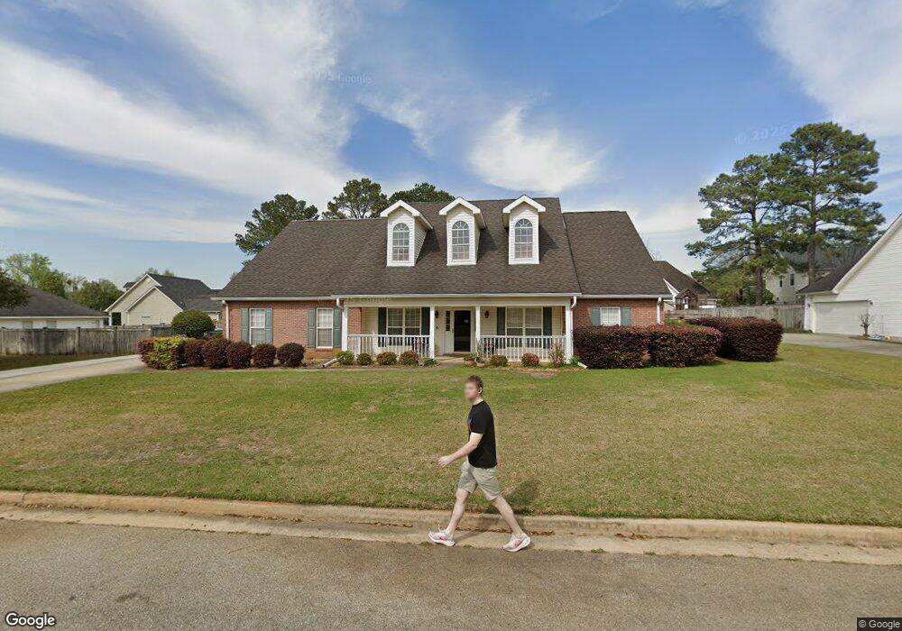
211 Sage Dr Warner Robins, GA 31088
Estimated Value: $279,000 - $329,000
--
Bed
1
Bath
2,306
Sq Ft
$134/Sq Ft
Est. Value
About This Home
This home is located at 211 Sage Dr, Warner Robins, GA 31088 and is currently estimated at $308,139, approximately $133 per square foot. 211 Sage Dr is a home located in Houston County with nearby schools including Lake Joy Primary School, Lake Joy Elementary School, and Feagin Mill Middle School.
Ownership History
Date
Name
Owned For
Owner Type
Purchase Details
Closed on
Feb 28, 2012
Sold by
Williams Deborah M
Bought by
Dunn Kennon C and Dunn Sarah J
Current Estimated Value
Purchase Details
Closed on
Jan 28, 2002
Sold by
Mike Carter Homes
Bought by
Williams Deborah M
Purchase Details
Closed on
May 17, 2001
Sold by
Hawthorne Group Llc
Bought by
Mike Carter Homes Inc
Create a Home Valuation Report for This Property
The Home Valuation Report is an in-depth analysis detailing your home's value as well as a comparison with similar homes in the area
Home Values in the Area
Average Home Value in this Area
Purchase History
| Date | Buyer | Sale Price | Title Company |
|---|---|---|---|
| Dunn Kennon C | $32,000 | None Available | |
| Williams Deborah M | $169,900 | -- | |
| Mike Carter Homes Inc | $25,500 | -- |
Source: Public Records
Tax History Compared to Growth
Tax History
| Year | Tax Paid | Tax Assessment Tax Assessment Total Assessment is a certain percentage of the fair market value that is determined by local assessors to be the total taxable value of land and additions on the property. | Land | Improvement |
|---|---|---|---|---|
| 2024 | $2,952 | $98,920 | $12,400 | $86,520 |
| 2023 | $2,545 | $85,840 | $12,400 | $73,440 |
| 2022 | $1,829 | $81,560 | $12,400 | $69,160 |
| 2021 | $1,636 | $72,760 | $12,400 | $60,360 |
| 2020 | $1,639 | $72,560 | $12,400 | $60,160 |
| 2019 | $1,639 | $72,560 | $12,400 | $60,160 |
| 2018 | $1,516 | $67,240 | $12,400 | $54,840 |
| 2017 | $1,517 | $67,240 | $12,400 | $54,840 |
| 2016 | $1,519 | $67,240 | $12,400 | $54,840 |
| 2015 | -- | $67,240 | $12,400 | $54,840 |
| 2014 | -- | $67,240 | $12,400 | $54,840 |
| 2013 | -- | $73,160 | $12,400 | $60,760 |
Source: Public Records
Map
Nearby Homes
- 209 Sage Dr
- 215 Sage Dr
- 112 White Pond Ln
- 503 Bay Laurel Cir
- 212 Sage Dr
- 114 White Pond Ln
- 207 Sage Dr
- 110 White Pond Ln
- 210 Sage Dr
- 403 Bay Laurel Cir
- 0 Bay Laurel Cir Unit 7170768
- 0 Bay Laurel Cir Unit 8814682
- 0 Bay Laurel Cir Unit 8804178
- 0 Bay Laurel Cir Unit 8757468
- 0 Bay Laurel Cir Unit 8755410
- 0 Bay Laurel Cir Unit 8605975
- 0 Bay Laurel Cir Unit 8576096
- 0 Bay Laurel Cir Unit 8362665
- 0 Bay Laurel Cir Unit 8067420
- 0 Bay Laurel Cir Unit 3220559