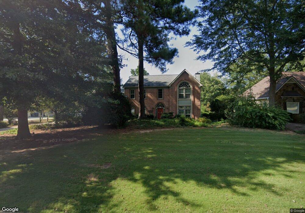
211 Saint Martin Dr Unit 3 Suwanee, GA 30024
Estimated Value: $528,768 - $611,000
4
Beds
3
Baths
2,168
Sq Ft
$258/Sq Ft
Est. Value
About This Home
This home is located at 211 Saint Martin Dr Unit 3, Suwanee, GA 30024 and is currently estimated at $559,442, approximately $258 per square foot. 211 Saint Martin Dr Unit 3 is a home located in Gwinnett County with nearby schools including Level Creek Elementary School, North Gwinnett Middle School, and North Gwinnett High School.
Ownership History
Date
Name
Owned For
Owner Type
Purchase Details
Closed on
Aug 1, 2002
Sold by
Crim John H and Crim Gloice Y
Bought by
Gooch Stphen A and Gooch Elizabeth M
Current Estimated Value
Home Financials for this Owner
Home Financials are based on the most recent Mortgage that was taken out on this home.
Original Mortgage
$141,000
Outstanding Balance
$59,579
Interest Rate
6.53%
Mortgage Type
New Conventional
Estimated Equity
$499,863
Purchase Details
Closed on
Jan 7, 1997
Sold by
Underwood Phillip
Bought by
Crim John Gloice
Create a Home Valuation Report for This Property
The Home Valuation Report is an in-depth analysis detailing your home's value as well as a comparison with similar homes in the area
Home Values in the Area
Average Home Value in this Area
Purchase History
| Date | Buyer | Sale Price | Title Company |
|---|---|---|---|
| Gooch Stphen A | $265,000 | -- | |
| Crim John Gloice | $215,000 | -- |
Source: Public Records
Mortgage History
| Date | Status | Borrower | Loan Amount |
|---|---|---|---|
| Open | Gooch Stphen A | $141,000 |
Source: Public Records
Tax History Compared to Growth
Tax History
| Year | Tax Paid | Tax Assessment Tax Assessment Total Assessment is a certain percentage of the fair market value that is determined by local assessors to be the total taxable value of land and additions on the property. | Land | Improvement |
|---|---|---|---|---|
| 2024 | $691 | $185,280 | $40,800 | $144,480 |
| 2023 | $691 | $177,000 | $40,800 | $136,200 |
| 2022 | $1,454 | $146,640 | $40,800 | $105,840 |
| 2021 | $1,196 | $112,280 | $29,960 | $82,320 |
| 2020 | $1,264 | $126,240 | $29,960 | $96,280 |
| 2019 | $686 | $101,640 | $23,920 | $77,720 |
| 2018 | $686 | $101,640 | $23,920 | $77,720 |
| 2016 | $680 | $97,320 | $28,800 | $68,520 |
| 2015 | $2,532 | $87,120 | $21,200 | $65,920 |
| 2014 | $2,567 | $88,040 | $31,200 | $56,840 |
Source: Public Records
Map
Nearby Homes
- 4719 Terquay Ct
- 4651 Deep Creek Dr NE
- 4570 Deep Creek Dr
- 4405 Donahue Ave
- 159 Level Creek Rd
- 5006 Suwanee Dam Rd
- 4863 Rosemoore Ct
- 4865 Settles Point Rd
- 4920 Puritan Dr Unit 1
- 4138 Baverton Dr
- 205 Finsbury Park Ct
- 280 Chandler Ct
- 5177 Cabot Creek Dr
- 425 Chandler Ct
- 5003 Pacific Dunes Dr
- 4166 Baverton Dr
- 5096 Akard Ct
- 5157 Wellisford Ct Unit 8
- 201 Saint Martin Dr
- 221 Saint Martin Dr
- 191 Saint Martin Dr
- 212 Saint Martin Dr
- 231 Saint Martin Dr
- 222 Saint Martin Dr
- 0 Saint Martin Dr
- 192 Saint Martin Dr Unit 3
- 181 Saint Martin Dr
- 4675 Lambton Cir Unit 3
- 4670 Lambton Cir
- 241 Saint Martin Dr Unit 3
- 182 Saint Martin Dr Unit 3
- 242 Saint Martin Dr Unit 3
- 171 Saint Martin Dr
- 4665 Lambton Cir
- 4660 Lambton Cir Unit 3
- 162 Saint Martin Dr Unit 3
- 4664 Camber Well Ln
- 235 Walford Ct