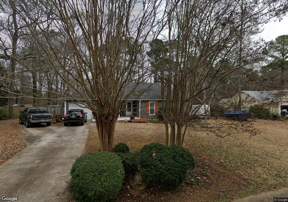
211 Stonybrook Cir Athens, GA 30605
Estimated Value: $275,000 - $316,000
3
Beds
2
Baths
1,367
Sq Ft
$215/Sq Ft
Est. Value
About This Home
This home is located at 211 Stonybrook Cir, Athens, GA 30605 and is currently estimated at $294,574, approximately $215 per square foot. 211 Stonybrook Cir is a home located in Clarke County with nearby schools including Barnett Shoals Elementary School, Hilsman Middle School, and Cedar Shoals High School.
Ownership History
Date
Name
Owned For
Owner Type
Purchase Details
Closed on
Jun 30, 2017
Sold by
Junkins Richard E
Bought by
Junkins Richard E and Junkins Marisa
Current Estimated Value
Home Financials for this Owner
Home Financials are based on the most recent Mortgage that was taken out on this home.
Original Mortgage
$126,100
Outstanding Balance
$104,404
Interest Rate
3.94%
Mortgage Type
New Conventional
Estimated Equity
$190,170
Purchase Details
Closed on
Sep 17, 2007
Sold by
Not Provided
Bought by
Junkins Richard E
Purchase Details
Closed on
Aug 30, 1993
Sold by
Rod Wright J and Rod Wright D
Bought by
Hopkins John P and Hopkins Rhonda B
Purchase Details
Closed on
Jun 6, 1993
Sold by
Brookstone Subdivision Inc
Bought by
Rod Wright J and Rod Wright D
Purchase Details
Closed on
Jun 28, 1985
Sold by
Hopkins John P and Hopkins Rhonda B
Bought by
Sanford Sara Grace
Create a Home Valuation Report for This Property
The Home Valuation Report is an in-depth analysis detailing your home's value as well as a comparison with similar homes in the area
Home Values in the Area
Average Home Value in this Area
Purchase History
| Date | Buyer | Sale Price | Title Company |
|---|---|---|---|
| Junkins Richard E | $130,000 | -- | |
| Junkins Richard E | $128,500 | -- | |
| Hopkins John P | $79,900 | -- | |
| Rod Wright J | $28,000 | -- | |
| Sanford Sara Grace | $87,400 | -- |
Source: Public Records
Mortgage History
| Date | Status | Borrower | Loan Amount |
|---|---|---|---|
| Open | Junkins Richard E | $126,100 |
Source: Public Records
Tax History Compared to Growth
Tax History
| Year | Tax Paid | Tax Assessment Tax Assessment Total Assessment is a certain percentage of the fair market value that is determined by local assessors to be the total taxable value of land and additions on the property. | Land | Improvement |
|---|---|---|---|---|
| 2025 | $3,055 | $98,405 | $12,000 | $86,405 |
| 2024 | $3,055 | $93,388 | $12,000 | $81,388 |
| 2023 | $2,918 | $89,090 | $12,000 | $77,090 |
| 2022 | $2,434 | $76,290 | $10,400 | $65,890 |
| 2021 | $2,068 | $61,371 | $10,400 | $50,971 |
| 2020 | $1,861 | $55,216 | $10,400 | $44,816 |
| 2019 | $1,788 | $52,656 | $10,400 | $42,256 |
| 2018 | $1,703 | $50,175 | $10,400 | $39,775 |
| 2017 | $1,541 | $45,384 | $10,400 | $34,984 |
| 2016 | $1,456 | $42,873 | $10,400 | $32,473 |
| 2015 | $1,472 | $43,294 | $10,400 | $32,894 |
| 2014 | $1,474 | $43,281 | $10,400 | $32,881 |
Source: Public Records
Map
Nearby Homes
- 123 Stonybrook Ct
- 153 Stonybrook Ct
- 375 Brookstone Dr
- 145 Myles Ct
- 345 Richard Way
- 200 Wiltshire Dr
- 309 Twin Creek Shores
- 355 Discovery Trail
- 365 Discovery Trail
- 350 Discovery Trail
- 440 Wood Ln
- 0 Williamsburg Ln Unit Lot 5
- 0 Williamsburg Ln Unit Lot 7
- 0 Williamsburg Ln Unit Lot 6
- 439 River Chase Dr
- 150 Greenwood Ln
- 0 Barnett Shoals Rd Unit Lot 2
- 201 Stonybrook Cir
- 201 Stonybrook Cir Unit APPLEBY DR
- 221 Stonybrook Cir
- 212 Stonybrook Cir
- 222 Stonybrook Cir
- 231 Stonybrook Cir
- 191 Stonybrook Cir
- 202 Stonybrook Cir
- 555 Brookstone Dr
- 232 Stonybrook Cir Unit n/a
- 232 Stonybrook Cir
- 110 Brookstone Place
- 585 Brookstone Dr
- 251 Stonybrook Cir
- 120 Brookstone Place
- 5095 Barnett Shoals Rd
- 000 Barnett Shoals Rd
- 2825/75 Barnett Shoals Rd
- 1455 Barnett Shoals Rd
- 4333 Barnett Shoals Rd