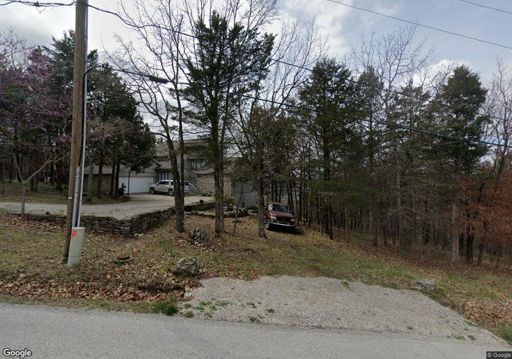
211 Table Rock Dr Eureka Springs, AR 72631
Estimated Value: $178,168 - $261,000
--
Bed
3
Baths
1,120
Sq Ft
$197/Sq Ft
Est. Value
About This Home
This home is located at 211 Table Rock Dr, Eureka Springs, AR 72631 and is currently estimated at $220,292, approximately $196 per square foot. 211 Table Rock Dr is a home located in Carroll County with nearby schools including Eureka Springs Elementary School, Eureka Springs Middle School, and Eureka Springs High School.
Ownership History
Date
Name
Owned For
Owner Type
Purchase Details
Closed on
Jan 11, 2010
Sold by
Burk Jerritt H
Bought by
Burk Jerritt H
Current Estimated Value
Home Financials for this Owner
Home Financials are based on the most recent Mortgage that was taken out on this home.
Original Mortgage
$81,050
Outstanding Balance
$53,160
Interest Rate
4.93%
Mortgage Type
New Conventional
Estimated Equity
$167,132
Purchase Details
Closed on
Jul 27, 2001
Sold by
Not Provided
Bought by
Burk and Burk Matthew
Purchase Details
Closed on
Jun 4, 2001
Sold by
Not Provided
Bought by
Martin Trst and Martin Burk/Matthews
Purchase Details
Closed on
Aug 14, 1996
Sold by
Martin
Bought by
Revoc Trust
Purchase Details
Closed on
Aug 30, 1983
Bought by
Qc H Martin To M Martin
Create a Home Valuation Report for This Property
The Home Valuation Report is an in-depth analysis detailing your home's value as well as a comparison with similar homes in the area
Home Values in the Area
Average Home Value in this Area
Purchase History
| Date | Buyer | Sale Price | Title Company |
|---|---|---|---|
| Burk Jerritt H | -- | None Available | |
| Burk | -- | -- | |
| Martin Trst | $87,000 | -- | |
| Revoc Trust | -- | -- | |
| Qc H Martin To M Martin | -- | -- |
Source: Public Records
Mortgage History
| Date | Status | Borrower | Loan Amount |
|---|---|---|---|
| Open | Burk Jerritt H | $81,050 |
Source: Public Records
Tax History Compared to Growth
Tax History
| Year | Tax Paid | Tax Assessment Tax Assessment Total Assessment is a certain percentage of the fair market value that is determined by local assessors to be the total taxable value of land and additions on the property. | Land | Improvement |
|---|---|---|---|---|
| 2024 | $514 | $24,660 | $4,000 | $20,660 |
| 2023 | $545 | $24,660 | $4,000 | $20,660 |
| 2022 | $551 | $24,660 | $4,000 | $20,660 |
| 2021 | $508 | $18,340 | $2,000 | $16,340 |
| 2020 | $508 | $18,340 | $2,000 | $16,340 |
| 2019 | $526 | $18,340 | $2,000 | $16,340 |
| 2018 | $551 | $18,340 | $2,000 | $16,340 |
| 2017 | $551 | $18,340 | $2,000 | $16,340 |
| 2016 | $614 | $20,030 | $2,000 | $18,030 |
| 2014 | -- | $20,030 | $2,000 | $18,030 |
Source: Public Records
Map
Nearby Homes
- 9 Cottonwood Ln
- Lot 14 Cottonwood Ln
- Lot 7 of Block 5 Stateline Dr
- Lot 3 Stateline Dr
- 80 Stateline Dr
- 67 Stateline Dr
- 63 Stateline Dr
- TBD Stateline Dr
- 7 Suntop Ln
- 19 Sycamore Ln
- 1 Thomas Cir W
- Lot 15 Table Rock Dr
- 194 Table Rock Dr
- Lot 6 Block 2 Valley Dr
- 86 Valley Dr Unit 4
- 20 Valley Dr
- 36 Starlite Ave
- 0 Table Rock Dr Unit 1321818
- 0 Table Rock Dr Unit 5 1309240
- 63 Eagle Dr
- 215 Table Rock Dr
- 213 Table Rock Dr
- 0 Table Rock Dr & Cottonwood Ln
- 212 Table Rock
- 139 Stateline Dr
- 2 Cottonwood Ln
- 7 Cottonwood Ln
- 120 Stateline Dr
- 118 Stateline Dr
- 149 Stateline Dr
- 3 Cottonwood Ln
- 106 Stateline Dr
- 10 Cottonwood Ln
- 95 Valley Dr
- 65 Eagle Dr
- 180 Stateline Dr
- 99 Valley Dr
- 29 Valley Dr
- 26 Valley Dr
- 49 Valley Dr