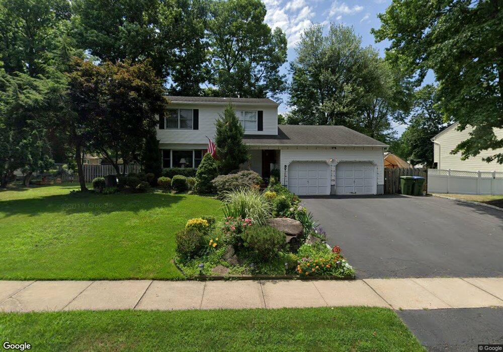
211 W Sherman Ave Edison, NJ 08820
Estimated Value: $776,182 - $982,000
--
Bed
--
Bath
2,128
Sq Ft
$410/Sq Ft
Est. Value
About This Home
This home is located at 211 W Sherman Ave, Edison, NJ 08820 and is currently estimated at $871,796, approximately $409 per square foot. 211 W Sherman Ave is a home located in Middlesex County with nearby schools including James Madison Primary School, James Madison Intermediate School, and John Adams Middle School.
Ownership History
Date
Name
Owned For
Owner Type
Purchase Details
Closed on
Feb 12, 2002
Sold by
Cho Wan
Bought by
Labayen Angelique Marie
Current Estimated Value
Home Financials for this Owner
Home Financials are based on the most recent Mortgage that was taken out on this home.
Original Mortgage
$210,000
Outstanding Balance
$86,526
Interest Rate
7.01%
Estimated Equity
$785,270
Purchase Details
Closed on
Apr 10, 1997
Sold by
White Thomas
Bought by
Cho Wan and Cho Soon
Home Financials for this Owner
Home Financials are based on the most recent Mortgage that was taken out on this home.
Original Mortgage
$183,000
Interest Rate
7.81%
Create a Home Valuation Report for This Property
The Home Valuation Report is an in-depth analysis detailing your home's value as well as a comparison with similar homes in the area
Home Values in the Area
Average Home Value in this Area
Purchase History
| Date | Buyer | Sale Price | Title Company |
|---|---|---|---|
| Labayen Angelique Marie | $346,000 | -- | |
| Cho Wan | $262,000 | -- |
Source: Public Records
Mortgage History
| Date | Status | Borrower | Loan Amount |
|---|---|---|---|
| Open | Labayen Angelique Marie | $210,000 | |
| Previous Owner | Cho Wan | $183,000 |
Source: Public Records
Tax History Compared to Growth
Tax History
| Year | Tax Paid | Tax Assessment Tax Assessment Total Assessment is a certain percentage of the fair market value that is determined by local assessors to be the total taxable value of land and additions on the property. | Land | Improvement |
|---|---|---|---|---|
| 2025 | $14,388 | $241,700 | $104,100 | $137,600 |
| 2024 | $14,311 | $241,700 | $104,100 | $137,600 |
| 2023 | $14,311 | $241,700 | $104,100 | $137,600 |
| 2022 | $14,316 | $241,700 | $104,100 | $137,600 |
| 2021 | $14,251 | $241,700 | $104,100 | $137,600 |
| 2020 | $14,137 | $241,700 | $104,100 | $137,600 |
| 2019 | $13,603 | $241,700 | $104,100 | $137,600 |
| 2018 | $13,274 | $241,700 | $104,100 | $137,600 |
| 2017 | $12,994 | $241,700 | $104,100 | $137,600 |
| 2016 | $12,752 | $241,700 | $104,100 | $137,600 |
| 2015 | $12,264 | $241,700 | $104,100 | $137,600 |
| 2014 | $11,906 | $241,700 | $104,100 | $137,600 |
Source: Public Records
Map
Nearby Homes
- 37 E Hegel Ave
- 868 Inman Ave
- 11 Bernice St
- 984 Feather Bed Ln
- 14 Bonnie Ln
- 86 Normandy Rd
- 24 Woodland Rd
- 24 Sandalwood Dr
- 67 Brookside Terrace
- 52 Brookside Terrace
- 41 Clover Ave
- 6 Tulip Ct
- 12 W Clark Place
- 131 Morningside Rd
- 975 Inman Ave
- 990 Inman Ave
- 80 Gaywood Ave
- 91 Amherst Ave
- 99 Cameo Place
- 70 Lancaster Rd
- 217 W Sherman Ave
- 214 W Prescott Ave
- 209 W Sherman Ave
- 218 W Prescott Ave
- 210 W Prescott Ave
- 212 W Sherman Ave
- 216 W Sherman Ave
- 219 W Sherman Ave
- 205 W Sherman Ave
- 208 W Sherman Ave
- 220 W Prescott Ave
- 206 W Prescott Ave
- 220 W Sherman Ave
- 213 W Prescott Ave
- 223 W Sherman Ave
- 209 W Grant Ave
- 204 W Sherman Ave
- 213 W Grant Ave
- 209 W Prescott Ave
- 217 W Prescott Ave