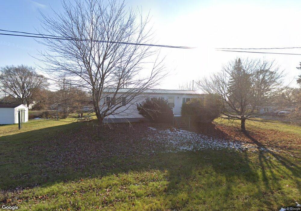
211 W Sherman St Whittemore, MI 48770
Estimated Value: $63,450 - $126,000
3
Beds
1
Bath
1,168
Sq Ft
$70/Sq Ft
Est. Value
About This Home
This home is located at 211 W Sherman St, Whittemore, MI 48770 and is currently estimated at $81,363, approximately $69 per square foot. 211 W Sherman St is a home located in Iosco County with nearby schools including Whittemore-Prescott Elementary School and Whittemore-Prescott Junior/Senior High School.
Ownership History
Date
Name
Owned For
Owner Type
Purchase Details
Closed on
Apr 27, 2019
Sold by
Nichols Leona M
Bought by
Nichols Leona M
Current Estimated Value
Create a Home Valuation Report for This Property
The Home Valuation Report is an in-depth analysis detailing your home's value as well as a comparison with similar homes in the area
Home Values in the Area
Average Home Value in this Area
Purchase History
| Date | Buyer | Sale Price | Title Company |
|---|---|---|---|
| Nichols Leona M | -- | -- |
Source: Public Records
Tax History Compared to Growth
Tax History
| Year | Tax Paid | Tax Assessment Tax Assessment Total Assessment is a certain percentage of the fair market value that is determined by local assessors to be the total taxable value of land and additions on the property. | Land | Improvement |
|---|---|---|---|---|
| 2025 | $472 | $20,400 | $20,400 | $0 |
| 2024 | $594 | $19,500 | $0 | $0 |
| 2023 | $142 | $18,600 | $18,600 | $0 |
| 2022 | $557 | $15,500 | $15,500 | $0 |
| 2021 | $509 | $14,000 | $14,000 | $0 |
| 2020 | $499 | $13,700 | $13,700 | $0 |
| 2019 | $474 | $12,700 | $12,700 | $0 |
| 2018 | $467 | $12,600 | $12,600 | $0 |
| 2017 | $448 | $12,700 | $12,700 | $0 |
| 2016 | $450 | $12,700 | $0 | $0 |
| 2015 | -- | $12,300 | $0 | $0 |
| 2014 | -- | $12,800 | $0 | $0 |
| 2013 | -- | $14,400 | $0 | $0 |
Source: Public Records
Map
Nearby Homes
- 100 & 102 S Bullock St
- 1870 Michigan 65
- 316 S Bullock St
- 7207 Prescott Rd
- 6849 Leggett Rd
- 1831 Kitchen Rd
- 8720 Whittemore Rd
- 8109 M 55
- 3433 Nile Rd
- 5745 Carpenter Rd
- 600 N Britt Rd
- 10 S Imperial Dr
- 5363 Keystone Rd
- 4901 Michigan 55
- 388 W Lagrant Rd
- 4861 Carpenter Rd
- 4121 Leggett Rd
- N/A Crosby Rd
- 10 W Maple Ridge Rd
- 111 South St
- 1950 S M 65
- 102 W 2nd St
- 111 W 2nd St
- 200 W Washington St
- 214 W Washington St
- 112 W 2nd St
- 200 First Street 1-10
- 200 W 1st St
- 101 W 3rd St
- 102 S Bullock St
- 100 S Bullock St
- 100 S Bullock St
- 101 N Bullock St
- 106 S Bullock St
- 310 W Washington St
- 105 N Bullock St
- 308 W Sherman St
- 306 W Sherman St
- 205 W Washington St
- 305 W Washington St