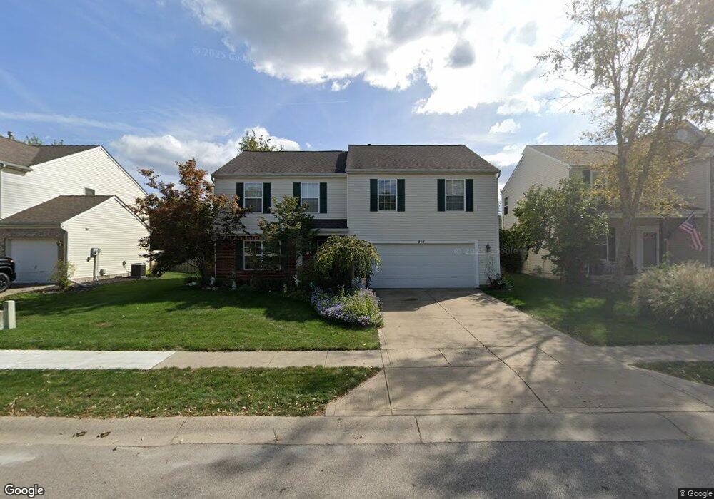
211 Winslow Dr Westfield, IN 46074
Estimated Value: $361,000 - $407,000
3
Beds
3
Baths
2,368
Sq Ft
$164/Sq Ft
Est. Value
About This Home
This home is located at 211 Winslow Dr, Westfield, IN 46074 and is currently estimated at $387,507, approximately $163 per square foot. 211 Winslow Dr is a home located in Hamilton County with nearby schools including Oak Trace Elementary School, Westfield Intermediate School, and Westfield Middle School.
Ownership History
Date
Name
Owned For
Owner Type
Purchase Details
Closed on
Aug 28, 2008
Sold by
Dillon Matthew C and Dillon Ammie E
Bought by
Green Jay R and Green Tammy S
Current Estimated Value
Home Financials for this Owner
Home Financials are based on the most recent Mortgage that was taken out on this home.
Original Mortgage
$125,600
Outstanding Balance
$84,099
Interest Rate
6.66%
Mortgage Type
Purchase Money Mortgage
Estimated Equity
$303,408
Purchase Details
Closed on
Dec 4, 2003
Sold by
Dillon Matthew C
Bought by
Dillon Matthew C and Dillon Ammie E
Home Financials for this Owner
Home Financials are based on the most recent Mortgage that was taken out on this home.
Original Mortgage
$140,500
Interest Rate
6.08%
Mortgage Type
New Conventional
Purchase Details
Closed on
Oct 5, 2001
Sold by
Dillon Matthew C
Bought by
Dillon Matthew C and Dillon Ammie E
Home Financials for this Owner
Home Financials are based on the most recent Mortgage that was taken out on this home.
Original Mortgage
$140,400
Interest Rate
7.03%
Purchase Details
Closed on
Aug 29, 2001
Sold by
M/I Schottenstein Homes Inc
Bought by
Dillon Matthew C
Home Financials for this Owner
Home Financials are based on the most recent Mortgage that was taken out on this home.
Original Mortgage
$140,400
Interest Rate
7.03%
Create a Home Valuation Report for This Property
The Home Valuation Report is an in-depth analysis detailing your home's value as well as a comparison with similar homes in the area
Home Values in the Area
Average Home Value in this Area
Purchase History
| Date | Buyer | Sale Price | Title Company |
|---|---|---|---|
| Green Jay R | -- | None Available | |
| Dillon Matthew C | -- | -- | |
| Dillon Matthew C | -- | -- | |
| Dillon Matthew C | -- | -- | |
| Dillon Matthew C | -- | -- |
Source: Public Records
Mortgage History
| Date | Status | Borrower | Loan Amount |
|---|---|---|---|
| Open | Green Jay R | $125,600 | |
| Previous Owner | Dillon Matthew C | $140,500 | |
| Previous Owner | Dillon Matthew C | $140,400 |
Source: Public Records
Tax History Compared to Growth
Tax History
| Year | Tax Paid | Tax Assessment Tax Assessment Total Assessment is a certain percentage of the fair market value that is determined by local assessors to be the total taxable value of land and additions on the property. | Land | Improvement |
|---|---|---|---|---|
| 2024 | $3,380 | $300,600 | $65,000 | $235,600 |
| 2023 | $3,415 | $299,200 | $65,000 | $234,200 |
| 2022 | $2,850 | $245,700 | $46,500 | $199,200 |
| 2021 | $2,607 | $219,300 | $46,500 | $172,800 |
| 2020 | $2,557 | $213,400 | $46,500 | $166,900 |
| 2019 | $2,353 | $196,900 | $29,300 | $167,600 |
| 2018 | $2,217 | $185,800 | $29,300 | $156,500 |
| 2017 | $1,937 | $174,000 | $29,300 | $144,700 |
| 2016 | $1,929 | $173,300 | $29,300 | $144,000 |
| 2014 | $1,706 | $154,900 | $29,300 | $125,600 |
| 2013 | $1,706 | $145,500 | $29,300 | $116,200 |
Source: Public Records
Map
Nearby Homes
- 349 E Quail Wood Ln
- 429 E Clear Lake Ln
- 408 Bedford Dr Unit 302
- 501 Fayette Dr
- 65 E Pine Ridge Dr
- 579 Overcup St Unit 11A
- 16719 Greensboro Dr
- 610 Sawtooth St
- 659 Decatur Dr
- 615 Nuttal St
- 259 Earl Park Way
- 16636 Brownstone Ct
- 17401 Austrian Pine Way
- 16628 Brownstone Ct
- 514 E Pine Ridge Dr
- 17081 Silver Vista Ln
- 239 Moose Ln
- 611 E Pine Ridge Dr
- 17069 Maple Springs Way
- 17318 Graley Place