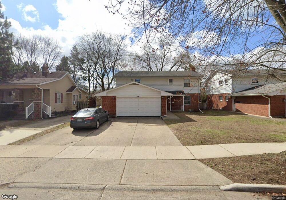
211 Woodsboro Dr Unit Bldg-Unit Royal Oak, MI 48067
Estimated Value: $384,000 - $694,950
6
Beds
4
Baths
2,542
Sq Ft
$226/Sq Ft
Est. Value
About This Home
This home is located at 211 Woodsboro Dr Unit Bldg-Unit, Royal Oak, MI 48067 and is currently estimated at $574,738, approximately $226 per square foot. 211 Woodsboro Dr Unit Bldg-Unit is a home located in Oakland County with nearby schools including Northwood Elementary School, Royal Oak Middle School, and Royal Oak High School.
Ownership History
Date
Name
Owned For
Owner Type
Purchase Details
Closed on
Jun 27, 2022
Sold by
Govil and Meenakshi
Bought by
Govil Family Trust
Current Estimated Value
Purchase Details
Closed on
Jun 15, 2018
Sold by
Wu Zhigang and Lu Shuangshuang
Bought by
Govil Sanjay and Govil Run Meenakshi
Purchase Details
Closed on
Jun 1, 2016
Sold by
Hill Cameron T and Hill Scott A
Bought by
Wu Zhigang
Purchase Details
Closed on
May 23, 2014
Sold by
Hill Phyllis S
Bought by
Hill Phyllis S and Hill Irrevoca Douglas G
Purchase Details
Closed on
Feb 8, 2013
Sold by
Hill Phyllis S and Hill Douglas G
Bought by
Hill Phyllis S and The Phyllis S Hill Revocable Living Trus
Create a Home Valuation Report for This Property
The Home Valuation Report is an in-depth analysis detailing your home's value as well as a comparison with similar homes in the area
Home Values in the Area
Average Home Value in this Area
Purchase History
| Date | Buyer | Sale Price | Title Company |
|---|---|---|---|
| Govil Family Trust | -- | None Listed On Document | |
| Govil Sanjay | $414,000 | None Available | |
| Wu Zhigang | $256,000 | None Available | |
| Hill Phyllis S | -- | None Available | |
| Hill Phyllis S | -- | None Available |
Source: Public Records
Tax History Compared to Growth
Tax History
| Year | Tax Paid | Tax Assessment Tax Assessment Total Assessment is a certain percentage of the fair market value that is determined by local assessors to be the total taxable value of land and additions on the property. | Land | Improvement |
|---|---|---|---|---|
| 2024 | $9,927 | $231,830 | $0 | $0 |
| 2022 | $10,826 | $208,930 | $0 | $0 |
| 2020 | $9,575 | $187,150 | $0 | $0 |
| 2018 | $10,826 | $155,570 | $0 | $0 |
| 2017 | $7,594 | $155,570 | $0 | $0 |
| 2015 | -- | $140,980 | $0 | $0 |
| 2014 | -- | $121,890 | $0 | $0 |
| 2011 | -- | $138,660 | $0 | $0 |
Source: Public Records
Map
Nearby Homes
- 320 Catalpa Dr
- 1821 N Washington Ave
- 1028 Edgewood Dr
- 1828 N Lafayette Ave
- 1833 N Washington Ave
- 307 Marlin Ave
- 606 Catalpa Dr
- 410 Crane Ave
- 334 Marlin Ave
- 719 W 12 Mile Rd
- 227 W Houstonia Ave
- 912 Woodsboro Dr
- 512 Marlin Ave
- 528 Marlin Ave
- 127 La Plaza Ct
- 408 Forest Ave
- 508 W Houstonia Ave
- 2115 Marywood Dr
- 715 Gardenia Ave
- 312 Park Ave
- 211 Dr
- 211 Woodsboro Dr
- 211 Woodsboro Dr Unit UPPER UNIT
- 211 Woodsboro Dr Unit LOWER
- 207 Woodsboro Dr
- 215 Woodsboro Dr Unit Bldg-Unit
- 215 Woodsboro Dr
- 123 Woodsboro Dr
- 1414 Crooks Rd
- 1420 N Washington Ave
- 214 Woodsboro Dr
- 210 Woodsboro Dr
- 121 Woodsboro Dr
- 206 Woodsboro Dr
- 218 Woodsboro Dr
- 1502 N Washington Ave
- 202 Woodsboro Dr
- 1506 N Washington Ave
- 116 Woodsboro Dr
- 1508 N Washington Ave