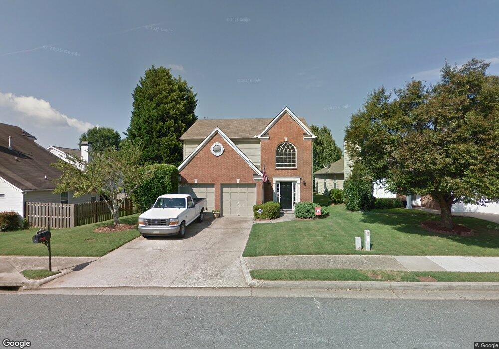
2110 Ashton Dr Unit 1 Roswell, GA 30076
Estimated Value: $504,510 - $524,000
3
Beds
3
Baths
1,848
Sq Ft
$278/Sq Ft
Est. Value
About This Home
This home is located at 2110 Ashton Dr Unit 1, Roswell, GA 30076 and is currently estimated at $513,128, approximately $277 per square foot. 2110 Ashton Dr Unit 1 is a home located in Fulton County with nearby schools including Sweet Apple Elementary School, Elkins Pointe Middle School, and Milton High School.
Ownership History
Date
Name
Owned For
Owner Type
Purchase Details
Closed on
Dec 12, 2001
Sold by
Nelms Pamela S
Bought by
Laurance Jackie
Current Estimated Value
Home Financials for this Owner
Home Financials are based on the most recent Mortgage that was taken out on this home.
Original Mortgage
$157,654
Outstanding Balance
$68,220
Interest Rate
6.72%
Mortgage Type
FHA
Estimated Equity
$444,908
Purchase Details
Closed on
May 21, 1997
Sold by
Yeater John L
Bought by
Nelms Pamela S
Home Financials for this Owner
Home Financials are based on the most recent Mortgage that was taken out on this home.
Original Mortgage
$125,800
Interest Rate
8.01%
Mortgage Type
FHA
Purchase Details
Closed on
Mar 31, 1993
Sold by
S G Torrey Atlanta Ltd
Bought by
Yeater John L
Home Financials for this Owner
Home Financials are based on the most recent Mortgage that was taken out on this home.
Original Mortgage
$90,450
Interest Rate
7.47%
Create a Home Valuation Report for This Property
The Home Valuation Report is an in-depth analysis detailing your home's value as well as a comparison with similar homes in the area
Home Values in the Area
Average Home Value in this Area
Purchase History
| Date | Buyer | Sale Price | Title Company |
|---|---|---|---|
| Laurance Jackie | $163,500 | -- | |
| Nelms Pamela S | $129,000 | -- | |
| Yeater John L | $100,600 | -- |
Source: Public Records
Mortgage History
| Date | Status | Borrower | Loan Amount |
|---|---|---|---|
| Open | Laurance Jackie | $157,654 | |
| Previous Owner | Nelms Pamela S | $125,800 | |
| Previous Owner | Yeater John L | $90,450 |
Source: Public Records
Tax History Compared to Growth
Tax History
| Year | Tax Paid | Tax Assessment Tax Assessment Total Assessment is a certain percentage of the fair market value that is determined by local assessors to be the total taxable value of land and additions on the property. | Land | Improvement |
|---|---|---|---|---|
| 2025 | $569 | $174,480 | $42,640 | $131,840 |
| 2023 | $4,932 | $174,720 | $57,320 | $117,400 |
| 2022 | $2,128 | $143,360 | $29,920 | $113,440 |
| 2021 | $2,541 | $126,360 | $25,920 | $100,440 |
| 2020 | $2,571 | $109,920 | $22,880 | $87,040 |
| 2019 | $441 | $122,560 | $22,480 | $100,080 |
| 2018 | $2,411 | $105,480 | $21,960 | $83,520 |
| 2017 | $2,073 | $83,680 | $16,640 | $67,040 |
| 2016 | $2,050 | $83,680 | $16,640 | $67,040 |
| 2015 | $2,491 | $82,720 | $16,640 | $66,080 |
| 2014 | $1,876 | $73,960 | $16,040 | $57,920 |
Source: Public Records
Map
Nearby Homes
- 1115 Primrose Dr
- 530 Camber Woods Dr
- 4520 Orchard Trace
- 1330 Primrose Dr
- 4404 Orchard Trace
- 640 Mae Ln
- 2002 Blossom Hill Dr
- 290 Rucker Rd
- 1040 Jordan Ln
- 285 N Farm Dr
- 406 Sweet Apple Cir
- 600 Rounsaville Rd
- 400 Carybell Ln
- 300 Saddle Creek Ln
- 666 Abbey Ct
- 1565 Parkside Dr
- 12440 Brookhill Crossing Ln
- 12250 Broadwell Rd
- 755 Anna Ln
- 580 Stillhouse Ln Unit 2
- 2120 Ashton Dr
- 1140 Birchwood Ln
- 1150 Birchwood Ln
- 2130 Ashton Dr
- 1160 Birchwood Ln
- 125 Ashton Ct
- 1170 Birchwood Ln
- 2140 Ashton Dr
- 2125 Ashton Dr
- 2115 Ashton Dr
- 2135 Ashton Dr
- 2105 Ashton Dr
- 1180 Birchwood Ln
- 115 Ashton Ct
- 2145 Ashton Dr Unit 83
- 2145 Ashton Dr
- 135 Ashton Ct Unit 1
- 1190 Birchwood Ln
- 1161 Birchwood Ln
- 2155 Ashton Dr