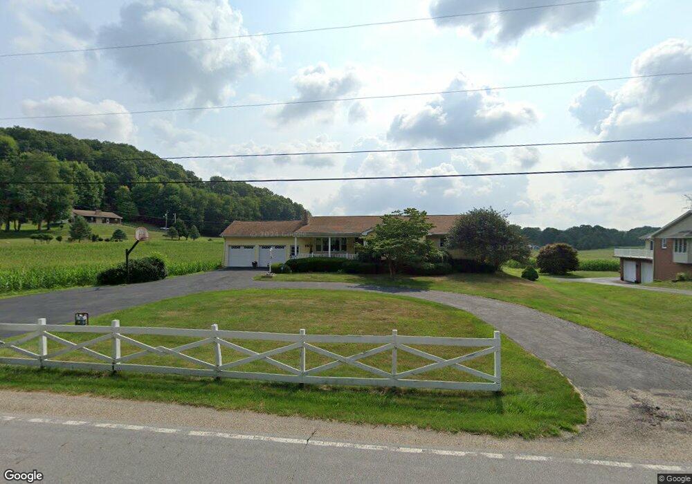
2110 Boving Rd SW Lancaster, OH 43130
Estimated Value: $352,870 - $387,000
3
Beds
3
Baths
1,720
Sq Ft
$212/Sq Ft
Est. Value
About This Home
This home is located at 2110 Boving Rd SW, Lancaster, OH 43130 and is currently estimated at $365,218, approximately $212 per square foot. 2110 Boving Rd SW is a home located in Fairfield County with nearby schools including Tallmadge Elementary School, General Sherman Junior High School, and Lancaster High School.
Ownership History
Date
Name
Owned For
Owner Type
Purchase Details
Closed on
Sep 9, 2024
Sold by
Merritt Donald and Merrit Donald Eugene
Bought by
Merritt Trust and Merritt
Current Estimated Value
Purchase Details
Closed on
Feb 28, 2005
Sold by
Fleming Thomas M and Fleming Virginia L
Bought by
Merritt Donald and Merritt Linda S
Home Financials for this Owner
Home Financials are based on the most recent Mortgage that was taken out on this home.
Original Mortgage
$170,500
Interest Rate
5.8%
Mortgage Type
Purchase Money Mortgage
Create a Home Valuation Report for This Property
The Home Valuation Report is an in-depth analysis detailing your home's value as well as a comparison with similar homes in the area
Home Values in the Area
Average Home Value in this Area
Purchase History
| Date | Buyer | Sale Price | Title Company |
|---|---|---|---|
| Merritt Trust | -- | None Listed On Document | |
| Merritt Donald | $170,500 | Valmer Land Title Agency |
Source: Public Records
Mortgage History
| Date | Status | Borrower | Loan Amount |
|---|---|---|---|
| Previous Owner | Merritt Donald | $170,500 |
Source: Public Records
Tax History Compared to Growth
Tax History
| Year | Tax Paid | Tax Assessment Tax Assessment Total Assessment is a certain percentage of the fair market value that is determined by local assessors to be the total taxable value of land and additions on the property. | Land | Improvement |
|---|---|---|---|---|
| 2024 | $8,254 | $89,230 | $14,300 | $74,930 |
| 2023 | $3,342 | $89,230 | $14,300 | $74,930 |
| 2022 | $3,386 | $89,230 | $14,300 | $74,930 |
| 2021 | $2,847 | $69,600 | $13,000 | $56,600 |
| 2020 | $2,672 | $69,600 | $13,000 | $56,600 |
| 2019 | $2,480 | $69,600 | $13,000 | $56,600 |
| 2018 | $2,074 | $56,940 | $12,350 | $44,590 |
| 2017 | $2,076 | $54,990 | $10,400 | $44,590 |
| 2016 | $2,023 | $54,990 | $10,400 | $44,590 |
| 2015 | $1,882 | $53,020 | $10,400 | $42,620 |
| 2014 | $1,787 | $53,020 | $10,400 | $42,620 |
| 2013 | $1,787 | $53,020 | $10,400 | $42,620 |
Source: Public Records
Map
Nearby Homes
- 0 Highland Ave
- 121 Sunset Dr
- 720 W Hubert Ave
- 0 Mill Rd SW
- 2300 Stonewall Cemetery Rd SW
- 636 Reese Ave
- 941 Wagner Dr SW
- 2241 Brookside Dr
- 126 Twin Creek Way
- 507 W Hubert Ave
- 1270 Mary Francis Ct
- 0 Hamburg Rd SW
- 0 Bis Rd SW Unit 225005143
- 896 Elizabeth Dr
- 1406 S Broad St
- 1430 Hamburg Rd SW
- 308 Hunter Ave
- 855 S Broad St
- 1715 W Walnut St
- 915 3rd St
- 2120 Boving Rd SW
- 2160 Boving Rd SW
- 2109 Boving Rd SW
- 2079 Boving Rd SW
- 2131 Boving Rd SW
- 2131 Boving Rd SW
- 2170 Boving Rd SW
- 2049 Boving Rd SW
- 2190 Boving Rd SW
- 2020 Boving Rd SW
- 2010 Boving Rd SW
- 0 Boving Rd SW
- 2009 Boving Rd SW
- 2220 Boving Rd SW
- 2193 Boving Rd SW
- 2193 Boving Rd SW Unit L 8
- 2225 Boving Rd SW
- 2250 Boving Rd SW
- 2200 Boving Rd SW
- 1960 Boving Rd SW
