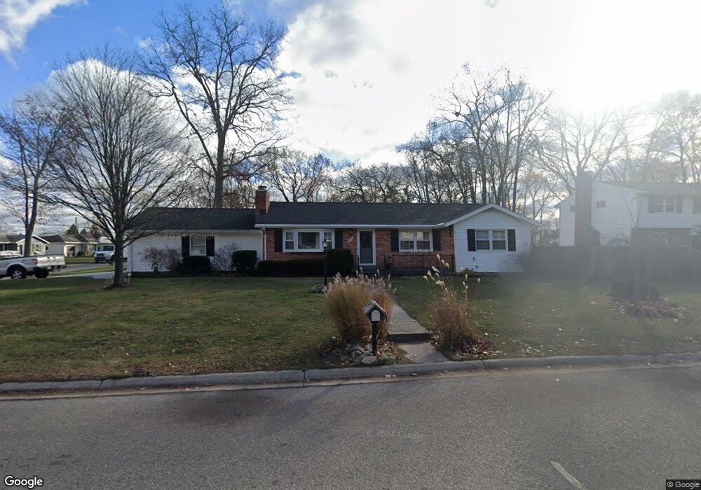
2110 Brandywine Ln Port Huron, MI 48060
Estimated Value: $235,000 - $261,000
3
Beds
3
Baths
1,450
Sq Ft
$168/Sq Ft
Est. Value
About This Home
This home is located at 2110 Brandywine Ln, Port Huron, MI 48060 and is currently estimated at $243,787, approximately $168 per square foot. 2110 Brandywine Ln is a home located in St. Clair County with nearby schools including H.D. Crull Elementary School, Holland Woods Middle School, and Port Huron Northern High School.
Ownership History
Date
Name
Owned For
Owner Type
Purchase Details
Closed on
Jan 12, 2024
Sold by
Lepla Dennis R and Lepla Barbara A
Bought by
Dennis R Lepla And Barbara A Lepla Trust and Lepla
Current Estimated Value
Purchase Details
Closed on
Mar 8, 2022
Sold by
Dennis R Lepla And Barbara A Lepla Trust
Bought by
Lepla Dennis R and Lepla Barbara A
Home Financials for this Owner
Home Financials are based on the most recent Mortgage that was taken out on this home.
Original Mortgage
$109,000
Interest Rate
3.89%
Mortgage Type
New Conventional
Purchase Details
Closed on
Jun 23, 2021
Sold by
Lepla Dennis R and Lepla Barbara A
Bought by
Lepla Dennis R and Lepla Barbara A
Purchase Details
Closed on
Mar 26, 2010
Sold by
Cook Michael J and Cook Kimberly A
Bought by
Lepla Dennis R and Lepla Barbara A
Create a Home Valuation Report for This Property
The Home Valuation Report is an in-depth analysis detailing your home's value as well as a comparison with similar homes in the area
Home Values in the Area
Average Home Value in this Area
Purchase History
| Date | Buyer | Sale Price | Title Company |
|---|---|---|---|
| Dennis R Lepla And Barbara A Lepla Trust | -- | None Listed On Document | |
| Dennis R Lepla And Barbara A Lepla Trust | -- | None Listed On Document | |
| Lepla Dennis R | -- | New Title Company Name | |
| Lepla Dennis R | -- | None Available | |
| Lepla Dennis R | -- | None Available |
Source: Public Records
Mortgage History
| Date | Status | Borrower | Loan Amount |
|---|---|---|---|
| Previous Owner | Lepla Dennis R | $109,000 |
Source: Public Records
Tax History
| Year | Tax Paid | Tax Assessment Tax Assessment Total Assessment is a certain percentage of the fair market value that is determined by local assessors to be the total taxable value of land and additions on the property. | Land | Improvement |
|---|---|---|---|---|
| 2025 | $2,782 | $108,300 | $0 | $0 |
| 2024 | $2,714 | $105,900 | $0 | $0 |
| 2023 | $2,563 | $97,000 | $0 | $0 |
| 2020 | $2,640 | $76,100 | $76,100 | $0 |
| 2019 | $2,593 | $59,600 | $0 | $0 |
| 2018 | $2,535 | $59,600 | $0 | $0 |
| 2017 | $2,263 | $59,800 | $0 | $0 |
| 2016 | $1,945 | $59,800 | $0 | $0 |
| 2015 | $1,909 | $57,900 | $57,900 | $0 |
| 2014 | $1,909 | $56,800 | $56,800 | $0 |
| 2013 | -- | $52,400 | $0 | $0 |
Source: Public Records
Map
Nearby Homes
- 1828 Kennelworth Dr
- 2915 Linda Ct
- 1813 N Woodland Dr
- 2224 Garfield St
- 3316 Hickory Ln
- 2846 Cooper Ave
- 2215 Hancock St
- 2915 10th Ave
- 2857 Riverside Dr
- 2525 19th Ave
- 3165 10th Ave
- 3444 Riverside Dr
- 2008 Elmwood St
- 2515 Woodstock Dr
- 1020 Sanborn St
- 817 Florida Ave
- 2838 Elmwood St
- 2400 Stone St Unit 2414
- 910 Church St
- 1907 Riverside Dr
- 2115 Brandywine Ln
- 2949 16th Ave
- 2120 Brandywine Ln
- 2105 Brandywine Ln
- 2016 Brandywine Ln
- 2945 16th Ave
- 2944 16th Ave
- 3018 E Village Ln
- 3025 Mount Vernon Rd
- 2204 Brandywine Ln
- 2938 16th Ave
- 2208 Brandywine Ln
- 2919 16th Ave
- 3030 Mount Vernon Rd
- 2930 16th Ave Unit Bldg-Unit
- 2930 16th Ave
- 3034 E Village Ln
- 2947 15th Ave
- 2010 Brandywine Ln
- 3035 E Village Ln
Your Personal Tour Guide
Ask me questions while you tour the home.