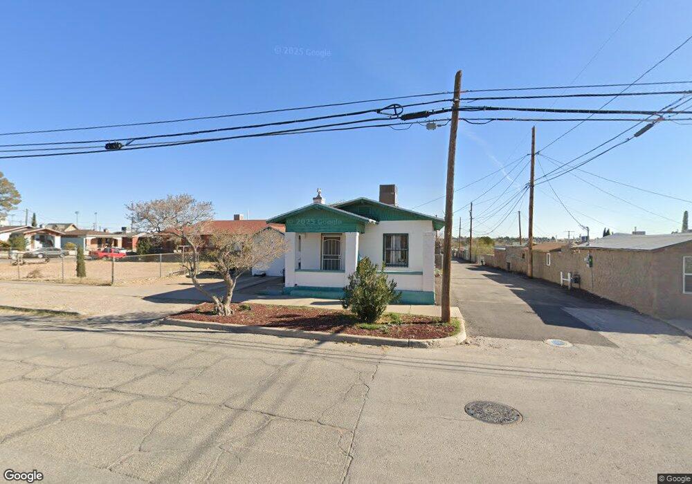
2110 Byron St Unit 1 El Paso, TX 79930
Manhattan Heights NeighborhoodEstimated Value: $180,000 - $254,000
4
Beds
2
Baths
1,735
Sq Ft
$125/Sq Ft
Est. Value
About This Home
This home is located at 2110 Byron St Unit 1, El Paso, TX 79930 and is currently estimated at $216,643, approximately $124 per square foot. 2110 Byron St Unit 1 is a home located in El Paso County with nearby schools including Crockett Elementary School, Armendariz Middle School, and Middle School-5 NW Middle.
Ownership History
Date
Name
Owned For
Owner Type
Purchase Details
Closed on
Jan 29, 2009
Sold by
Sanchez Hipolito and Sanchez Primitivo
Bought by
Ortega Janett P and Parra Maria Teresa
Current Estimated Value
Home Financials for this Owner
Home Financials are based on the most recent Mortgage that was taken out on this home.
Original Mortgage
$73,075
Outstanding Balance
$46,365
Interest Rate
5.17%
Mortgage Type
Purchase Money Mortgage
Estimated Equity
$170,278
Purchase Details
Closed on
Feb 16, 2006
Sold by
Silva Ana Marcelina
Bought by
Sanchez Hipolito and Sanchez Primitivo
Create a Home Valuation Report for This Property
The Home Valuation Report is an in-depth analysis detailing your home's value as well as a comparison with similar homes in the area
Home Values in the Area
Average Home Value in this Area
Purchase History
| Date | Buyer | Sale Price | Title Company |
|---|---|---|---|
| Ortega Janett P | -- | None Available | |
| Sanchez Hipolito | -- | None Available |
Source: Public Records
Mortgage History
| Date | Status | Borrower | Loan Amount |
|---|---|---|---|
| Open | Ortega Janett P | $73,075 |
Source: Public Records
Tax History Compared to Growth
Tax History
| Year | Tax Paid | Tax Assessment Tax Assessment Total Assessment is a certain percentage of the fair market value that is determined by local assessors to be the total taxable value of land and additions on the property. | Land | Improvement |
|---|---|---|---|---|
| 2025 | $1,306 | $129,630 | -- | -- |
| 2024 | $1,306 | $117,845 | -- | -- |
| 2023 | $1,230 | $107,132 | $0 | $0 |
| 2022 | $2,883 | $97,393 | $0 | $0 |
| 2021 | $2,764 | $94,133 | $18,450 | $75,683 |
| 2020 | $2,474 | $80,490 | $17,122 | $63,368 |
| 2018 | $2,279 | $79,273 | $17,122 | $62,151 |
| 2017 | $1,972 | $70,000 | $17,122 | $52,878 |
| 2016 | $1,972 | $70,000 | $17,122 | $52,878 |
| 2015 | $2,247 | $70,000 | $17,122 | $52,878 |
| 2014 | $2,247 | $90,982 | $17,122 | $73,860 |
Source: Public Records
Map
Nearby Homes
- 3625 Richmond Ave
- 3408 Lebanon Ave
- 3524 Mobile Ave
- 3816 Hastings Dr
- 3817 Frankfort Ave
- 3204 Memphis Ave
- 3327 Mobile Ave
- 2518 Partello St
- 3215 Mobile Ave
- 3009 Savannah Ave
- 3905 Nashville Ave
- 3116 Wheeling Ave
- 3919 Cumberland Ave
- 3427 Hamilton Ave
- 3921 Mobile Ave
- 2903 Savannah Ave
- 3018 Sacramento Ave
- 3510 Porter Ave
- 3125 Hamilton Ave
- 3608 Douglas Ave
- 2110 Byron St
- 3504 Richmond Ave
- 3508 Richmond Ave
- 3430 Richmond Ave
- 3501 Louisville Ave
- 3512 Richmond Ave
- 3505 Louisville Ave
- 3509 Louisville Ave
- 3428 Richmond Ave
- 3431 Louisville Ave
- 3511 Louisville Ave
- 3501 Richmond Ave
- 3505 Richmond Ave
- 3516 Richmond Ave
- 3507 Richmond Ave
- 3515 Louisville Ave
- 3424 Richmond Ave
- 3511 Richmond Ave
- 3431 Richmond Ave
- 3425 Louisville Ave