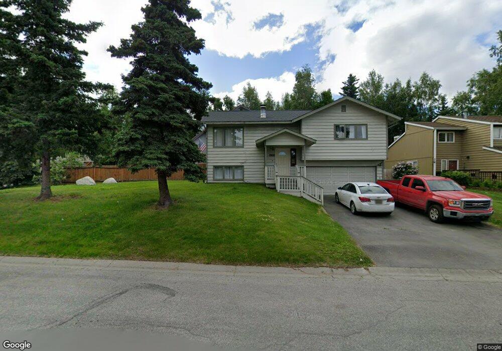
2110 Colony Loop Anchorage, AK 99507
Abbott Loop NeighborhoodEstimated Value: $444,000 - $623,000
3
Beds
2
Baths
2,356
Sq Ft
$209/Sq Ft
Est. Value
About This Home
This home is located at 2110 Colony Loop, Anchorage, AK 99507 and is currently estimated at $493,321, approximately $209 per square foot. 2110 Colony Loop is a home located in Anchorage Municipality with nearby schools including Spring Hill Elementary School, Hanshew Middle School, and Service High School.
Ownership History
Date
Name
Owned For
Owner Type
Purchase Details
Closed on
Apr 17, 2003
Sold by
Davidson Carol M
Bought by
Jacksich Melanie M
Current Estimated Value
Purchase Details
Closed on
Sep 8, 1999
Sold by
Tallent Robert L and Tallent Pamela J
Bought by
Jacksich Melanie and Davidson Carol
Home Financials for this Owner
Home Financials are based on the most recent Mortgage that was taken out on this home.
Original Mortgage
$149,500
Interest Rate
7.66%
Mortgage Type
New Conventional
Purchase Details
Closed on
Jun 4, 1992
Sold by
Rivera Keith and Rivera Vicki
Bought by
Tallent Robert L and Tallent Pamela J
Home Financials for this Owner
Home Financials are based on the most recent Mortgage that was taken out on this home.
Original Mortgage
$140,130
Interest Rate
8.87%
Mortgage Type
FHA
Create a Home Valuation Report for This Property
The Home Valuation Report is an in-depth analysis detailing your home's value as well as a comparison with similar homes in the area
Home Values in the Area
Average Home Value in this Area
Purchase History
| Date | Buyer | Sale Price | Title Company |
|---|---|---|---|
| Jacksich Melanie M | -- | -- | |
| Jacksich Melanie | -- | -- | |
| Tallent Robert L | -- | -- | |
| Tallent Robert L | -- | -- |
Source: Public Records
Mortgage History
| Date | Status | Borrower | Loan Amount |
|---|---|---|---|
| Previous Owner | Jacksich Melanie | $149,500 | |
| Previous Owner | Tallent Robert L | $140,130 |
Source: Public Records
Tax History
| Year | Tax Paid | Tax Assessment Tax Assessment Total Assessment is a certain percentage of the fair market value that is determined by local assessors to be the total taxable value of land and additions on the property. | Land | Improvement |
|---|---|---|---|---|
| 2025 | $5,638 | $457,000 | $93,600 | $363,400 |
| 2024 | $5,638 | $424,200 | $93,600 | $330,600 |
| 2023 | $6,631 | $389,400 | $93,600 | $295,800 |
| 2022 | $5,557 | $380,000 | $93,600 | $286,400 |
| 2021 | $6,201 | $344,100 | $93,600 | $250,500 |
| 2020 | $5,935 | $349,100 | $93,600 | $255,500 |
| 2019 | $5,575 | $340,800 | $93,600 | $247,200 |
| 2018 | $905 | $329,600 | $89,500 | $240,100 |
| 2017 | $5,404 | $345,100 | $89,500 | $255,600 |
| 2016 | $4,646 | $332,100 | $86,100 | $246,000 |
| 2015 | $4,646 | $320,700 | $86,100 | $234,600 |
| 2014 | $4,646 | $320,500 | $86,100 | $234,400 |
Source: Public Records
Map
Nearby Homes
- 9751 Newhaven Loop
- 9750 Vanguard Dr Unit 54
- 9715 Independence Dr Unit B306
- 9710 Vanguard Dr Unit 80
- 2211 Sentry Dr Unit B6
- 2300 Sentry Dr Unit E102
- 2300 Sentry Dr Unit E106
- 8000 Independence Park Dr
- 1900-1941 Marthas Vineyard Cir
- 9599 Brayton Dr Unit 422
- 2430 Sentry Dr Unit B306
- 1962 Commodore Dr
- 1935 Commodore Dr
- 9130 Golovin St
- 9499 Brayton Dr Unit 39
- 9499 Brayton Dr Unit 152
- 9499 Brayton Dr Unit 245
- 9387 Morningside Loop
- 9610 Morningside Loop Unit B1
- 10240 Old Seward Hwy
- 2100 Colony Loop
- 2120 Colony Loop
- 2060 Colony Loop
- 2130 Colony Loop
- 1828 Colony Loop Unit 7
- 1817 Colony Loop Unit 16
- 2050 Colony Loop
- 2051 Sturbridge Cir
- 2061 Sturbridge Cir
- 9804 Newhaven Loop
- 9806 Newhaven Loop
- 10001 Nantucket Cir
- 2040 Colony Loop
- 10000 Nantucket Cir
- 9803 Newhaven Loop
- 9604 Newhaven Loop
- 9800 Newhaven Loop
- 10006 Nantucket Cir
- 2041 Sturbridge Cir
- 9802 Newhaven Loop
Your Personal Tour Guide
Ask me questions while you tour the home.