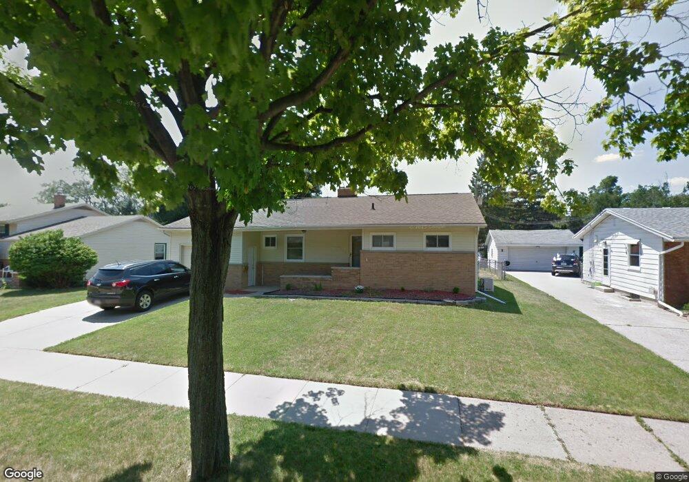
2110 Edwin Place Lansing, MI 48911
Lewton Rich NeighborhoodEstimated Value: $198,000 - $219,000
3
Beds
2
Baths
1,122
Sq Ft
$182/Sq Ft
Est. Value
About This Home
This home is located at 2110 Edwin Place, Lansing, MI 48911 and is currently estimated at $204,440, approximately $182 per square foot. 2110 Edwin Place is a home located in Ingham County with nearby schools including Averill Elementary School, Attwood School, and J.W. Sexton High School.
Ownership History
Date
Name
Owned For
Owner Type
Purchase Details
Closed on
May 28, 2010
Sold by
Schram Morley D
Bought by
Schram Morley D and Schram Patricia A
Current Estimated Value
Purchase Details
Closed on
Nov 18, 2004
Sold by
Devlin Lawrence J and Devlin Bethany A
Bought by
Schram Morley D
Home Financials for this Owner
Home Financials are based on the most recent Mortgage that was taken out on this home.
Original Mortgage
$126,000
Outstanding Balance
$63,046
Interest Rate
5.82%
Mortgage Type
New Conventional
Estimated Equity
$141,394
Create a Home Valuation Report for This Property
The Home Valuation Report is an in-depth analysis detailing your home's value as well as a comparison with similar homes in the area
Home Values in the Area
Average Home Value in this Area
Purchase History
| Date | Buyer | Sale Price | Title Company |
|---|---|---|---|
| Schram Morley D | -- | None Available | |
| Schram Morley D | $140,000 | Transnation Title |
Source: Public Records
Mortgage History
| Date | Status | Borrower | Loan Amount |
|---|---|---|---|
| Open | Schram Morley D | $126,000 |
Source: Public Records
Tax History
| Year | Tax Paid | Tax Assessment Tax Assessment Total Assessment is a certain percentage of the fair market value that is determined by local assessors to be the total taxable value of land and additions on the property. | Land | Improvement |
|---|---|---|---|---|
| 2025 | $2,982 | $98,900 | $12,800 | $86,100 |
| 2024 | $24 | $88,700 | $12,800 | $75,900 |
| 2023 | $2,796 | $78,000 | $12,800 | $65,200 |
| 2022 | $2,521 | $68,500 | $11,100 | $57,400 |
| 2021 | $2,469 | $62,800 | $9,900 | $52,900 |
| 2020 | $2,454 | $60,100 | $9,900 | $50,200 |
| 2019 | $2,352 | $54,200 | $9,900 | $44,300 |
| 2018 | $2,204 | $49,100 | $9,900 | $39,200 |
| 2017 | $2,110 | $49,100 | $9,900 | $39,200 |
| 2016 | $2,194 | $43,000 | $9,900 | $33,100 |
| 2015 | $2,194 | $36,300 | $19,844 | $16,456 |
| 2014 | $2,194 | $39,000 | $19,844 | $19,156 |
Source: Public Records
Map
Nearby Homes
- 2200 Rossiter Place
- 2924 Woodview Dr
- 3000 Westchester Rd
- 1533 Cambridge Rd
- 2409 Victor Ave
- 2505 Fairfax Rd
- 3215 S Cambridge Rd
- 2500 Skye Rd
- 3508 Muirfield Dr
- 3425 Cooley Dr
- 3601 Muirfield Dr
- 3522 Saint Andrews Cir Unit 33
- 1740 Wellington Rd Unit 103
- 3612 Muirfield Dr Unit 5
- 1341 Cambridge Rd
- 3125 Boston Blvd
- 2838 Sunderland Rd
- 1618 Loraine Ave
- 1517 Lenore Ave
- 3211 S Deerfield Ave
- 2104 Edwin Place
- 2118 Edwin Place
- 2111 Rossiter Place
- 2100 Edwin Place
- 2117 Rossiter Place
- 2107 Rossiter Place
- 2122 Edwin Place
- 2125 Rossiter Place
- 2101 Rossiter Place
- 2016 Edwin Place
- 2107 Edwin Place
- 2111 Edwin Place
- 2117 Edwin Place
- 2101 Edwin Place
- 2017 Rossiter Place
- 2700 Cooley Dr
- 2201 Rossiter Place
- 2606 Hanover Dr
- 2017 Edwin Place
- 2010 Edwin Place
Your Personal Tour Guide
Ask me questions while you tour the home.