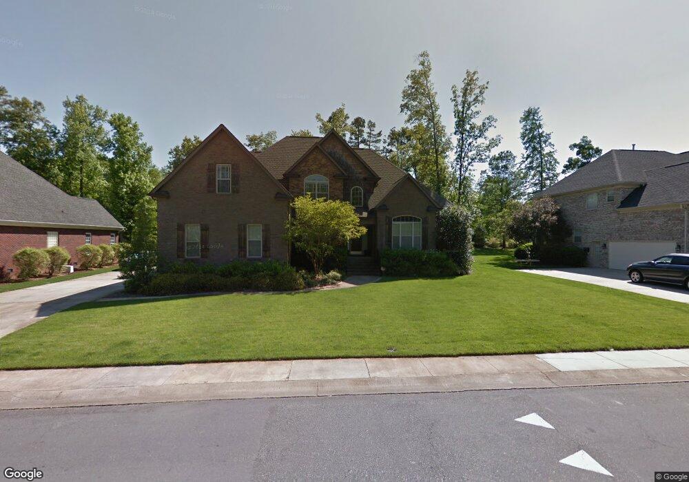
2110 Flagstick Dr Matthews, NC 28104
Estimated Value: $825,039 - $933,000
5
Beds
4
Baths
3,750
Sq Ft
$234/Sq Ft
Est. Value
About This Home
This home is located at 2110 Flagstick Dr, Matthews, NC 28104 and is currently estimated at $878,260, approximately $234 per square foot. 2110 Flagstick Dr is a home located in Union County with nearby schools including Stallings Elementary School, Porter Ridge Middle School, and Porter Ridge High School.
Ownership History
Date
Name
Owned For
Owner Type
Purchase Details
Closed on
Jun 15, 2006
Sold by
Ashland Custom Homes Inc
Bought by
Mellon Curtis B and Mellon Debra H
Current Estimated Value
Home Financials for this Owner
Home Financials are based on the most recent Mortgage that was taken out on this home.
Original Mortgage
$353,600
Outstanding Balance
$204,956
Interest Rate
6.51%
Mortgage Type
Unknown
Estimated Equity
$673,304
Purchase Details
Closed on
Apr 5, 2005
Sold by
Ty Par Realty Inc
Bought by
Ashland Custom Homes Inc
Home Financials for this Owner
Home Financials are based on the most recent Mortgage that was taken out on this home.
Original Mortgage
$93,800
Interest Rate
5.62%
Mortgage Type
Unknown
Create a Home Valuation Report for This Property
The Home Valuation Report is an in-depth analysis detailing your home's value as well as a comparison with similar homes in the area
Purchase History
| Date | Buyer | Sale Price | Title Company |
|---|---|---|---|
| Mellon Curtis B | $442,000 | None Available | |
| Ashland Custom Homes Inc | $125,500 | -- |
Source: Public Records
Mortgage History
| Date | Status | Borrower | Loan Amount |
|---|---|---|---|
| Open | Mellon Curtis B | $353,600 | |
| Previous Owner | Ashland Custom Homes Inc | $93,800 |
Source: Public Records
Tax History
| Year | Tax Paid | Tax Assessment Tax Assessment Total Assessment is a certain percentage of the fair market value that is determined by local assessors to be the total taxable value of land and additions on the property. | Land | Improvement |
|---|---|---|---|---|
| 2025 | $5,386 | $798,800 | $0 | $0 |
| 2024 | $4,398 | $506,400 | $79,700 | $426,700 |
| 2023 | $4,210 | $506,400 | $79,700 | $426,700 |
| 2022 | $4,189 | $506,400 | $79,700 | $426,700 |
| 2021 | $4,189 | $506,400 | $79,700 | $426,700 |
| 2020 | $4,212 | $418,900 | $58,000 | $360,900 |
| 2019 | $4,213 | $418,900 | $58,000 | $360,900 |
| 2018 | $4,213 | $418,900 | $58,000 | $360,900 |
| 2017 | $4,383 | $418,900 | $58,000 | $360,900 |
| 2016 | $4,361 | $418,900 | $58,000 | $360,900 |
| 2015 | $4,414 | $418,900 | $58,000 | $360,900 |
| 2014 | $3,143 | $439,970 | $55,000 | $384,970 |
Source: Public Records
Map
Nearby Homes
- 9008 Birch Ct
- 6107 Colchester Ln
- 1151 Avalon Place
- 1344 Garden Vista Dr
- 8106 Castlemaine Dr
- 5020 Scaleybark Ct
- 607 Southstone Dr
- 15920 Fieldstone Dr
- 516 Aspen Ln
- 8056 Hunley Ridge Rd
- 1009 Hunley Hill Ct
- 6120 Four Wood Dr
- 1915 Millbrook Ln
- 15927 Lawyers Rd
- 5518 Two Iron Dr
- 0 Union Rd Unit CAR4114099
- 1330 Millview Ln
- 1022 Galloway Dr
- 1026 Galloway Dr
- 14404 Lawyers Rd
- 2104 Flagstick Dr
- 2116 Flagstick Dr
- 2122 Flagstick Dr
- 2109 Flagstick Dr
- 1003 Hawthorne Dr
- 2103 Flagstick Dr
- 2115 Flagstick Dr
- 3100 Beech Ct
- 2128 Flagstick Dr
- 1011 Hawthorne Dr
- 1100 Emerald Lake Dr
- 3070 Beech Ct
- 1703 Caddy Ct
- 2129 Flagstick Dr
- 2129 Flagstick Dr Unit 57
- 2502 Albatross Ln
- 2502 Albatross Ln Unit 119
- 1017 Hawthorne Dr
- 1006 Hawthorne Dr
- 1106 Emerald Lake Dr
Your Personal Tour Guide
Ask me questions while you tour the home.