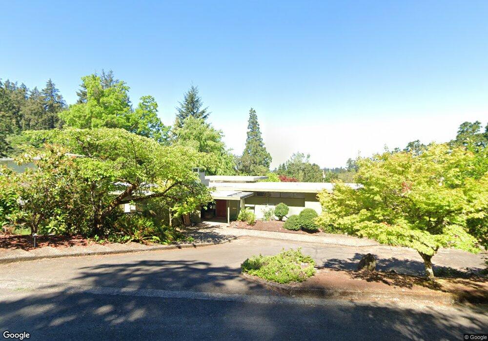
2110 Hubbard Ln Eugene, OR 97403
Fairmount NeighborhoodEstimated Value: $842,264 - $876,000
3
Beds
4
Baths
2,572
Sq Ft
$334/Sq Ft
Est. Value
About This Home
This home is located at 2110 Hubbard Ln, Eugene, OR 97403 and is currently estimated at $859,566, approximately $334 per square foot. 2110 Hubbard Ln is a home located in Lane County with nearby schools including Edison Elementary School, Roosevelt Middle School, and South Eugene High School.
Ownership History
Date
Name
Owned For
Owner Type
Purchase Details
Closed on
Sep 26, 2014
Sold by
King Jane L
Bought by
Visser Matthew L and Visser Carissa B
Current Estimated Value
Home Financials for this Owner
Home Financials are based on the most recent Mortgage that was taken out on this home.
Original Mortgage
$130,500
Outstanding Balance
$40,296
Interest Rate
3.19%
Mortgage Type
New Conventional
Estimated Equity
$819,270
Create a Home Valuation Report for This Property
The Home Valuation Report is an in-depth analysis detailing your home's value as well as a comparison with similar homes in the area
Home Values in the Area
Average Home Value in this Area
Purchase History
| Date | Buyer | Sale Price | Title Company |
|---|---|---|---|
| Visser Matthew L | $400,000 | Cascade Title Company | |
| King Jane L | -- | Cascade Title Company |
Source: Public Records
Mortgage History
| Date | Status | Borrower | Loan Amount |
|---|---|---|---|
| Open | Visser Matthew L | $130,500 |
Source: Public Records
Tax History
| Year | Tax Paid | Tax Assessment Tax Assessment Total Assessment is a certain percentage of the fair market value that is determined by local assessors to be the total taxable value of land and additions on the property. | Land | Improvement |
|---|---|---|---|---|
| 2025 | $7,388 | $379,186 | -- | -- |
| 2024 | $7,296 | $368,142 | -- | -- |
| 2023 | $7,296 | $357,420 | $0 | $0 |
| 2022 | $6,835 | $347,010 | $0 | $0 |
| 2021 | $6,420 | $336,903 | $0 | $0 |
| 2020 | $6,443 | $327,091 | $0 | $0 |
| 2019 | $6,222 | $317,565 | $0 | $0 |
| 2018 | $5,857 | $299,336 | $0 | $0 |
| 2017 | $5,595 | $299,336 | $0 | $0 |
| 2016 | $5,456 | $290,617 | $0 | $0 |
| 2015 | $5,299 | $282,152 | $0 | $0 |
| 2014 | $5,192 | $273,934 | $0 | $0 |
Source: Public Records
Map
Nearby Homes
- 275 Sunset Dr
- 1867 Fircrest Dr
- 1993 Fircrest Dr
- 2993 Capital Dr Unit 1
- 1925 Sylvan St
- 2985 Capital Dr Unit 3
- 2627 Cupola Dr Unit 9
- 2620 Cupola Dr Unit 27
- 2629 Cupola Dr Unit 10
- 2683 Cresta de Ruta St
- 2969 Capital Dr
- 0 Sylvan St Unit 247715494
- 2639 Cupola Dr Unit 12
- 2645 Cupola Dr Unit 13
- 2825 2819 Capital Dr Unit 18, 19
- 0 Capital Dr
- 2662 Cupola Dr Unit 31
- 2642 Central Blvd
- 2694 Cupola Dr Unit 21
- 2693 Cupola Dr
- 2015 Elk Ave
- 2140 Hamble Ave
- 2010 Hubbard Ln
- 2013 Elk Ave
- 2095 Hubbard Ln
- 2105 Hubbard Ln
- 2171 Hamble Ave
- 2011 Elk Ave
- 2017 Elk Ave
- 2110 Hamble Dr
- 2075 Hubbard Ln
- 2014 Elk Ave
- 2110 Hamble Ave
- 2115 Hamble Dr
- 2115 Hamble Ave
- 2104 Hamble Ave
- 2197 Summit Ave
- 2009 Elk Ave
- 1990 Parkside Dr
- 2130 Summit Ave
Your Personal Tour Guide
Ask me questions while you tour the home.