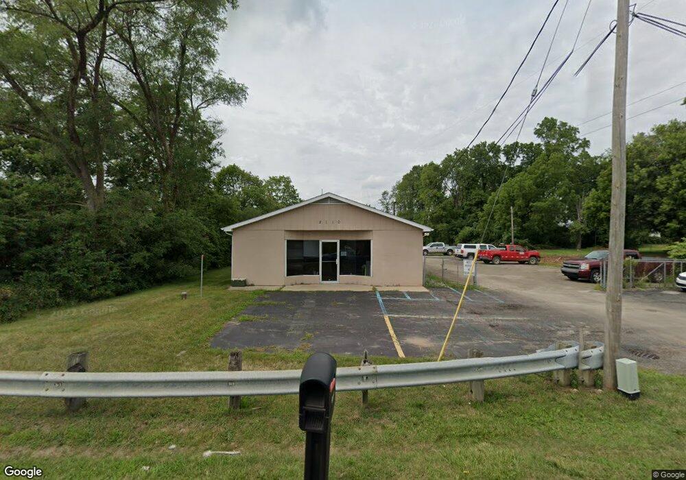
2110 Lansing Ave Jackson, MI 49202
Estimated Value: $457,324
Studio
--
Bath
3,240
Sq Ft
$141/Sq Ft
Est. Value
About This Home
This home is located at 2110 Lansing Ave, Jackson, MI 49202 and is currently estimated at $457,324, approximately $141 per square foot. 2110 Lansing Ave is a home located in Jackson County with nearby schools including Northwest Early Elementary School, Northwest Elementary School, and Northwest Middle School.
Ownership History
Date
Name
Owned For
Owner Type
Purchase Details
Closed on
Oct 17, 2017
Sold by
Fukerson Inc
Bought by
Trasnpost Michagin Deparoemnt
Current Estimated Value
Purchase Details
Closed on
Nov 18, 2011
Sold by
Jackson Crematory Services Inc
Bought by
Flulekrson Inc
Purchase Details
Closed on
Jul 21, 2011
Sold by
Berry Brian and Berry Allison
Bought by
Jackson Crematory Services Inc
Purchase Details
Closed on
Jun 27, 2011
Sold by
Sigers Billy J and Sigers Beatrice
Bought by
Berry Brian
Purchase Details
Closed on
Feb 1, 1994
Bought by
Sigers
Create a Home Valuation Report for This Property
The Home Valuation Report is an in-depth analysis detailing your home's value as well as a comparison with similar homes in the area
Home Values in the Area
Average Home Value in this Area
Purchase History
We collect this data history from publicly available records. To have your information removed, we recommend requesting removal directly through your county’s website.
| Date | Buyer | Sale Price | Title Company |
|---|---|---|---|
| Trasnpost Michagin Deparoemnt | $250,000 | None Available | |
| Flulekrson Inc | -- | American Title Company Of Ja | |
| Jackson Crematory Services Inc | -- | American Title Co Of Jackson | |
| Berry Brian | $70,000 | At | |
| Sigers | $65,000 | -- |
Source: Public Records
Tax History
| Year | Tax Paid | Tax Assessment Tax Assessment Total Assessment is a certain percentage of the fair market value that is determined by local assessors to be the total taxable value of land and additions on the property. | Land | Improvement |
|---|---|---|---|---|
| 2025 | -- | $0 | $0 | $0 |
| 2024 | -- | $0 | $0 | $0 |
| 2022 | $0 | $0 | $0 | $0 |
| 2020 | $0 | $0 | $0 | $0 |
| 2019 | $0 | $0 | $0 | $0 |
| 2018 | $0 | $0 | $0 | $0 |
| 2017 | $0 | $0 | $0 | $0 |
| 2016 | $0 | $0 | $0 | $0 |
| 2015 | -- | $0 | $0 | $0 |
| 2014 | -- | $0 | $0 | $0 |
| 2013 | -- | $0 | $0 | $0 |
Source: Public Records
Map
Nearby Homes
- 583 Shirley Dr
- 302 Hillsdale St
- 537 Commonwealth Ave
- 1915 River St
- 1403 Lansing Ave
- 951 W Monroe St
- 426 Madison St
- 0 Brookley Ave
- 1108 N Blackstone St
- 1105 Clinton Rd
- 121 Frost St
- 0 Shirley Dr Unit 24064060
- 127 W Argyle St
- 836 Lincoln St
- 309 Montgomery St
- 835 N West Ave
- 313 E Argyle St
- 831 N West Ave
- 1300 N Waterloo Ave
- 709 Lansing Ave
- 2120 Lansing Ave
- 529 Shirley Dr
- 2124 Lansing Ave
- 537 Shirley Dr
- 2019 Lansing Ave
- 2015 Lansing Ave
- 534 Shirley Dr
- 545 Shirley Dr
- 2212 Lansing Ave
- 536 Shirley Dr
- 2151 Lansing Ave
- 2008 Lansing Ave
- 510 Royal Dr
- 555 Shirley Dr
- 2213 Lansing Ave
- 2222 Lansing Ave
- 512 Royal Dr
- 530 Shirley Dr
- 1949 Lansing Ave Unit Suite B
- 1949 Lansing Ave
Your Personal Tour Guide
Ask me questions while you tour the home.