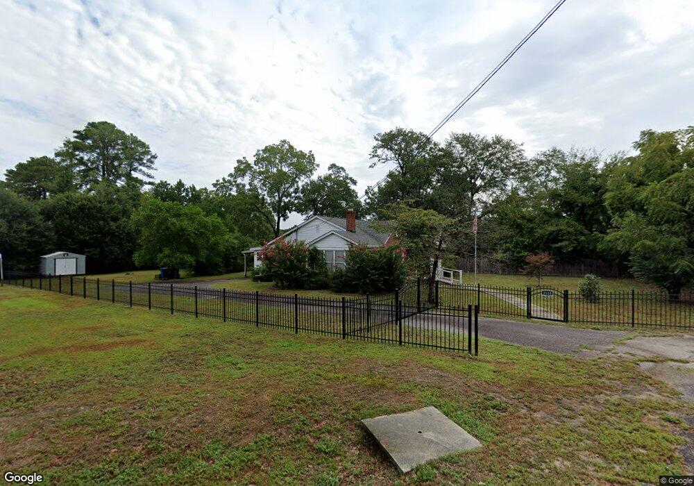
2110 Leaphart Rd West Columbia, SC 29169
Estimated Value: $223,140 - $278,000
4
Beds
1
Bath
1,674
Sq Ft
$147/Sq Ft
Est. Value
About This Home
This home is located at 2110 Leaphart Rd, West Columbia, SC 29169 and is currently estimated at $245,285, approximately $146 per square foot. 2110 Leaphart Rd is a home located in Lexington County with nearby schools including Riverbank Elementary, Northside Middle, and Brookland-Cayce High School.
Ownership History
Date
Name
Owned For
Owner Type
Purchase Details
Closed on
Oct 5, 2022
Sold by
Sharpe John R
Bought by
John Robert Sharpe Sr Trust
Current Estimated Value
Purchase Details
Closed on
Sep 22, 2015
Sold by
Sharpe Jannette P
Bought by
Sharpe Jannette P and Sharpe John R
Purchase Details
Closed on
Jul 23, 2015
Sold by
Senn Woody G and Taylor Gary W
Bought by
Sharpe Janett P
Purchase Details
Closed on
Oct 30, 2014
Sold by
Senn Woody G and Taylor Gary W
Bought by
Senn Woody G and Taylor Gary W
Purchase Details
Closed on
Jun 24, 2013
Sold by
Hendrix James W
Bought by
Hendrix James W
Create a Home Valuation Report for This Property
The Home Valuation Report is an in-depth analysis detailing your home's value as well as a comparison with similar homes in the area
Home Values in the Area
Average Home Value in this Area
Purchase History
| Date | Buyer | Sale Price | Title Company |
|---|---|---|---|
| John Robert Sharpe Sr Trust | -- | -- | |
| Sharpe Jannette P | $211 | -- | |
| Sharpe Janett P | -- | -- | |
| Senn Woody G | -- | -- | |
| Hendrix James W | -- | -- |
Source: Public Records
Tax History Compared to Growth
Tax History
| Year | Tax Paid | Tax Assessment Tax Assessment Total Assessment is a certain percentage of the fair market value that is determined by local assessors to be the total taxable value of land and additions on the property. | Land | Improvement |
|---|---|---|---|---|
| 2024 | $2,958 | $6,865 | $1,832 | $5,033 |
| 2023 | $2,712 | $6,865 | $1,832 | $5,033 |
| 2022 | $2,569 | $6,865 | $1,832 | $5,033 |
| 2020 | $2,435 | $6,865 | $1,832 | $5,033 |
| 2019 | $2,138 | $5,970 | $2,100 | $3,870 |
| 2018 | $2,120 | $5,970 | $2,100 | $3,870 |
| 2017 | $2,081 | $5,970 | $2,100 | $3,870 |
| 2016 | $2,105 | $5,970 | $2,100 | $3,870 |
| 2014 | $496 | $5,086 | $1,150 | $3,936 |
| 2013 | -- | $5,090 | $1,150 | $3,940 |
Source: Public Records
Map
Nearby Homes
- 215 Sandel Ln
- 2004 Dew Ave
- 116 Silver Run Place
- 135 Silver Run Place
- 349 Gum Swamp Trail
- 0 Platt Springs Rd Unit 606355
- 309 Hammond Ave
- 165 Cavendish Dr
- 1802 D Ave
- 117 Bonnie St
- 1734 C Ave
- 529 Finnegan Ln
- 617 Holland Cir
- 913 Harper Rose Ct
- 1608 Crapps Ave
- 641 Brooks Ave
- 914 Hook Ave
- 132 War Admiral Dr
- 615 Dawn Dr
- 1610 D Ave
- 111 Hook Ave
- 107 Hook Ave
- 2112 Leaphart Rd
- 102 Woodhaven Dr
- 115 Hook Ave
- 0 Woodhaven Dr
- 106 Woodhaven Dr
- 2124 Leaphart Rd
- 2128 Leaphart Rd
- 201 Hook Ave
- 110 Woodhaven Dr
- 105 Woodhaven Dr
- 0 Alexandria St
- 205 Hook Ave
- 2132 Leaphart Rd
- 1 Janice Faye Trail
- 2123 Augusta Rd
- 107 Woodhaven Dr
- 211 Hook Ave
- 114 Woodhaven Dr