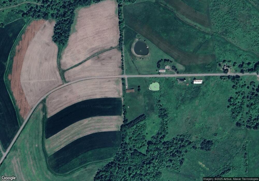
2110 Mac Rd Ulster, PA 18850
Estimated Value: $324,000 - $523,000
3
Beds
3
Baths
--
Sq Ft
1,742,400
Sq Ft
About This Home
This home is located at 2110 Mac Rd, Ulster, PA 18850 and is currently estimated at $396,592. 2110 Mac Rd is a home located in Bradford County with nearby schools including W.R. Croman Elementary School and Troy Area Junior/Senior High School.
Ownership History
Date
Name
Owned For
Owner Type
Purchase Details
Closed on
Mar 14, 2008
Sold by
Sautner Craig A and Sautner Julie I
Bought by
Thomas Daniel A
Current Estimated Value
Home Financials for this Owner
Home Financials are based on the most recent Mortgage that was taken out on this home.
Original Mortgage
$259,000
Outstanding Balance
$50,734
Interest Rate
5.76%
Mortgage Type
Purchase Money Mortgage
Estimated Equity
$345,858
Purchase Details
Closed on
Dec 14, 2005
Sold by
Kingeter William H and Henichek Susan M
Bought by
Manzek Land Company Inc
Create a Home Valuation Report for This Property
The Home Valuation Report is an in-depth analysis detailing your home's value as well as a comparison with similar homes in the area
Purchase History
| Date | Buyer | Sale Price | Title Company |
|---|---|---|---|
| Thomas Daniel A | $305,000 | None Available | |
| Manzek Land Company Inc | -- | None Available |
Source: Public Records
Mortgage History
| Date | Status | Borrower | Loan Amount |
|---|---|---|---|
| Open | Thomas Daniel A | $259,000 |
Source: Public Records
Tax History
| Year | Tax Paid | Tax Assessment Tax Assessment Total Assessment is a certain percentage of the fair market value that is determined by local assessors to be the total taxable value of land and additions on the property. | Land | Improvement |
|---|---|---|---|---|
| 2025 | $3,319 | $53,450 | $0 | $0 |
| 2024 | $3,249 | $53,450 | $0 | $0 |
| 2023 | $3,249 | $53,450 | $0 | $0 |
| 2022 | $3,158 | $53,450 | $0 | $0 |
| 2021 | $3,110 | $53,450 | $0 | $0 |
| 2020 | $3,110 | $53,450 | $0 | $0 |
| 2019 | $3,074 | $53,450 | $0 | $0 |
| 2018 | $3,038 | $53,450 | $0 | $0 |
| 2017 | $2,964 | $53,450 | $0 | $0 |
| 2016 | -- | $53,450 | $0 | $0 |
| 2015 | -- | $53,450 | $0 | $0 |
| 2014 | $1,458 | $53,450 | $0 | $0 |
Source: Public Records
Map
Nearby Homes
- 4535 Covered Bridge Rd
- 316 Maple Ln
- 5961 Ulster Rd
- 6007 Ulster Rd
- 1319 East Rd
- 5049 Saco Rd
- 211 Hanks Rd
- 000 Mary Mac Rd
- 392 Wood Rd
- 208 2nd St
- 600 Laurel Hill Rd
- 1053 Hornbrook Rd
- 99 Wallyworld Ln
- 32 Investment Ln
- 604-618 Reuter Blvd
- 81 Parsonage Rd
- 71 Hillcrest Dr
- 6104 Milan Rd
- 12 Simpatico Ln
- 232 N 4th St
- RR 2 Mac Rd
- 2815 Mac Rd
- 2961 Mac Rd
- 2747 Mac Rd
- 0 Rr2 Box 98 Mac Rd
- RR2 Box 98 Mac Rd
- 3173 Mac Rd
- 1198 Slater Hill Rd
- 305 Shotgun Hollow Rd
- 420 Shotgun Hollow Rd
- 420 Shotgun Hollow Rd
- 794 Codding Rd
- 1095 Kendall Hill Rd
- 1166 Codding Rd
- 00 Slater Hill Rd
- 814 Codding Rd
- RR#2 Codding Rd
- 516 Codding Rd
- 0 Codding Rd
- 1146 Codding Rd
Your Personal Tour Guide
Ask me questions while you tour the home.
