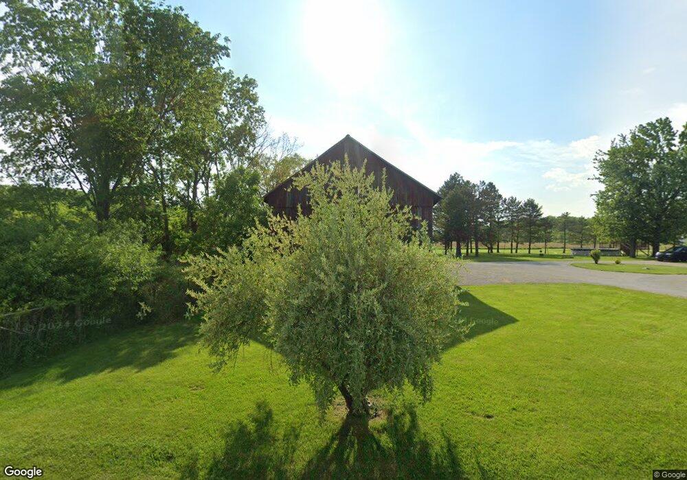
2110 N State Route 590 Graytown, OH 43432
Estimated Value: $212,329 - $460,000
5
Beds
1
Bath
2,174
Sq Ft
$142/Sq Ft
Est. Value
About This Home
This home is located at 2110 N State Route 590, Graytown, OH 43432 and is currently estimated at $308,582, approximately $141 per square foot. 2110 N State Route 590 is a home located in Ottawa County with nearby schools including Oak Harbor High School.
Ownership History
Date
Name
Owned For
Owner Type
Purchase Details
Closed on
Mar 8, 2021
Sold by
Green Mary R and Green Mark A
Bought by
Green Mary R and Green Mark A
Current Estimated Value
Home Financials for this Owner
Home Financials are based on the most recent Mortgage that was taken out on this home.
Original Mortgage
$133,500
Interest Rate
2.2%
Mortgage Type
New Conventional
Purchase Details
Closed on
Jan 27, 2014
Sold by
Tyburski David S and Tyburski Mary R
Bought by
Tyburski Mary R
Home Financials for this Owner
Home Financials are based on the most recent Mortgage that was taken out on this home.
Original Mortgage
$143,500
Interest Rate
4.54%
Mortgage Type
New Conventional
Purchase Details
Closed on
Mar 24, 2006
Sold by
Zunk Et Al Michael D
Bought by
Tyberski David S
Create a Home Valuation Report for This Property
The Home Valuation Report is an in-depth analysis detailing your home's value as well as a comparison with similar homes in the area
Home Values in the Area
Average Home Value in this Area
Purchase History
| Date | Buyer | Sale Price | Title Company |
|---|---|---|---|
| Green Mary R | -- | None Available | |
| Tyburski Mary R | -- | Attorney | |
| Tyberski David S | $164,000 | -- |
Source: Public Records
Mortgage History
| Date | Status | Borrower | Loan Amount |
|---|---|---|---|
| Closed | Green Mary R | $133,500 | |
| Closed | Tyburski Mary R | $143,500 |
Source: Public Records
Tax History Compared to Growth
Tax History
| Year | Tax Paid | Tax Assessment Tax Assessment Total Assessment is a certain percentage of the fair market value that is determined by local assessors to be the total taxable value of land and additions on the property. | Land | Improvement |
|---|---|---|---|---|
| 2024 | $2,347 | $64,113 | $15,862 | $48,251 |
| 2023 | $2,347 | $52,420 | $10,745 | $41,675 |
| 2022 | $2,167 | $52,420 | $10,745 | $41,675 |
| 2021 | $2,182 | $52,420 | $10,750 | $41,670 |
| 2020 | $1,936 | $44,980 | $9,590 | $35,390 |
| 2019 | $1,869 | $44,980 | $9,590 | $35,390 |
| 2018 | $1,713 | $44,980 | $9,590 | $35,390 |
| 2017 | $1,298 | $37,390 | $7,800 | $29,590 |
| 2016 | $1,301 | $37,390 | $7,800 | $29,590 |
| 2015 | $1,275 | $37,390 | $7,800 | $29,590 |
| 2014 | $642 | $35,840 | $7,800 | $28,040 |
| 2013 | $626 | $35,840 | $7,800 | $28,040 |
Source: Public Records
Map
Nearby Homes
- 14642 W 3rd St
- 14339 3rd St
- 14339 & 14363 W 3rd St
- 770 N State Route 590
- 14046 3rd St
- 3784 N Stange Rd
- 2349 N Elliston Trowbridge Rd
- 13538 W Velliquette Rd
- 0 W Walbridge E Unit 6135427
- 15115 W Portage River Rd S Unit 12222
- 12342 W State Route 105
- 12672 W Portage River Rd S
- 506 W Water St
- 336 N Church St
- 16047 W Krause Rd
- 236 W Main St
- 214 N Church St
- 11968 W Michael Dr
- 130 E Water St
- 14328 W State Route 163
- 2150 N State Route 590
- 2180 N State Route 590
- 1982 N State Route 590
- 1955 N State Route 590
- 1950 N State Route 590
- 1939 N State Route 590
- 1910 N State Route 590
- 2390 N State Route 590
- 15181 W Rock Bottom Dr
- 1850 N State Route 590
- 1800 N State Route 590
- 14468 W Toussaint North Rd
- 14526 W Toussaint North Rd
- 14526 W Toussaint North Rd
- 15143 W Toussaint North Rd
- 15191 W Toussaint North Rd
- 15025 W Toussaint North Rd
- 1724 N State Route 590
- 14795 W Toussaint North Rd
- 15229 W Toussaint North Rd