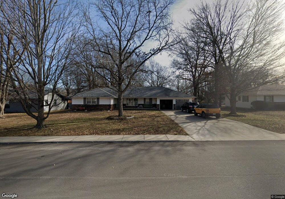
2110 Pearl St Carthage, MO 64836
Estimated Value: $272,000 - $296,000
3
Beds
2
Baths
2,078
Sq Ft
$134/Sq Ft
Est. Value
About This Home
This home is located at 2110 Pearl St, Carthage, MO 64836 and is currently estimated at $279,187, approximately $134 per square foot. 2110 Pearl St is a home located in Jasper County with nearby schools including Carthage High School, St. Ann's Catholic School, and Victory Academy.
Ownership History
Date
Name
Owned For
Owner Type
Purchase Details
Closed on
Aug 22, 2013
Sold by
Riley Oneta M
Bought by
Zoromski Keith R and Zoromski Stephanie A
Current Estimated Value
Home Financials for this Owner
Home Financials are based on the most recent Mortgage that was taken out on this home.
Original Mortgage
$128,250
Outstanding Balance
$95,615
Interest Rate
4.53%
Mortgage Type
New Conventional
Estimated Equity
$183,572
Create a Home Valuation Report for This Property
The Home Valuation Report is an in-depth analysis detailing your home's value as well as a comparison with similar homes in the area
Home Values in the Area
Average Home Value in this Area
Purchase History
| Date | Buyer | Sale Price | Title Company |
|---|---|---|---|
| Zoromski Keith R | -- | Fatco |
Source: Public Records
Mortgage History
| Date | Status | Borrower | Loan Amount |
|---|---|---|---|
| Open | Zoromski Keith R | $128,250 |
Source: Public Records
Tax History Compared to Growth
Tax History
| Year | Tax Paid | Tax Assessment Tax Assessment Total Assessment is a certain percentage of the fair market value that is determined by local assessors to be the total taxable value of land and additions on the property. | Land | Improvement |
|---|---|---|---|---|
| 2025 | $1,451 | $31,350 | $3,800 | $27,550 |
| 2024 | $1,451 | $28,190 | $3,800 | $24,390 |
| 2023 | $1,451 | $28,190 | $3,800 | $24,390 |
| 2022 | $1,433 | $27,930 | $3,800 | $24,130 |
| 2021 | $1,417 | $27,930 | $3,800 | $24,130 |
| 2020 | $1,366 | $25,800 | $3,800 | $22,000 |
| 2019 | $1,369 | $25,800 | $3,800 | $22,000 |
| 2018 | $1,216 | $22,990 | $0 | $0 |
| 2017 | $1,219 | $22,990 | $0 | $0 |
| 2016 | $1,264 | $23,900 | $0 | $0 |
| 2015 | -- | $23,900 | $0 | $0 |
| 2014 | -- | $23,380 | $0 | $0 |
Source: Public Records
Map
Nearby Homes
- 2141 Carrie St
- 1004 Gene Taylor Dr
- 909 Durward Hall Dr
- 1211 E Airport Dr
- 1106 Southern Hills
- 837 Modern Way
- 839 Modern Way
- 1341 E Airport Dr
- 1922 Southwood Ln
- NE COR Airport Dr & River
- 1823 S River St
- 1431 Quail Place
- 1320 Belle Air Place
- 1131 Belle Air Place
- 1743 S River St
- 619 Belle Air Place
- 739 Sheridan St
- 1647 Glenwood Place
- 1012 Euclid Blvd
- TBD Lexie Ln
- 2104 Pearl St
- 2122 Pearl St
- 2131 Carrie St
- 2121 Carrie St
- 2048 Pearl St
- 1117 Lillie Dr
- 1116 Lillie Dr
- 2111 Carrie St
- 1109 Lillie Dr
- 2040 Pearl St
- 1118 Ridgecrest Ave
- 2148 Carrie St
- 1110 Lillie Dr
- 2142 Carrie St
- 2136 Carrie St
- 2105 Carrie St
- 1103 Lillie Dr
- 2130 Carrie St
- 2140 Pearl St
- 1110 Ridgecrest Ave