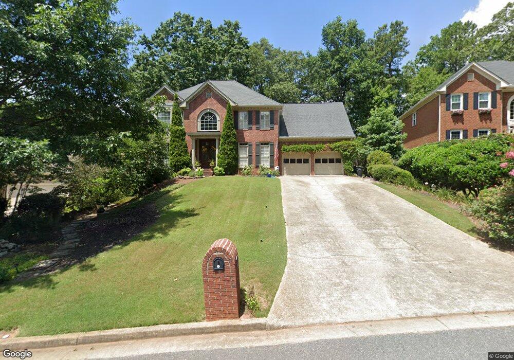
2110 Pearwood Path Unit V Roswell, GA 30076
Estimated Value: $712,000 - $836,000
4
Beds
3
Baths
3,268
Sq Ft
$232/Sq Ft
Est. Value
About This Home
This home is located at 2110 Pearwood Path Unit V, Roswell, GA 30076 and is currently estimated at $756,910, approximately $231 per square foot. 2110 Pearwood Path Unit V is a home located in Fulton County with nearby schools including Hillside Elementary School, Haynes Bridge Middle School, and Centennial High School.
Ownership History
Date
Name
Owned For
Owner Type
Purchase Details
Closed on
Oct 10, 2022
Sold by
Pellegrom Robin T
Bought by
Silver Robert Alan and Silver Kelly A
Current Estimated Value
Home Financials for this Owner
Home Financials are based on the most recent Mortgage that was taken out on this home.
Original Mortgage
$630,800
Outstanding Balance
$606,377
Interest Rate
5.89%
Mortgage Type
New Conventional
Estimated Equity
$150,533
Purchase Details
Closed on
Jun 27, 2000
Sold by
Carbonara Jeffrey M
Bought by
Pellegrom Michael
Home Financials for this Owner
Home Financials are based on the most recent Mortgage that was taken out on this home.
Original Mortgage
$130,000
Interest Rate
8.63%
Mortgage Type
New Conventional
Purchase Details
Closed on
Jun 29, 1995
Sold by
Rosas Leah S Olmedo A
Bought by
Carbonara Jeffrey M Karen A
Create a Home Valuation Report for This Property
The Home Valuation Report is an in-depth analysis detailing your home's value as well as a comparison with similar homes in the area
Home Values in the Area
Average Home Value in this Area
Purchase History
| Date | Buyer | Sale Price | Title Company |
|---|---|---|---|
| Silver Robert Alan | $664,000 | -- | |
| Pellegrom Michael | $300,000 | -- | |
| Carbonara Jeffrey M Karen A | $238,000 | -- |
Source: Public Records
Mortgage History
| Date | Status | Borrower | Loan Amount |
|---|---|---|---|
| Open | Silver Robert Alan | $630,800 | |
| Previous Owner | Pellegrom Michael | $130,000 | |
| Previous Owner | Pellegrom Michael | $81,300 | |
| Closed | Carbonara Jeffrey M Karen A | $0 |
Source: Public Records
Tax History Compared to Growth
Tax History
| Year | Tax Paid | Tax Assessment Tax Assessment Total Assessment is a certain percentage of the fair market value that is determined by local assessors to be the total taxable value of land and additions on the property. | Land | Improvement |
|---|---|---|---|---|
| 2025 | $1,317 | $279,160 | $45,120 | $234,040 |
| 2023 | $7,457 | $264,200 | $45,880 | $218,320 |
| 2022 | $3,925 | $226,000 | $31,120 | $194,880 |
| 2021 | $4,645 | $193,760 | $27,600 | $166,160 |
| 2020 | $4,719 | $196,120 | $24,400 | $171,720 |
| 2019 | $961 | $194,000 | $33,400 | $160,600 |
| 2018 | $5,073 | $179,720 | $22,920 | $156,800 |
| 2017 | $3,866 | $144,440 | $17,520 | $126,920 |
| 2016 | $3,853 | $144,440 | $17,520 | $126,920 |
| 2015 | $4,655 | $144,440 | $17,520 | $126,920 |
| 2014 | $3,995 | $144,440 | $17,520 | $126,920 |
Source: Public Records
Map
Nearby Homes
- 600 Wood Work Way
- 1250 Atherton Park
- 1020 Summer Oaks Close Unit 4
- 260 Spring Ridge Dr
- 9195 Nesbit Lakes Dr
- 940 Waters Reach Ct
- 920 Waters Reach Ct
- 2765 Chandon Place
- 590 Ridgemont Dr
- 1095 Northpointe Trace
- 970 Laurel Mill Dr
- 585 Saint Regis Ln
- 615 Barrington Way
- 620 Lake Forest Ct
- 145 W Ridge Way
- 315 Anchorage Place
- 515 Forest Place
- 109 W Ridge Way
- 280 Vidaulan Ct
- 225 Barrington Dr E
- 2120 Pearwood Path
- 2100 Pearwood Path
- 290 Spring Ridge Trace Unit 4B
- 280 Spring Ridge Trace
- 2130 Pearwood Path
- 300 Spring Ridge Trace Unit 4B
- 280 Spring Ridge Dr
- 2085 Pearwood Path Unit V
- 2090 Pearwood Path
- 2105 Pearwood Path
- 270 Spring Ridge Trace Unit 4B
- 310 Spring Ridge Trace
- 2080 Pearwood Path
- 2125 Pearwood Path
- 2140 Pearwood Path
- 260 Spring Ridge Trace
- 2150 Pearwood Path
- 285 Spring Ridge Trace
- 2070 Pearwood Path
- 610 Wood Work Way