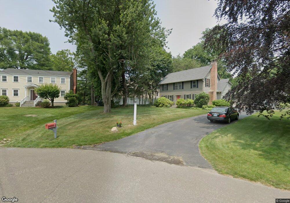
2110 Post Rd Darien, CT 06820
Estimated Value: $2,368,000 - $3,254,000
7
Beds
5
Baths
5,212
Sq Ft
$556/Sq Ft
Est. Value
About This Home
This home is located at 2110 Post Rd, Darien, CT 06820 and is currently estimated at $2,898,026, approximately $556 per square foot. 2110 Post Rd is a home located in Fairfield County with nearby schools including Hindley Elementary School, Middlesex Middle School, and Darien High School.
Ownership History
Date
Name
Owned For
Owner Type
Purchase Details
Closed on
Aug 11, 2010
Sold by
Tricerri Louis J and Tricerri Elizabeth M
Bought by
Orr Robert W and Bhat Meghana
Current Estimated Value
Home Financials for this Owner
Home Financials are based on the most recent Mortgage that was taken out on this home.
Original Mortgage
$682,000
Interest Rate
4.63%
Purchase Details
Closed on
Aug 8, 2005
Sold by
Hardinge Julie T
Bought by
Tricerri Louis J and Tricerri Elizabeth M
Purchase Details
Closed on
Aug 16, 1995
Sold by
Giannattasio Bldg Cont
Bought by
Hardinge Julie and Hardinge Charles
Purchase Details
Closed on
Mar 31, 1995
Sold by
Lazzaro Janet
Bought by
Giannattasio Bldg Cont
Create a Home Valuation Report for This Property
The Home Valuation Report is an in-depth analysis detailing your home's value as well as a comparison with similar homes in the area
Home Values in the Area
Average Home Value in this Area
Purchase History
| Date | Buyer | Sale Price | Title Company |
|---|---|---|---|
| Orr Robert W | $1,365,000 | -- | |
| Tricerri Louis J | $1,975,000 | -- | |
| Hardinge Julie | $620,000 | -- | |
| Giannattasio Bldg Cont | $250,000 | -- | |
| Orr Robert W | $1,365,000 | -- | |
| Tricerri Louis J | $1,975,000 | -- | |
| Hardinge Julie | $620,000 | -- | |
| Giannattasio Bldg Cont | $250,000 | -- |
Source: Public Records
Mortgage History
| Date | Status | Borrower | Loan Amount |
|---|---|---|---|
| Open | Giannattasio Bldg Cont | $670,000 | |
| Closed | Giannattasio Bldg Cont | $682,000 |
Source: Public Records
Tax History
| Year | Tax Paid | Tax Assessment Tax Assessment Total Assessment is a certain percentage of the fair market value that is determined by local assessors to be the total taxable value of land and additions on the property. | Land | Improvement |
|---|---|---|---|---|
| 2025 | $21,701 | $1,401,890 | $483,910 | $917,980 |
| 2024 | $20,594 | $1,401,890 | $483,910 | $917,980 |
| 2023 | $20,193 | $1,146,670 | $345,660 | $801,010 |
| 2022 | $19,757 | $1,146,670 | $345,660 | $801,010 |
| 2021 | $19,310 | $1,146,670 | $345,660 | $801,010 |
| 2020 | $18,760 | $1,146,670 | $345,660 | $801,010 |
| 2019 | $18,886 | $1,146,670 | $345,660 | $801,010 |
| 2018 | $15,793 | $982,170 | $323,750 | $658,420 |
| 2017 | $15,872 | $982,170 | $323,750 | $658,420 |
| 2016 | $15,489 | $982,170 | $323,750 | $658,420 |
| 2015 | $15,076 | $982,170 | $323,750 | $658,420 |
| 2014 | $14,742 | $982,170 | $323,750 | $658,420 |
Source: Public Records
Map
Nearby Homes
- 25 Patricia Ln
- 20 Outlook Dr
- 3 Salt Box Ln E
- 18 Pasture Ln
- 19 Thomasina Ln
- 43 Dubois St
- 32 Relihan Rd
- 66 Stanton Rd
- 29 Walmsley Rd
- 12 Walmsley Rd
- 77 Maple St
- 25 Hillside Ave
- 166 Hollow Tree Ridge Rd
- 167 Hollow Tree Ridge Rd
- 11 Patton Dr
- 29 Waterbury Ave
- 16 Fairfield Ave
- 15 Charles St
- 25 Albin Rd
- 33 Dora St
Your Personal Tour Guide
Ask me questions while you tour the home.