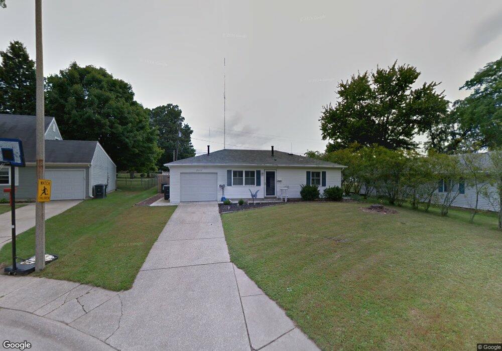
2110 Renfrew Ct South Bend, IN 46614
Scottsdale NeighborhoodEstimated Value: $155,000 - $177,000
3
Beds
1
Bath
896
Sq Ft
$183/Sq Ft
Est. Value
About This Home
This home is located at 2110 Renfrew Ct, South Bend, IN 46614 and is currently estimated at $163,589, approximately $182 per square foot. 2110 Renfrew Ct is a home located in St. Joseph County with nearby schools including Marshall Traditional School, Hay Elementary School, and Clay Intermediate Center.
Ownership History
Date
Name
Owned For
Owner Type
Purchase Details
Closed on
Sep 21, 2010
Sold by
Thompson Blake
Bought by
Hansen Ruby
Current Estimated Value
Purchase Details
Closed on
Jun 25, 2010
Sold by
Thompson Blake
Bought by
Thompson Blake and Hansen Ruby
Purchase Details
Closed on
Dec 3, 2009
Sold by
First Of Steel Mountain Ii Llc
Bought by
Lemke Larry
Purchase Details
Closed on
Mar 13, 2008
Sold by
Mcfadden Albert W and Mcfadden Marilyn
Bought by
First Of Steel Mountain Ii Llc
Purchase Details
Closed on
Oct 31, 2005
Sold by
Turner Larry
Bought by
Mcfadden Albert W and Mcfadden Marilyn
Home Financials for this Owner
Home Financials are based on the most recent Mortgage that was taken out on this home.
Original Mortgage
$68,720
Interest Rate
9.25%
Mortgage Type
Adjustable Rate Mortgage/ARM
Create a Home Valuation Report for This Property
The Home Valuation Report is an in-depth analysis detailing your home's value as well as a comparison with similar homes in the area
Home Values in the Area
Average Home Value in this Area
Purchase History
| Date | Buyer | Sale Price | Title Company |
|---|---|---|---|
| Hansen Ruby | -- | None Available | |
| Thompson Blake | -- | Meridian Title Corp | |
| Thompson Blake | -- | Meridian Title Corp | |
| Lemke Larry | -- | None Available | |
| First Of Steel Mountain Ii Llc | -- | None Available | |
| Mcfadden Albert W | -- | None Available |
Source: Public Records
Mortgage History
| Date | Status | Borrower | Loan Amount |
|---|---|---|---|
| Previous Owner | Mcfadden Albert W | $68,720 |
Source: Public Records
Tax History Compared to Growth
Tax History
| Year | Tax Paid | Tax Assessment Tax Assessment Total Assessment is a certain percentage of the fair market value that is determined by local assessors to be the total taxable value of land and additions on the property. | Land | Improvement |
|---|---|---|---|---|
| 2024 | $158 | $118,000 | $17,700 | $100,300 |
| 2023 | $115 | $76,900 | $17,700 | $59,200 |
| 2022 | $191 | $77,100 | $17,700 | $59,400 |
| 2021 | $397 | $95,700 | $17,700 | $78,000 |
| 2020 | $876 | $90,600 | $15,700 | $74,900 |
| 2019 | $884 | $92,400 | $15,300 | $77,100 |
| 2018 | $925 | $76,600 | $12,700 | $63,900 |
| 2017 | $936 | $76,000 | $12,700 | $63,300 |
| 2016 | $951 | $76,100 | $12,700 | $63,400 |
| 2014 | $779 | $66,000 | $10,600 | $55,400 |
Source: Public Records
Map
Nearby Homes
- 1957 Broadford Dr
- 1951 Broadford Dr
- 17746 Hartman St
- 1725 Thornhill Dr
- 1719 Thornhill Dr
- 4555 Macdougall Ct
- 1515 Strathmore Ct
- 4312 Sampson St
- 4909 Selkirk Dr
- 5541 Deer Hollow Dr
- 60506 Woodstock Dr
- 1834 Saint Michaels Ct
- 1512 Oakdale Dr
- 1413 Orkney Ct
- 1426 Oakdale Dr
- 5653 Danbury Dr
- 4039 Coral Dr
- 4028 Coral Dr
- 4015 Coral Dr
- 5912 York Rd
- 2137 Thornhill Dr
- 2114 Renfrew Ct
- 2118 Renfrew Ct
- 2101 Renfrew Ct
- 2122 Renfrew Ct
- 2138 Thornhill Dr
- 2115 Renfrew Ct
- 5105 S Ironwood Rd
- 2119 Renfrew Ct
- 2016 Renfrew Dr
- 2122 Thornhill Dr
- 2044 Carrbridge Ct
- 2048 Carrbridge Ct
- 2015 Renfrew Dr
- 2037 Thornhill Dr
- 2010 Renfrew Dr
- 2034 Thornhill Dr
- 2009 Renfrew Dr
- 59880 Ironwood Rd
- 2054 Carrbridge Ct