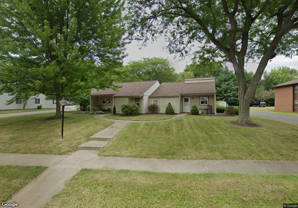
2110 Tanglewood Ave Alliance, OH 44601
Estimated Value: $122,000 - $144,000
2
Beds
1
Bath
1,022
Sq Ft
$131/Sq Ft
Est. Value
About This Home
This home is located at 2110 Tanglewood Ave, Alliance, OH 44601 and is currently estimated at $133,494, approximately $130 per square foot. 2110 Tanglewood Ave is a home located in Stark County with nearby schools including Marlington High School and Regina Coeli/St Joseph School.
Ownership History
Date
Name
Owned For
Owner Type
Purchase Details
Closed on
Oct 4, 2013
Sold by
Laubert Lois Y
Bought by
Lotz Albert
Current Estimated Value
Purchase Details
Closed on
May 1, 1996
Sold by
E M M S Inc
Bought by
Lotz Albert T
Home Financials for this Owner
Home Financials are based on the most recent Mortgage that was taken out on this home.
Original Mortgage
$54,000
Interest Rate
7.63%
Mortgage Type
New Conventional
Purchase Details
Closed on
Sep 2, 1994
Sold by
Sherer Kathlyn S
Bought by
E M M S Inc
Home Financials for this Owner
Home Financials are based on the most recent Mortgage that was taken out on this home.
Original Mortgage
$43,500
Interest Rate
8.59%
Mortgage Type
New Conventional
Purchase Details
Closed on
Jun 29, 1990
Create a Home Valuation Report for This Property
The Home Valuation Report is an in-depth analysis detailing your home's value as well as a comparison with similar homes in the area
Home Values in the Area
Average Home Value in this Area
Purchase History
| Date | Buyer | Sale Price | Title Company |
|---|---|---|---|
| Lotz Albert | $58,000 | None Available | |
| Lotz Albert T | $60,000 | -- | |
| E M M S Inc | $53,500 | -- | |
| -- | $50,000 | -- |
Source: Public Records
Mortgage History
| Date | Status | Borrower | Loan Amount |
|---|---|---|---|
| Previous Owner | Lotz Albert T | $54,000 | |
| Previous Owner | E M M S Inc | $43,500 |
Source: Public Records
Tax History Compared to Growth
Tax History
| Year | Tax Paid | Tax Assessment Tax Assessment Total Assessment is a certain percentage of the fair market value that is determined by local assessors to be the total taxable value of land and additions on the property. | Land | Improvement |
|---|---|---|---|---|
| 2025 | -- | $34,060 | $5,080 | $28,980 |
| 2024 | -- | $34,060 | $5,080 | $28,980 |
| 2023 | $908 | $28,630 | $5,110 | $23,520 |
| 2022 | $912 | $28,630 | $5,110 | $23,520 |
| 2021 | $915 | $28,630 | $5,110 | $23,520 |
| 2020 | $635 | $26,960 | $4,380 | $22,580 |
| 2019 | $629 | $26,960 | $4,380 | $22,580 |
| 2018 | $630 | $26,960 | $4,380 | $22,580 |
| 2017 | $516 | $23,780 | $4,380 | $19,400 |
| 2016 | $507 | $23,500 | $4,380 | $19,120 |
| 2015 | $508 | $23,500 | $4,380 | $19,120 |
| 2014 | $554 | $23,490 | $5,010 | $18,480 |
| 2013 | $277 | $23,490 | $5,010 | $18,480 |
Source: Public Records
Map
Nearby Homes
- 2851 Patriots Path Unit 3D
- 0 Easton St NE
- 1870 Northview Ave
- 0 Valewood Cir Unit 5006281
- 0 Winchester St
- 0 Winchester St Unit 5162877
- 2195 Blenheim Ave
- 1201 Overlook Dr
- 3030 Center Ave
- 1059 Oakwood Dr
- 1042 Hartshorn St
- 0 W Main St Unit 5090123
- 1030 Sunset Dr
- 856 Birchwood Dr
- 1039 Glamorgan St
- 970 Kingsway St
- 2245 Ridgewood Ave
- 1136 Parkway Blvd
- 1050 Parkway Blvd
- 549 Linwood Dr
- 2110 Tanglewood Ave
- 2112 Tanglewood Ave
- 2302 Ansley St Unit 2302
- 2146 Tanglewood Ave Unit C
- 2146 Tanglewood Ave
- 2304 Ansley St
- 2144 Tanglewood Ave
- 2306 Ansley St
- 2308 Ansley St Unit A2308
- 2301 Ansley St Unit B2301
- 2310 Ansley St
- 2303 Ansley St
- 2303 Camalak Ln
- 2305 Ansley St
- 2307 Ansley St
- 2307 Camalak Ln
- 2302 Camalak Ln
- 8869 Schubert Ave NE
- 8903 Schubert Ave NE
- 8853 Schubert Ave NE