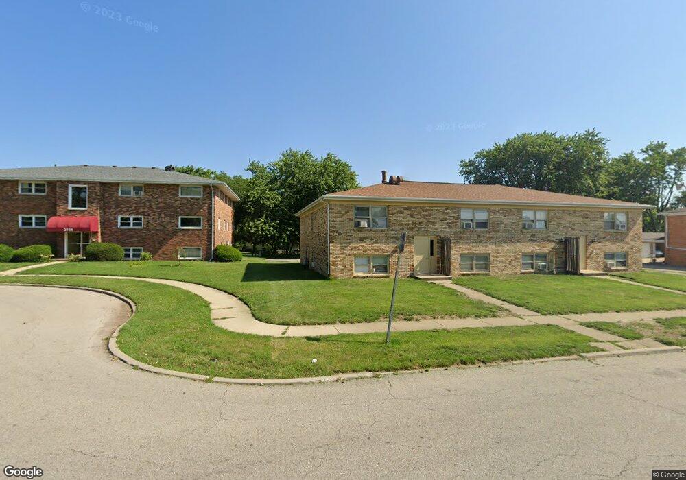
2110 Todd Dr 6 Bloomington, IL 61701
Lakewood-Hillcrest NeighborhoodEstimated Value: $73,000 - $121,000
2
Beds
2
Baths
1,092
Sq Ft
$89/Sq Ft
Est. Value
About This Home
This home is located at 2110 Todd Dr 6, Bloomington, IL 61701 and is currently estimated at $97,464, approximately $89 per square foot. 2110 Todd Dr 6 is a home located in McLean County with nearby schools including Stevenson Elementary School, Bloomington Junior High School, and Bloomington High School.
Ownership History
Date
Name
Owned For
Owner Type
Purchase Details
Closed on
Jun 12, 2018
Sold by
Federal National Mortgage Association
Bought by
Martin Linda Whitcombe
Current Estimated Value
Purchase Details
Closed on
May 3, 2007
Sold by
Post Brian and Post Jannelle L
Bought by
Hawkins Jacqueline N
Home Financials for this Owner
Home Financials are based on the most recent Mortgage that was taken out on this home.
Original Mortgage
$77,503
Interest Rate
6.21%
Mortgage Type
New Conventional
Create a Home Valuation Report for This Property
The Home Valuation Report is an in-depth analysis detailing your home's value as well as a comparison with similar homes in the area
Home Values in the Area
Average Home Value in this Area
Purchase History
| Date | Buyer | Sale Price | Title Company |
|---|---|---|---|
| Martin Linda Whitcombe | $38,000 | None Available | |
| Hawkins Jacqueline N | $80,000 | None Available |
Source: Public Records
Mortgage History
| Date | Status | Borrower | Loan Amount |
|---|---|---|---|
| Previous Owner | Hawkins Jacqueline N | $77,503 |
Source: Public Records
Tax History
| Year | Tax Paid | Tax Assessment Tax Assessment Total Assessment is a certain percentage of the fair market value that is determined by local assessors to be the total taxable value of land and additions on the property. | Land | Improvement |
|---|---|---|---|---|
| 2024 | $1,083 | $28,948 | $3,482 | $25,466 |
| 2022 | $1,083 | $23,737 | $2,855 | $20,882 |
| 2021 | $1,409 | $22,577 | $2,715 | $19,862 |
| 2020 | $1,405 | $22,577 | $2,715 | $19,862 |
| 2019 | $1,401 | $22,577 | $2,715 | $19,862 |
| 2018 | $1,900 | $22,577 | $2,715 | $19,862 |
| 2017 | $1,396 | $22,577 | $2,715 | $19,862 |
| 2016 | $1,393 | $22,577 | $2,715 | $19,862 |
| 2015 | $1,561 | $24,621 | $2,961 | $21,660 |
| 2014 | -- | $24,621 | $2,961 | $21,660 |
| 2013 | -- | $24,621 | $2,961 | $21,660 |
Source: Public Records
Map
Nearby Homes
- 1206 N Hershey Rd
- 1218 Orchard Rd
- 1307 Glenwood Rd
- 2419 Maloney Dr
- 310 Rowe Dr
- 29 Brandywine Ct
- 110 S Hershey Rd
- 59 Bandecon Way
- 2501 Yorktown Dr
- 1903 Oakwood Ave
- 711 Lara Rd
- 4 Monarch Dr
- 2814 Richard Rd
- 3009 E Oakland Ave
- 1111 Sheridan Rd
- 4 Scofield Ct
- 1510 E Olive St
- 317 Waterford Estates Dr
- 3610 Ballyford Dr
- 404 Chelsea Dr
- 2110 Todd Dr
- 2110 Todd Dr Unit 6
- 2110 Todd Dr Unit 5
- 2110 Todd Dr Unit 4
- 2110 Todd Dr Unit 3
- 2110 Todd Dr Unit 2
- 2110 Todd Dr Unit 1
- 1106 Gettysburg Dr
- 2106 Todd Dr
- 2105 Lamon Dr
- 2109 Todd Dr
- 2111 Todd Dr
- 2103 Lamon Dr
- 2101 Lamon Dr
- 2107 Todd Dr
- 1108 Gettysburg Dr
- 2105 Todd Dr
- 1105 Gettysburg Dr
- 1204 Townley Dr
- 1103 Gettysburg Dr
Your Personal Tour Guide
Ask me questions while you tour the home.