
Seller's Agent in 2025
Karla Meislahn
Coldwell Banker Select
(918) 638-5894
121 Total Sales
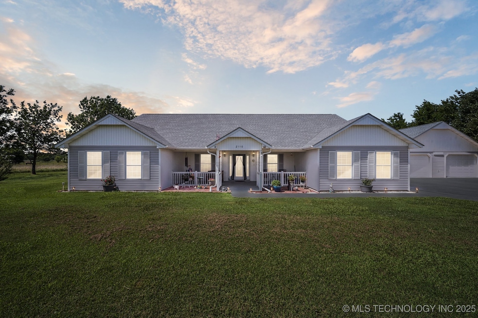
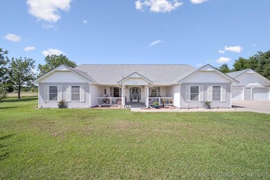

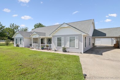

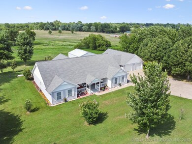
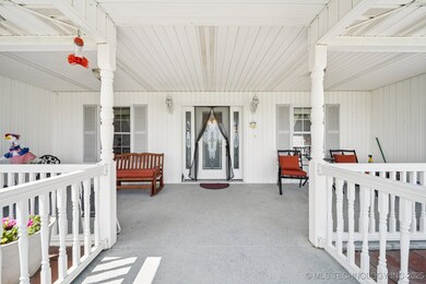
Lovely home on 6 beautiful acres w/pond, fenced, excellent pasture, mature trees, fruit trees that include pear, apple, & cherry and 24x30 shop, large storm cellar and 1 bed guest apartment w/kitchen. The home features split bedrooms, extra large great room open to the kitchen/dining with fireplace. The large sunny kitchen is every cook's dream with abundant cabinets, center island, newer SS double ovens & refrigerator, 2 pantries & plenty of storage. Other features include an enclosed sunroom ideal for entertaining, large primary bedroom with private bath and guest bedrooms that are also extra-large size. You will enjoy the portico that goes from the utility room outside to the garage and guesthouse behind the garage. The garage is oversized and all the additional parking is ideal for company and large gatherings. The charming guesthouse features living area open to kitchen/dining and also a full bath & bedroom, perfect for guests or family. The roof and H&A were newly installed in 2024. This property is ideally located just outside of Pryor and off of Hwy 69 for convenience to everywhere. Alot here to appreciate. See to appreciate all this home has to offer
Last Agent to Sell the Property
Coldwell Banker Select License #120862 Listed on: 07/03/2025
| Date | Type | Sale Price | Title Company |
|---|---|---|---|
| Warranty Deed | $504,000 | Grand River Abstract & Title | |
| Warranty Deed | $219,000 | None Available | |
| Warranty Deed | $5,000 | -- |
| Date | Status | Loan Amount | Loan Type |
|---|---|---|---|
| Open | $504,000 | VA |
| Date | Event | Price | List to Sale | Price per Sq Ft |
|---|---|---|---|---|
| 08/27/2025 08/27/25 | Sold | $504,000 | +3.1% | $181 / Sq Ft |
| 07/16/2025 07/16/25 | Pending | -- | -- | -- |
| 07/03/2025 07/03/25 | For Sale | $489,000 | -- | $176 / Sq Ft |
| Year | Tax Paid | Tax Assessment Tax Assessment Total Assessment is a certain percentage of the fair market value that is determined by local assessors to be the total taxable value of land and additions on the property. | Land | Improvement |
|---|---|---|---|---|
| 2025 | $3,262 | $39,629 | $4,795 | $34,834 |
| 2024 | $3,164 | $38,474 | $4,655 | $33,819 |
| 2023 | $3,164 | $37,354 | $4,566 | $32,788 |
| 2022 | $2,948 | $36,266 | $4,443 | $31,823 |
| 2021 | $2,888 | $35,210 | $5,456 | $29,754 |
| 2020 | $2,747 | $34,184 | $5,228 | $28,956 |
| 2019 | $2,749 | $33,188 | $4,371 | $28,817 |
| 2018 | $2,651 | $32,222 | $4,118 | $28,104 |
| 2017 | $2,391 | $31,284 | $2,755 | $28,529 |
| 2016 | $2,342 | $30,372 | $2,674 | $27,698 |
| 2015 | $2,309 | $29,488 | $2,597 | $26,891 |
| 2014 | $2,239 | $28,629 | $2,521 | $26,108 |
Seller's Agent in 2025
Karla Meislahn
Coldwell Banker Select
(918) 638-5894
121 Total Sales
Buyer's Agent in 2025
Kimm Kennon
Lakeland Real Estate NEOK
(918) 864-4922
192 Total Sales
Source: MLS Technology
MLS Number: 2528879
APN: 0000-29-22N-19E-4-006-00
Disclaimer: Certain information contained herein is derived from information provided by parties other than Homes.com. All information provided is deemed reliable, but is not guaranteed to be accurate and should be independently verified.
![]() IDX information is provided exclusively for personal, non-commercial use, and may not be used for any purpose other than to identify prospective properties consumers may be interested in purchasing.
IDX information is provided exclusively for personal, non-commercial use, and may not be used for any purpose other than to identify prospective properties consumers may be interested in purchasing.
Information is deemed reliable but not guaranteed.
Ask me questions while you tour the home.