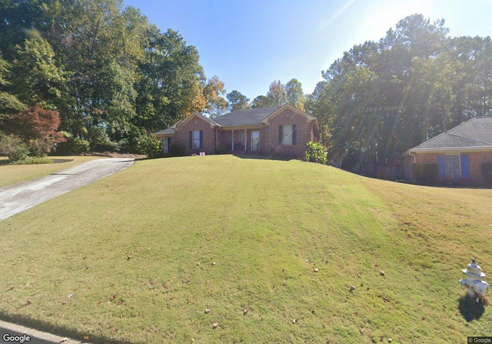
2110 Weatherstone Cir SE Conyers, GA 30094
Estimated Value: $341,282 - $406,000
3
Beds
3
Baths
2,535
Sq Ft
$150/Sq Ft
Est. Value
About This Home
This home is located at 2110 Weatherstone Cir SE, Conyers, GA 30094 and is currently estimated at $379,071, approximately $149 per square foot. 2110 Weatherstone Cir SE is a home located in Rockdale County with nearby schools including Flat Shoals Elementary School, Edwards Middle School, and Rockdale County High School.
Ownership History
Date
Name
Owned For
Owner Type
Purchase Details
Closed on
Jun 19, 2017
Sold by
Martin Thomas Anthony
Bought by
Martin Thomas Anthony and Martin Sandra Denise
Current Estimated Value
Purchase Details
Closed on
May 15, 2014
Sold by
Easter Harold E
Bought by
Martin Thomas Anthony
Home Financials for this Owner
Home Financials are based on the most recent Mortgage that was taken out on this home.
Original Mortgage
$139,650
Interest Rate
4.32%
Mortgage Type
New Conventional
Purchase Details
Closed on
Feb 14, 2006
Sold by
Woodward Ruthh F
Bought by
Easter Harold E and Easter Audrey J
Home Financials for this Owner
Home Financials are based on the most recent Mortgage that was taken out on this home.
Original Mortgage
$23,000
Interest Rate
8.37%
Mortgage Type
Unknown
Create a Home Valuation Report for This Property
The Home Valuation Report is an in-depth analysis detailing your home's value as well as a comparison with similar homes in the area
Home Values in the Area
Average Home Value in this Area
Purchase History
| Date | Buyer | Sale Price | Title Company |
|---|---|---|---|
| Martin Thomas Anthony | -- | -- | |
| Martin Thomas Anthony | $147,000 | -- | |
| Easter Harold E | $230,000 | -- |
Source: Public Records
Mortgage History
| Date | Status | Borrower | Loan Amount |
|---|---|---|---|
| Previous Owner | Martin Thomas Anthony | $139,650 | |
| Previous Owner | Easter Harold E | $23,000 | |
| Previous Owner | Easter Harold E | $184,000 |
Source: Public Records
Tax History Compared to Growth
Tax History
| Year | Tax Paid | Tax Assessment Tax Assessment Total Assessment is a certain percentage of the fair market value that is determined by local assessors to be the total taxable value of land and additions on the property. | Land | Improvement |
|---|---|---|---|---|
| 2024 | $2,385 | $126,080 | $30,800 | $95,280 |
| 2023 | $2,424 | $132,880 | $30,800 | $102,080 |
| 2022 | $2,122 | $108,840 | $24,960 | $83,880 |
| 2021 | $1,783 | $91,360 | $20,800 | $70,560 |
| 2020 | $1,486 | $80,320 | $17,760 | $62,560 |
| 2019 | $1,319 | $73,360 | $10,800 | $62,560 |
| 2018 | $1,087 | $65,600 | $10,800 | $54,800 |
| 2017 | $967 | $61,360 | $10,800 | $50,560 |
| 2016 | $977 | $65,600 | $10,800 | $54,800 |
| 2015 | $748 | $57,680 | $9,320 | $48,360 |
| 2014 | $2,460 | $53,040 | $8,000 | $45,040 |
| 2013 | -- | $68,520 | $13,600 | $54,920 |
Source: Public Records
Map
Nearby Homes
- Astrid Plan at Alder Park
- Harrison Plan at Alder Park
- Baker Plan at Alder Park
- Oliver Plan at Alder Park
- 2197 Boxwood Cir
- Boston Plan at Millers Pointe
- Atlanta Plan at Millers Pointe
- Columbus Plan at Millers Pointe
- 1242 Saxony Dr SE
- 1402 Aramore Dr SE
- 1408 Aramore Dr SE
- 660 Kirkus Dr SE
- 2464 Lennox Rd SE
- 1019 Henna Ct SE
- 1870 Parker Rd SE
- 0 Georgia 20 Unit 10439576
- 1000 Silver Summit Dr SE
- 2608 Downing Park Dr SE
- 1701 Silver Summit Dr SE
- 1502 Silver Summit Dr SE
- 2110 Weatherstone Cir SE Unit 11
- 2100 Weatherstone Cir SE
- 2120 Weatherstone Cir SE
- 1756 Hayes Ct
- 1754 Hayes Ct
- 2090 Weatherstone Cir SE
- 2081 Weatherstone Cir SE
- 2071 Weatherstone Cir SE
- 0 Hayes Ct Unit 8762156
- 1903 Sheldon Ln Unit 14
- 1903 Sheldon Ln
- 2080 Weatherstone Cir SE
- 2061 Weatherstone Cir SE
- 1755 Hayes Ct
- 1752 Hayes Ct
- 2080 Boxwood Cir
- 2091 Weatherstone Cir SE Unit 1
- 2194 Boxwood Cir SE
- 2182 Boxwood Cir SE
- 2070 Weatherstone Cir SE