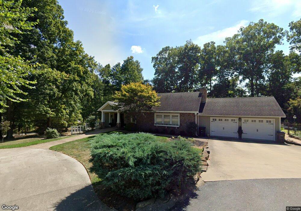
2110 Woodhaven Rd Cape Girardeau, MO 63701
Estimated Value: $383,000 - $744,000
4
Beds
3
Baths
2,500
Sq Ft
$224/Sq Ft
Est. Value
About This Home
This home is located at 2110 Woodhaven Rd, Cape Girardeau, MO 63701 and is currently estimated at $560,675, approximately $224 per square foot. 2110 Woodhaven Rd is a home located in Cape Girardeau County with nearby schools including Alma Schrader Elementary School, Central Middle School, and Central Junior High School.
Ownership History
Date
Name
Owned For
Owner Type
Purchase Details
Closed on
Sep 22, 2011
Sold by
Caruso Paul A and Caruso Beverly D
Bought by
Blattner Charles F and Blattner Tracy
Current Estimated Value
Purchase Details
Closed on
Jul 29, 2010
Sold by
Caruso Paul Anthony and Caruso Paul
Bought by
Caruso Paul A and Caruso Beverly D
Purchase Details
Closed on
Jul 9, 2010
Sold by
Caruso Paul Anthony and Caruso Paul
Bought by
Caruso Paul A and Caruso Beverly D
Purchase Details
Closed on
Aug 7, 2008
Sold by
Strom Stephen E
Bought by
Caruso Pual Anthony and Caruso Bevelry D
Home Financials for this Owner
Home Financials are based on the most recent Mortgage that was taken out on this home.
Original Mortgage
$307,810
Interest Rate
6.42%
Mortgage Type
Unknown
Create a Home Valuation Report for This Property
The Home Valuation Report is an in-depth analysis detailing your home's value as well as a comparison with similar homes in the area
Home Values in the Area
Average Home Value in this Area
Purchase History
| Date | Buyer | Sale Price | Title Company |
|---|---|---|---|
| Blattner Charles F | -- | None Available | |
| Caruso Paul A | -- | None Available | |
| Caruso Paul A | -- | None Available | |
| Caruso Pual Anthony | -- | None Available |
Source: Public Records
Mortgage History
| Date | Status | Borrower | Loan Amount |
|---|---|---|---|
| Previous Owner | Caruso Pual Anthony | $307,810 |
Source: Public Records
Tax History Compared to Growth
Tax History
| Year | Tax Paid | Tax Assessment Tax Assessment Total Assessment is a certain percentage of the fair market value that is determined by local assessors to be the total taxable value of land and additions on the property. | Land | Improvement |
|---|---|---|---|---|
| 2025 | $43 | $87,060 | $6,930 | $80,130 |
| 2024 | $43 | $82,920 | $6,600 | $76,320 |
| 2023 | $4,310 | $82,920 | $6,600 | $76,320 |
| 2022 | $3,974 | $76,420 | $6,080 | $70,340 |
| 2021 | $3,973 | $76,420 | $6,080 | $70,340 |
| 2020 | $3,985 | $76,420 | $6,080 | $70,340 |
| 2019 | $3,979 | $76,420 | $0 | $0 |
| 2018 | $3,971 | $76,420 | $0 | $0 |
| 2017 | $3,981 | $76,420 | $0 | $0 |
| 2016 | $3,755 | $72,370 | $0 | $0 |
| 2015 | $3,446 | $66,370 | $0 | $0 |
| 2014 | $3,463 | $66,370 | $0 | $0 |
Source: Public Records
Map
Nearby Homes
- 1572 Lexington Ave
- 1608 Lexington Ave
- 1577 Saratoga St
- 1623 Lexington Ave
- 1912 Perryville Rd
- 1910 Sherwood Dr
- 1413 Parkmor Dr
- 1960 Briarwood Dr
- 1553 Valley Forge Ln
- 1230 Brookshire Rd Unit 1230 & 1232
- 2062 Concord Place
- 1938 Westwood Dr
- 2237 Sherwood Dr
- 1546 Oak Lei Dr
- 1717 Perryville Rd
- 1533 Birchwood
- 2213 Crown Point Dr
- 1966 Randol Ave
- 2323 Brookwood Dr
- 0 W Cape Rock Drive (Lot# 2) Unit MIS25044464
- 2112 Woodhaven Rd
- 2101 Woodhaven Rd
- 2105 Woodhaven Rd
- 2107 Woodhaven Rd
- 2111 Woodhaven Rd
- 2122 Woodhaven Rd
- 1565 Lexington Ave
- 1573 Lexington Ave
- 1569 Lexington Ave
- 1561 Lexington Ave
- 1557 Lexington Ave
- 871 Lexington Ave
- 0 Lexington Ave
- 2119 Woodhaven Rd
- 1553 Lexington Ave
- 1581 Lexington Ave
- 1568 Lexington Ave
- 2026 Sherwood Dr
- 2014 Sherwood Dr
- 1603 Lexington Ave