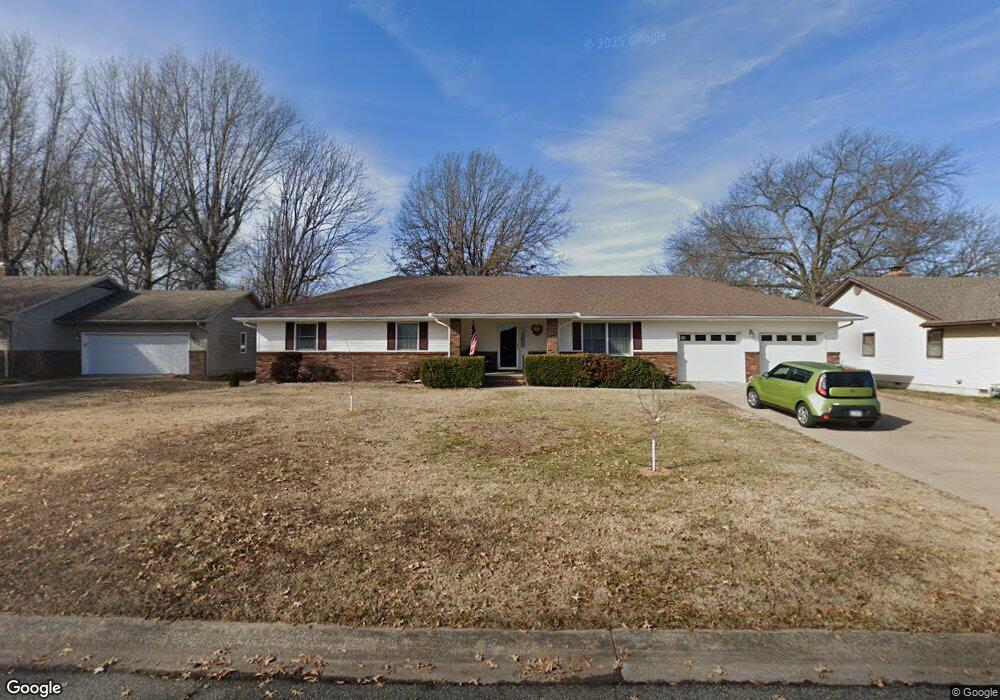
2111 Carrie St Carthage, MO 64836
Estimated Value: $269,000 - $350,000
3
Beds
2
Baths
2,340
Sq Ft
$128/Sq Ft
Est. Value
About This Home
This home is located at 2111 Carrie St, Carthage, MO 64836 and is currently estimated at $299,932, approximately $128 per square foot. 2111 Carrie St is a home located in Jasper County with nearby schools including Carthage High School, St. Ann's Catholic School, and Victory Academy.
Ownership History
Date
Name
Owned For
Owner Type
Purchase Details
Closed on
Nov 16, 2023
Sold by
Long Margaret I and Dreier Keith S
Bought by
Margaret I Long Trust and Keith S Dreier Trust
Current Estimated Value
Purchase Details
Closed on
Jun 14, 2019
Sold by
Barnett John M and Barnett Linda K
Bought by
Dreier Keith S and Long Margaret I
Purchase Details
Closed on
Oct 25, 2010
Sold by
Schmidt Randy A and Schmidt Jannett G
Bought by
Schmidt Randy A and Schmidt Jannett G
Create a Home Valuation Report for This Property
The Home Valuation Report is an in-depth analysis detailing your home's value as well as a comparison with similar homes in the area
Home Values in the Area
Average Home Value in this Area
Purchase History
| Date | Buyer | Sale Price | Title Company |
|---|---|---|---|
| Margaret I Long Trust | -- | None Listed On Document | |
| Dreier Keith S | -- | -- | |
| Schmidt Randy A | -- | None Available |
Source: Public Records
Tax History Compared to Growth
Tax History
| Year | Tax Paid | Tax Assessment Tax Assessment Total Assessment is a certain percentage of the fair market value that is determined by local assessors to be the total taxable value of land and additions on the property. | Land | Improvement |
|---|---|---|---|---|
| 2025 | $1,374 | $29,670 | $4,000 | $25,670 |
| 2024 | $1,374 | $26,700 | $4,000 | $22,700 |
| 2023 | $1,374 | $26,700 | $4,000 | $22,700 |
| 2022 | $1,357 | $26,460 | $4,000 | $22,460 |
| 2021 | $1,343 | $26,460 | $4,000 | $22,460 |
| 2020 | $1,297 | $24,490 | $4,000 | $20,490 |
| 2019 | $1,299 | $24,490 | $4,000 | $20,490 |
| 2018 | $1,167 | $22,050 | $0 | $0 |
| 2017 | $1,170 | $22,050 | $0 | $0 |
| 2016 | $1,199 | $22,680 | $0 | $0 |
| 2015 | $1,108 | $22,680 | $0 | $0 |
| 2014 | $1,108 | $22,680 | $0 | $0 |
Source: Public Records
Map
Nearby Homes
- 2141 Carrie St
- 925 Gene Taylor Dr
- 1106 Southern Hills
- 1004 Gene Taylor Dr
- 909 Durward Hall Dr
- 1211 E Airport Dr
- 837 Modern Way
- 839 Modern Way
- 1341 E Airport Dr
- 1922 Southwood Ln
- 1431 Quail Place
- 1823 S River St
- NE COR Airport Dr & River
- 1320 Belle Air Place
- 1131 Belle Air Place
- 619 Belle Air Place
- 1647 Glenwood Place
- 1743 S River St
- 1012 Euclid Blvd
- 739 Sheridan St
- 2121 Carrie St
- 2105 Carrie St
- 2112 Carrie St
- 2048 Pearl St
- 2040 Pearl St
- 2104 Pearl St
- 2131 Carrie St
- 2120 Carrie St
- 2100 Carrie St
- 2110 Pearl St
- 2130 Carrie St
- 1118 Ridgecrest Ave
- 2032 Katherine St
- 2136 Carrie St
- 1117 Lillie Dr
- 2122 Pearl St
- 2127 Alison St
- 2135 Alison St
- 2119 Alison St
- 1220 E Fairview Ave