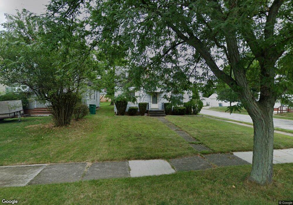
21115 Raymond St Maple Heights, OH 44137
Estimated Value: $94,000 - $122,000
2
Beds
1
Bath
900
Sq Ft
$115/Sq Ft
Est. Value
About This Home
This home is located at 21115 Raymond St, Maple Heights, OH 44137 and is currently estimated at $103,634, approximately $115 per square foot. 21115 Raymond St is a home located in Cuyahoga County with nearby schools including Abraham Lincoln Elementary School, Rockside/ J.F. Kennedy School, and Italy High School.
Ownership History
Date
Name
Owned For
Owner Type
Purchase Details
Closed on
Apr 3, 1987
Sold by
Vascek Louis M
Bought by
Vascek David P
Current Estimated Value
Purchase Details
Closed on
Jun 13, 1985
Sold by
Vascek Louis M
Bought by
Vascek Louis M
Purchase Details
Closed on
Oct 25, 1984
Sold by
Kulchar Pal and Kulchar Helena
Bought by
Vascek Louis M
Purchase Details
Closed on
Jan 7, 1983
Sold by
Kulchar Paul
Bought by
Kulchar Pal and Kulchar Helena
Purchase Details
Closed on
Dec 3, 1976
Sold by
Kulchar Valerie
Bought by
Kulchar Paul
Purchase Details
Closed on
Jan 1, 1975
Bought by
Kulchar Valerie
Create a Home Valuation Report for This Property
The Home Valuation Report is an in-depth analysis detailing your home's value as well as a comparison with similar homes in the area
Home Values in the Area
Average Home Value in this Area
Purchase History
| Date | Buyer | Sale Price | Title Company |
|---|---|---|---|
| Vascek David P | -- | -- | |
| Vascek Louis M | -- | -- | |
| Vascek Louis M | $37,000 | -- | |
| Kulchar Pal | -- | -- | |
| Kulchar Paul | -- | -- | |
| Kulchar Valerie | -- | -- |
Source: Public Records
Tax History Compared to Growth
Tax History
| Year | Tax Paid | Tax Assessment Tax Assessment Total Assessment is a certain percentage of the fair market value that is determined by local assessors to be the total taxable value of land and additions on the property. | Land | Improvement |
|---|---|---|---|---|
| 2024 | $2,668 | $28,770 | $6,965 | $21,805 |
| 2023 | $1,694 | $14,700 | $3,990 | $10,710 |
| 2022 | $1,688 | $14,700 | $3,990 | $10,710 |
| 2021 | $1,791 | $14,700 | $3,990 | $10,710 |
| 2020 | $1,548 | $11,130 | $3,010 | $8,120 |
| 2019 | $1,537 | $31,800 | $8,600 | $23,200 |
| 2018 | $1,528 | $11,130 | $3,010 | $8,120 |
| 2017 | $1,372 | $9,450 | $2,800 | $6,650 |
| 2016 | $1,730 | $13,300 | $2,800 | $10,500 |
| 2015 | $1,723 | $13,300 | $2,800 | $10,500 |
| 2014 | $1,723 | $14,630 | $3,080 | $11,550 |
Source: Public Records
Map
Nearby Homes
- 21207 Franklin Rd
- 21102 Raymond St
- 20907 Watson Rd
- 20814 Watson Rd
- 20715 Watson Rd
- 20814 Kenyon Dr
- 21416 Gardenview Dr
- 20701 Kenyon Dr
- 20510 Mountville Dr
- 20120 Mccracken Rd
- 20107 Libby Rd
- 19807 Gardenview Dr
- 19806 Mountville Dr
- 5285 Mardale Ave
- 5301 Mardale Ave
- 19812 Stockton Ave
- 19520 Maple Heights Blvd
- 20750 Bowling Green Rd
- 19309 Nitra Ave
- 20732 Applegate Rd
- 21111 Raymond St
- 21107 Raymond St
- 21203 Raymond St
- 21207 Raymond St
- 21116 Watson Rd
- 21112 Watson Rd
- 21108 Watson Rd
- 21200 Watson Rd
- 21019 Raymond St
- 21211 Raymond St
- 21104 Watson Rd
- 21204 Watson Rd
- 21114 Raymond St
- 21110 Raymond St
- 21106 Raymond St
- 21202 Raymond St
- 21015 Raymond St
- 21215 Raymond St
- 21208 Watson Rd
- 21206 Raymond St