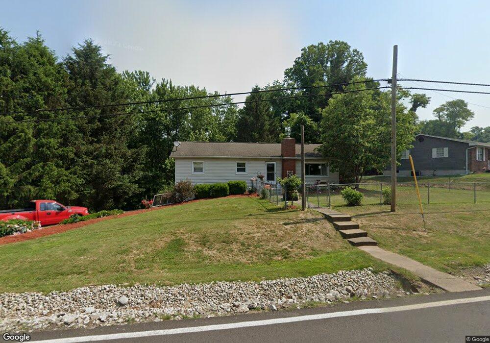
21115 State Route 676 Marietta, OH 45750
Estimated Value: $140,000 - $215,000
3
Beds
1
Bath
1,248
Sq Ft
$140/Sq Ft
Est. Value
About This Home
This home is located at 21115 State Route 676, Marietta, OH 45750 and is currently estimated at $174,199, approximately $139 per square foot. 21115 State Route 676 is a home located in Washington County with nearby schools including Warren High School, Veritas Classical Academy, and St. John Central Grade School.
Ownership History
Date
Name
Owned For
Owner Type
Purchase Details
Closed on
Jul 29, 2024
Sold by
Hill Samuel L and Hill Diane R
Bought by
Schott Carylon S
Current Estimated Value
Purchase Details
Closed on
May 16, 2024
Sold by
Wittekind Darrell S and Hill Diane R
Bought by
Hill Samuel L and Hill Diane R
Purchase Details
Closed on
Sep 8, 2006
Sold by
Wittekind Irma Jean
Bought by
Wittekind Darrell S and Hill Diane R
Purchase Details
Closed on
Feb 10, 1988
Create a Home Valuation Report for This Property
The Home Valuation Report is an in-depth analysis detailing your home's value as well as a comparison with similar homes in the area
Home Values in the Area
Average Home Value in this Area
Purchase History
| Date | Buyer | Sale Price | Title Company |
|---|---|---|---|
| Schott Carylon S | -- | None Listed On Document | |
| Schott Carylon S | -- | None Listed On Document | |
| Hill Samuel L | $56,500 | None Listed On Document | |
| Hill Samuel L | $56,500 | None Listed On Document | |
| Wittekind Darrell S | -- | None Available | |
| -- | -- | -- | |
| -- | -- | -- |
Source: Public Records
Tax History Compared to Growth
Tax History
| Year | Tax Paid | Tax Assessment Tax Assessment Total Assessment is a certain percentage of the fair market value that is determined by local assessors to be the total taxable value of land and additions on the property. | Land | Improvement |
|---|---|---|---|---|
| 2024 | $1,495 | $39,480 | $10,900 | $28,580 |
| 2023 | $1,495 | $39,480 | $10,900 | $28,580 |
| 2022 | $1,492 | $39,480 | $10,900 | $28,580 |
| 2021 | $1,235 | $31,200 | $7,560 | $23,640 |
| 2020 | $1,228 | $31,200 | $7,560 | $23,640 |
| 2019 | $1,217 | $31,200 | $7,560 | $23,640 |
| 2018 | $1,129 | $28,070 | $6,580 | $21,490 |
| 2017 | $1,123 | $28,070 | $6,580 | $21,490 |
| 2016 | $1,429 | $28,070 | $6,580 | $21,490 |
| 2015 | $867 | $24,100 | $6,310 | $17,790 |
| 2014 | $1,240 | $24,100 | $6,310 | $17,790 |
| 2013 | $864 | $24,100 | $6,310 | $17,790 |
Source: Public Records
Map
Nearby Homes
- 760 Lang Farm Rd
- 127 Pineview Dr Unit END
- 1119 Lancaster St
- 20043 State Route 550
- 20 Silver Globe Rd
- 65 High Point Dr
- 106 Cheyenne Rd
- 977 Gilman Ave
- 204 Coventry Rd
- 315 Muskingum Dr
- 722 1/2 3rd St
- 404, 404 1/2, 406 1/ E Montgomery St
- 146 Riverview Dr
- 202 Sacra Via St
- 619 3rd St
- 645 Pearl Street Extension
- 723 6th St
- 723 N 7th St
- 735 Bramblewood Heights Rd
- 725 8th St
- 21159 Ohio 676
- 21110 State Route 676
- 21185 Ohio 676
- 21185 State Route 676
- 21166 State Route 676
- 21084 State Route 676
- 21197 State Route 676
- 21124 State Route 676
- 21200 Ohio 676
- 21200 State Route 676
- 21062 State Route 676
- 21219 State Route 676
- 21212 State Route 676
- 21227 State Route 676
- 21120 State Route 676
- 21030 State Route 676
- 21005 State Route 676
- 21245 State Route 676
- 21281 State Route 676
- 20943 State Route 676