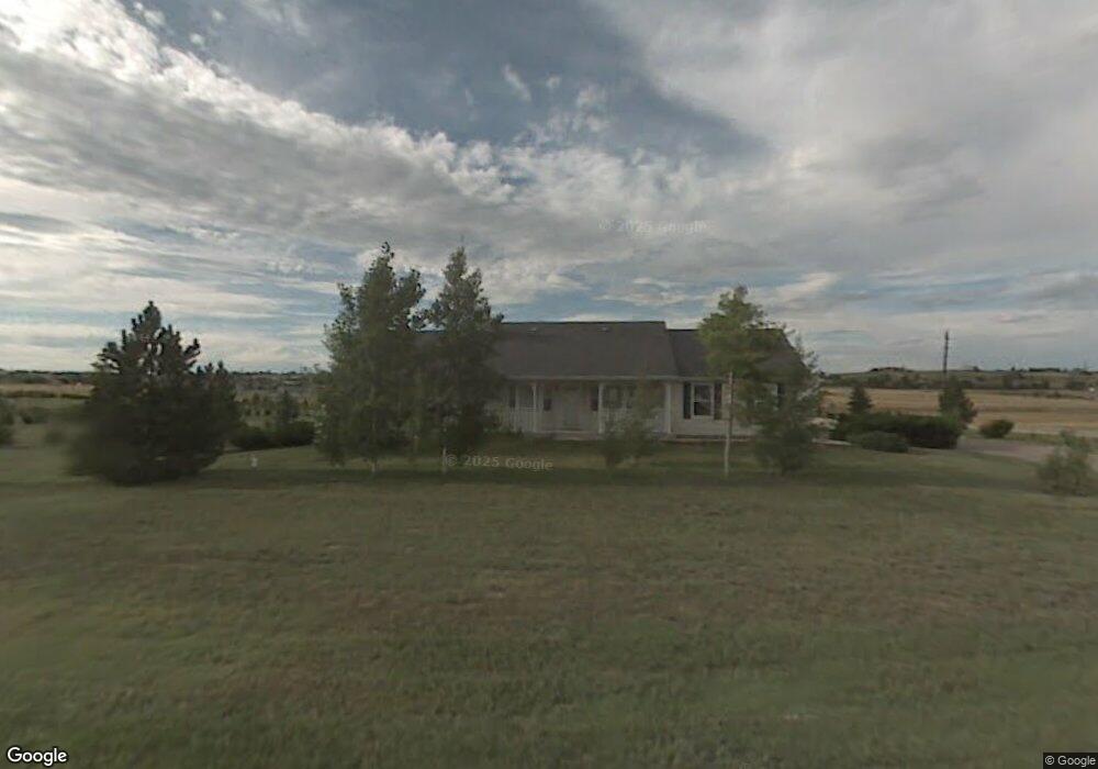
2112 Columbia Dr Cheyenne, WY 82009
Ranchettes NeighborhoodEstimated Value: $520,000 - $647,000
--
Bed
--
Bath
1,820
Sq Ft
$326/Sq Ft
Est. Value
About This Home
This home is located at 2112 Columbia Dr, Cheyenne, WY 82009 and is currently estimated at $592,461, approximately $325 per square foot. 2112 Columbia Dr is a home located in Laramie County with nearby schools including Hobbs Elementary School, McCormick Junior High School, and Central High School.
Ownership History
Date
Name
Owned For
Owner Type
Purchase Details
Closed on
Jun 21, 2013
Sold by
Duncan George C and Duncan Shigeko K
Bought by
Meares George A and Meares Melissa J
Current Estimated Value
Home Financials for this Owner
Home Financials are based on the most recent Mortgage that was taken out on this home.
Original Mortgage
$225,600
Outstanding Balance
$160,836
Interest Rate
3.54%
Mortgage Type
New Conventional
Estimated Equity
$431,625
Create a Home Valuation Report for This Property
The Home Valuation Report is an in-depth analysis detailing your home's value as well as a comparison with similar homes in the area
Home Values in the Area
Average Home Value in this Area
Purchase History
| Date | Buyer | Sale Price | Title Company |
|---|---|---|---|
| Meares George A | -- | None Available |
Source: Public Records
Mortgage History
| Date | Status | Borrower | Loan Amount |
|---|---|---|---|
| Open | Meares George A | $225,600 |
Source: Public Records
Tax History Compared to Growth
Tax History
| Year | Tax Paid | Tax Assessment Tax Assessment Total Assessment is a certain percentage of the fair market value that is determined by local assessors to be the total taxable value of land and additions on the property. | Land | Improvement |
|---|---|---|---|---|
| 2025 | $3,271 | $37,128 | $8,796 | $28,332 |
| 2024 | $3,271 | $48,675 | $11,728 | $36,947 |
| 2023 | $3,111 | $47,345 | $11,728 | $35,617 |
| 2022 | $2,826 | $42,067 | $11,728 | $30,339 |
| 2021 | $2,536 | $37,660 | $9,405 | $28,255 |
| 2020 | $2,502 | $37,266 | $9,405 | $27,861 |
| 2019 | $2,413 | $35,902 | $9,405 | $26,497 |
| 2018 | $2,152 | $32,349 | $6,817 | $25,532 |
| 2017 | $2,091 | $31,123 | $6,605 | $24,518 |
| 2016 | $2,062 | $30,683 | $6,394 | $24,289 |
| 2015 | $1,669 | $24,830 | $6,394 | $18,436 |
| 2014 | $1,667 | $24,634 | $6,394 | $18,240 |
Source: Public Records
Map
Nearby Homes
- 6712 Big Sky Trail
- 1348 Jack Ln
- 1336 Jessi Dr
- 1348 Jessi Dr
- 1314 Marie Ln
- 1236 Jessi Dr
- 2553 Wildhorse Trail
- 1213 Alyssa Way
- 8007 Kepler Dr
- 8012 Bobcat Rd
- 1121 Alyssa Way
- TBD Kepler Dr
- 7115 Macy Place
- 1218 Wendy Ln
- 1108 Marie Ln
- 5801 Mica Bluff
- 5702 Mica Bluff
- 6901 Pointe Pinnacle
- 7612 Danni Marie Cir
- 2544 Levi Rd
- 2113 Columbia Dr
- 7390 Buckskin Trail
- 2100 Columbia Dr
- 2101 Columbia Dr
- 2262 Wind River Trail
- 7124 Buckskin Trail
- 2040 Columbia Dr
- 2263 Wind River Trail
- 2105 E Four Mile Rd
- 2035 Columbia Dr
- 2303 Wind River Trail
- 7313 Space Dr
- 7037 Buckskin Trail
- 2324 Wind River Trail
- 2121 E Four Mile Rd
- 2349 Wind River Trail
- 6950 Buckskin Trail
- 2207 E Four Mile Rd
- 7221 Space Dr
- 2364 Sweetwater Trail