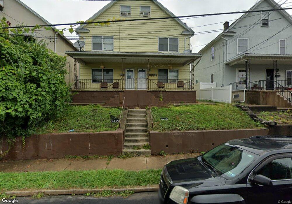
2112 Farr St Unit 2114 Scranton, PA 18504
Hyde Park NeighborhoodEstimated Value: $269,000 - $344,000
--
Bed
--
Bath
--
Sq Ft
5,401
Sq Ft Lot
About This Home
This home is located at 2112 Farr St Unit 2114, Scranton, PA 18504 and is currently estimated at $296,149. 2112 Farr St Unit 2114 is a home located in Lackawanna County with nearby schools including Longan Elementary School, Adams Elementary School, and Isaac Tripp Elementary School.
Ownership History
Date
Name
Owned For
Owner Type
Purchase Details
Closed on
Jul 1, 2024
Sold by
2112 Farr Llc
Bought by
Rodriguez Pablo
Current Estimated Value
Home Financials for this Owner
Home Financials are based on the most recent Mortgage that was taken out on this home.
Original Mortgage
$271,700
Outstanding Balance
$268,424
Interest Rate
6.94%
Mortgage Type
New Conventional
Estimated Equity
$27,725
Purchase Details
Closed on
Aug 11, 2021
Sold by
Titone Peter
Bought by
2112 Farr Llc
Purchase Details
Closed on
Jan 12, 2021
Sold by
Emiliani Mario and Emiliani Donna Lee
Bought by
Titone Peter
Purchase Details
Closed on
Jun 16, 2014
Sold by
Primack William A and Emiliani Alma Rita
Bought by
Emiliani Mario and Emiliani Donna Lee
Create a Home Valuation Report for This Property
The Home Valuation Report is an in-depth analysis detailing your home's value as well as a comparison with similar homes in the area
Home Values in the Area
Average Home Value in this Area
Purchase History
| Date | Buyer | Sale Price | Title Company |
|---|---|---|---|
| Rodriguez Pablo | $286,000 | None Listed On Document | |
| 2112 Farr Llc | $115,744 | None Available | |
| Titone Peter | $112,000 | Reliable Abstract Co | |
| Emiliani Mario | -- | None Available |
Source: Public Records
Mortgage History
| Date | Status | Borrower | Loan Amount |
|---|---|---|---|
| Open | Rodriguez Pablo | $271,700 |
Source: Public Records
Tax History Compared to Growth
Tax History
| Year | Tax Paid | Tax Assessment Tax Assessment Total Assessment is a certain percentage of the fair market value that is determined by local assessors to be the total taxable value of land and additions on the property. | Land | Improvement |
|---|---|---|---|---|
| 2025 | $3,279 | $10,648 | $948 | $9,700 |
| 2024 | $2,987 | $10,648 | $948 | $9,700 |
| 2023 | $2,987 | $10,648 | $948 | $9,700 |
| 2022 | $2,921 | $10,648 | $948 | $9,700 |
| 2021 | $2,921 | $10,648 | $948 | $9,700 |
| 2020 | $2,864 | $10,648 | $948 | $9,700 |
| 2019 | $2,690 | $10,648 | $948 | $9,700 |
| 2018 | $2,690 | $10,648 | $948 | $9,700 |
| 2017 | $2,640 | $10,648 | $948 | $9,700 |
| 2016 | $0 | $10,648 | $948 | $9,700 |
| 2015 | $1,955 | $10,648 | $948 | $9,700 |
| 2014 | -- | $10,648 | $948 | $9,700 |
Source: Public Records
Map
Nearby Homes
- 2133 Dorothy St
- 1727 Dorothy St
- 1501 Farr St
- 1431 Dorothy St
- 1425 Bulwer St
- 116 Little Spike Way Unit L 40
- 991 N Sumner Ave Unit 1/2 L 13
- 1327 Oram St
- 534-536 N Garfield Ave
- 638 N Lincoln Ave
- 1126 W Gibson St
- 523 N Rebecca Ave
- 602 604 N Lincoln Ave
- 2503 2505 Swetland St Unit L 2
- 444 N Cameron Ave
- 352 N Fillmore Ave
- 1235 N Sumner Ave
- 357 Hughes Ct
- 1819 Clearview St Unit L 109
- 833 Powderly Ct
- 2112 2114 Farr Unit L5
- 2114 Farr St
- 2108 Farr St
- 0 Farr St Unit GSB017253
- 0 Farr St
- 2116 Farr St Unit 2118
- 2106 Farr St
- 2120 Farr St Unit 22
- 2104 Farr St
- 2130 Farr St
- 2107 Farr St
- 2102 Farr & Everett
- 2132 Farr St
- 2117 Dorothy St
- 2113 Dorothy St
- 2121 Dorothy St Unit L19
- 2109 Dorothy St
- 2125 Dorothy St
- 2105 Farr St
- 2136 Farr St