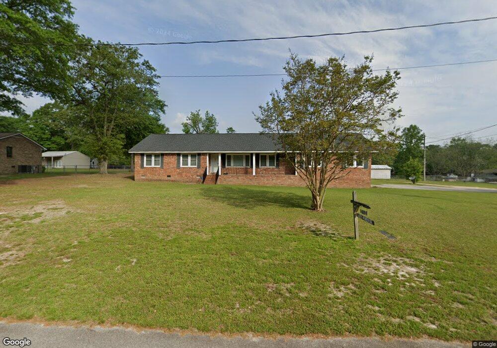
2112 Lazy Pines Dr West Columbia, SC 29169
Estimated Value: $296,000 - $351,200
3
Beds
3
Baths
1,832
Sq Ft
$170/Sq Ft
Est. Value
About This Home
This home is located at 2112 Lazy Pines Dr, West Columbia, SC 29169 and is currently estimated at $312,300, approximately $170 per square foot. 2112 Lazy Pines Dr is a home located in Lexington County with nearby schools including Riverbank Elementary, Northside Middle, and Brookland-Cayce High School.
Ownership History
Date
Name
Owned For
Owner Type
Purchase Details
Closed on
Feb 21, 2020
Sold by
Hawley Cheryl P and Hawley Gary W
Bought by
Hawley Charles J and Hawley Cheryl L
Current Estimated Value
Home Financials for this Owner
Home Financials are based on the most recent Mortgage that was taken out on this home.
Original Mortgage
$189,000
Outstanding Balance
$167,346
Interest Rate
3.6%
Mortgage Type
New Conventional
Estimated Equity
$144,954
Purchase Details
Closed on
Feb 8, 2019
Sold by
Lee Richard
Bought by
Neeley Catherine and Neeley Carl Edward
Create a Home Valuation Report for This Property
The Home Valuation Report is an in-depth analysis detailing your home's value as well as a comparison with similar homes in the area
Home Values in the Area
Average Home Value in this Area
Purchase History
| Date | Buyer | Sale Price | Title Company |
|---|---|---|---|
| Hawley Charles J | $210,000 | None Available | |
| Neeley Catherine | $34,000 | None Available |
Source: Public Records
Mortgage History
| Date | Status | Borrower | Loan Amount |
|---|---|---|---|
| Open | Hawley Charles J | $189,000 |
Source: Public Records
Tax History Compared to Growth
Tax History
| Year | Tax Paid | Tax Assessment Tax Assessment Total Assessment is a certain percentage of the fair market value that is determined by local assessors to be the total taxable value of land and additions on the property. | Land | Improvement |
|---|---|---|---|---|
| 2024 | $1,780 | $8,400 | $2,400 | $6,000 |
| 2023 | $1,605 | $8,400 | $2,400 | $6,000 |
| 2022 | $1,621 | $8,400 | $2,400 | $6,000 |
| 2020 | $735 | $6,562 | $2,079 | $4,483 |
| 2019 | $592 | $5,706 | $1,065 | $4,641 |
| 2018 | $603 | $5,706 | $1,065 | $4,641 |
| 2017 | $568 | $5,706 | $1,065 | $4,641 |
| 2016 | $594 | $5,705 | $1,064 | $4,641 |
| 2014 | $326 | $4,961 | $901 | $4,060 |
| 2013 | -- | $4,960 | $900 | $4,060 |
Source: Public Records
Map
Nearby Homes
- 0 Platt Springs Rd Unit 606355
- 623 Hook Ave
- 207 Woodhaven Dr
- 215 Sandel Ln
- 2004 Dew Ave
- 529 Finnegan Ln
- 500 Finnegan Ln
- 165 Cavendish Dr
- 913 Harper Rose Ct
- 235 Harvest Glen Ln
- 339 Gum Swamp Trail
- 108 Harvest Glen Ln
- 349 Gum Swamp Trail
- 0 Sunset Blvd Unit 553428
- 179 War Admiral Dr
- 116 Silver Run Place
- 135 Silver Run Place
- 617 Holland Cir
- 161 Weeping Oak Ln
- 1615 Holland St
- 2112 Lazy Pines Dr
- 2116 Lazy Pines Dr
- 2111 Lazy Pines Dr
- Lots 3A & B Lazy Pines Dr
- 2108 Lazy Pines Dr
- 2130 Lazy Pines Dr
- 2119 Lazy Pines Dr
- 0 Platt Springs Rd Unit 454852
- 0 Platt Springs Rd Unit 453318
- 1A Arehart St
- 0 Platt Springs Rd Unit 445622
- 0 Platt Springs Rd Unit 439046
- 0 Platt Springs Rd Unit 436421
- 0 S Side of Wren Dr Unit 212477
- 0 S Side of Wren Dr Unit 225484
- 0 N Side of Gunter Dr Unit 225483
- NONE Pine Rd
- 0 S Side Wren Dr Unit 234051
- 0 N Side Gunter Dr Unit 240982
- 1230 Lownsdown Rd